Culver Down
![]()
![]() Explore the beautiful Culver Down before visiting Bembridge Fort on this circular walk on the Isle of Wight coast. There are fabulous views over Sandown Bay, Shanklin Bay and the Solent to enjoy on the walk. The downs are also covered in pretty wildflowers such as cowslip, rock rose, Bee orchid and birdsfoot trefoil. These attract many butterflies such as the chalkhill blue.
Explore the beautiful Culver Down before visiting Bembridge Fort on this circular walk on the Isle of Wight coast. There are fabulous views over Sandown Bay, Shanklin Bay and the Solent to enjoy on the walk. The downs are also covered in pretty wildflowers such as cowslip, rock rose, Bee orchid and birdsfoot trefoil. These attract many butterflies such as the chalkhill blue.
The walk starts at the Culver Cliff car park and heads to Culver Battery and Whitecliff Ledge where there are great views over Whitecliff Bay, Horseshoe Bay and Bembridge. You continue along the coast path before climbing to the hill fort. Here you can explore the remains of 19th-century and First World War fortifications with gun emplacements. From the elevated position there are tremendous views over the downs to the sea.
From the fort you descend across Bembridge Down back to the car park. You'll pass the Yarborough Monument, a memorial to Lord Yarborough, the first Commodore of the Royal Yacht Squadron on the way.
You can extend your walk by continuing along the Isle of Wight Coast Path in either direction. The Bembridge Trail and the Yar River Trail also pass through the area just north of the hill fort. If you are on a bike then National Cycle Route 67 also runs close to the fort. You can follow the route from Bembridge to Culver Down Road and turn south to reach the downs and the fort.
Postcode
PO35 5QB - Please note: Postcode may be approximate for some rural locationsCulver Down Ordnance Survey Map  - view and print off detailed OS map
Culver Down Open Street Map  - view and print off detailed map
Culver Down OS Map  - Mobile GPS OS Map with Location tracking
Culver Down Open Street Map  - Mobile GPS Map with Location tracking
Explore the Area with Google Street View 
Pubs/Cafes
The Culver Haven pub is situated on the top of Culver down right next to the Yarbridge Monument. It's a great place for some post walk refreshments with fabulous views and a nice outdoor seating area. It's very walker and dog friendly with a postcode of PO36 8QT for your sat navs.
Dog Walking
The downs are a great place for dog walking and the Culver Haven is a dog friendly place to visit after your exercise.
Further Information and Other Local Ideas
In August you can try the popular St Helens Fort Walk. The walk takes you out to the 19th century St Helens Fort along the causeway at low tide.
Cycle Routes and Walking Routes Nearby
Photos
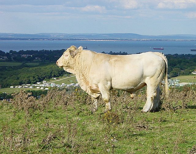
Charolais Bull on Culver Down. Looking NNE, Portsmouth in the distance across the Solent.
Cowslips on Culver Down. In May the eastern-most end of Culver Down is covered in Cowslips. As you approach from Sandown Bay in the south-west you spot single plants and small clumps of flowers but as you reach the end of the Down above the chalk cliff there is carpet of bright yellow flowers. Looking North is Whitecliff Bay, to the west and south nothing but the sea far below with occasional boats (the QE2 on this particular day).
Culver Down Monument. The monument on Culver Down in memory of Charles Anderson Pelham Earl of Yarborough


