Denbies Hillside Circular Walk
![]()
![]() Explore this lovely area of the North Downs on this short circular walk. You can start the walk from the Denbies Hillside car park on Ranmore Common. There's waymarked trails, woodland paths and great views of Leith Hill and Dorking from the high points. There's also lots of interesting plants and wildlife to look out for. Several species of orchid grow on the hillside and there are a vairiety of butterflies to see in the summer months.
Explore this lovely area of the North Downs on this short circular walk. You can start the walk from the Denbies Hillside car park on Ranmore Common. There's waymarked trails, woodland paths and great views of Leith Hill and Dorking from the high points. There's also lots of interesting plants and wildlife to look out for. Several species of orchid grow on the hillside and there are a vairiety of butterflies to see in the summer months.
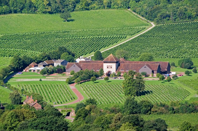
The area also includes the Denbies Wine Estate which contains the largest vineyard in England, representing more than 10 per cent of the plantings in the whole of the United Kingdom. There's an excellent visitor centre with a working winery where you can learn all about the wine making process.
The North Downs Way passes over the hills so you can continue along the trail to extend your walk. You could follow the trail a couple of miles to the north east and visit the lovely Box Hill Country Park.
You can also further explore Ranmore Common by heading north from the car park.
The site can be easily reached on foot from nearby Dorking. Just follow the Mole Gap Trail north from the town and you will soon come to the estate.
Postcode
RH5 6SR - Please note: Postcode may be approximate for some rural locationsDenbies Hillside Ordnance Survey Map  - view and print off detailed OS map
Denbies Hillside Open Street Map  - view and print off detailed map
*New* - Walks and Cycle Routes Near Me Map - Waymarked Routes and Mountain Bike Trails>>
Denbies Hillside OS Map  - Mobile GPS OS Map with Location tracking
Denbies Hillside Open Street Map  - Mobile GPS Map with Location tracking
Pubs/Cafes
Café La Crème is based at Denbies Hillside Car Park throughout the year. They serve delicious cakes and hot drinks with great views from the benches.
Dog Walking
The area is great for dog walking with lots of woodland trails in the adjacent Ranmore Common.
Further Information and Other Local Ideas
Just to the south there's the village of Betchworth where you can visit the ruined Betchworth Castle which sits next to the River Mole. There's also the adjacent village of Brockham where you can explore the Brockham Quarry Nature Reserve. The interesting site was once the site of chalk extraction and the lime making industry during the Victorian Era.
Cycle Routes and Walking Routes Nearby
Photos
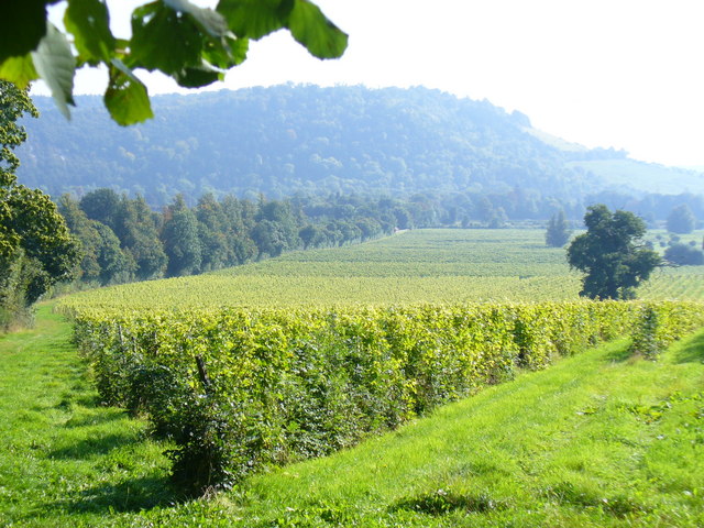
Denbies Hillside. This path crosses the open downland of Denbies Hillside, with wide views to the south. It serves as an alternative to the parallel North Downs Way through the woodland to the left, The Spains. In the background is Dorking. Named after John Denby, a 17th-century farmer, the hillside is home to a great variety of plants and animals, including adonis blue and chalkhill blue butterflies.
A corner at the northern edge of Denbies Vineyard with views across the Mole Gap to Box Hill. The striking chalk escarpment offers an impressive display of chalk downland flora and fauna. The nutrient–poor soils support a range of specialised wildflowers and plants, such as wild orchids and aromatic herbs like thyme and marjoram, which thrive in the open, sunlit conditions. This habitat nurtures several butterfly species—including the delicate Adonis Blue and Chalkhill Blue—that depend on these chalk-loving plants, while the open grassland and scrub provide refuge for reptiles such as adders and lizards, and attract a variety of birds like kestrels that soar overhead.
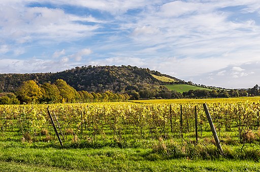
Denbies vineyard and Box Hill in Autumn. Beyond its rich natural diversity, Denbies Hillside offers visitors panoramic views stretching towards Leith Hill, the highest point in southeast England, and a sense of dramatic, unspoilt countryside. The area is steeped in local history and cultural heritage, with its name harking back to a 17th-century farmer and its landscape subtly marked by relics such as Second World War pill boxes that were once built to defend against invasion. A network of well-maintained footpaths and bridleways allows for leisurely exploration, making it a perfect destination for wildlife observation, peaceful walks, and appreciating the historical as well as the natural beauty of the Surrey Hills.
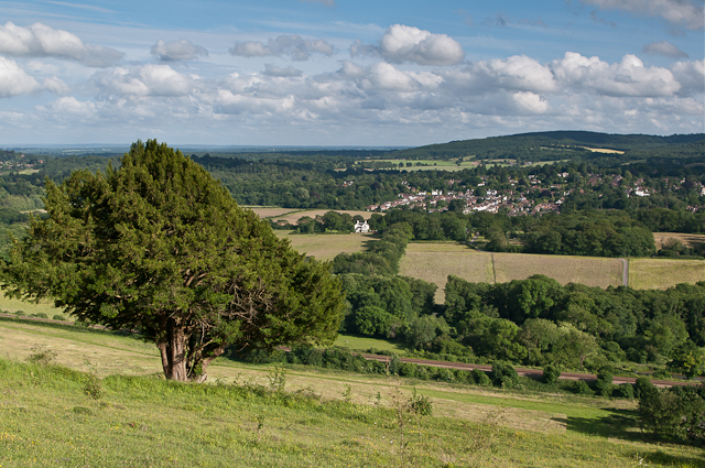
Entrance into Steers Field (with magnificent views over the Surrey Hills - the equivalent of Boxhill on the west side of the Mole Gap) from Denbies Hillside car park. The car park is managed by the National Trust, which operates a pay-and-display scheme. It can be very busy at weekends, although there is another car park at the western end of the common.


