Eskdale - River and Fells Walk
![]()
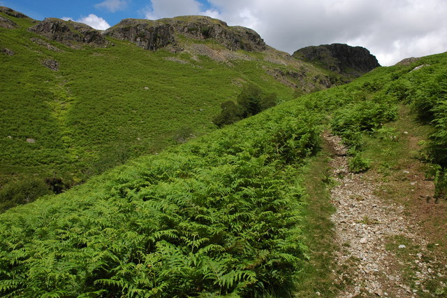
![]() Explore beautiful Eskdale and enjoy waterside paths along the rushing River Esk on this varied route. Along the way there's lots of waterfalls, beautiful Lakeland scenery and fabulous views from the high points.
Explore beautiful Eskdale and enjoy waterside paths along the rushing River Esk on this varied route. Along the way there's lots of waterfalls, beautiful Lakeland scenery and fabulous views from the high points.
Eskdale is one of the quieter areas of the Lake District so expect a peaceful and beautiful valley walk.
You can start the walk from Dalegarth where there is a car park and a train station on the Ravenglass & Eskdale Railway. From here you can pick up the footpaths along the river passing Gill Force waterfall. The walk takes you along the river to Brotherikeld before climbing to Cam Spout Crag, close to Scafell Pike. You then follow a splendid elevated path to Silverybield Crag before descending to Scale Gill. The route then finishes by following the river back to Dalegarth.
There's lots of other great walks in the Eskdale area to try. You could enjoy a climb to Muncaster Fell just to the west of Dalegarth. It's another great ridge walk with fine views over the Cumbrian Coast around Ravenglass. You can visit Eskdale from the town by following our Ravenglass to Eskdale Walk which crosses the fell.
Near Brotherikeld you can climb to Harter Fell and enjoy woodland trails through Dunnerdale Forest.
Also nearby is Devoke Water, the largest tarn in the Lake District.
In Upper Eskdale you can climb to Scafell Pike, the highest mountain in England.
Eskdale Ordnance Survey Map  - view and print off detailed OS map
Eskdale Open Street Map  - view and print off detailed map
Eskdale OS Map  - Mobile GPS OS Map with Location tracking
Eskdale Open Street Map  - Mobile GPS Map with Location tracking
Walks near Eskdale
- Muncaster Fell - This fine circular walk near Ravenglass climbs to Muncaster Fell with a visit to Muncaster Tarn and great views along the Cumbrian Coast
- Devoke Water - This walk visits Devoke Water, the largest tarn in the Lake District
- Harter Fell - An enjoyable climb to Harter Fell in the Eskdale area of the Western Lake District.
You can start the walk from the car park at Birks Bridge, just over a mile to the east of the fell - Scafell Pike - Climb the highest mountain in England on this spectacular walk in the Lake District
- Stanley Ghyll Force - This lovely walk in Eskdale takes you to Stanley Ghyll Force Waterfall
- Blea Tarn - This is a nice easy walk around the lovely Blea Tarn near Eltwerwater in the Lake District National Park
- Crinkle Crags - Crinkle Crags stands at a height of 859 m (2,818 ft) surrounding the valleys of Great Langdale and Upper Eskdale.
- Ravenglass to Eskdale - This walk from Ravenglass takes you to the beautiful Eskdale in the Lake District National Park
- Ravenglass - This coastal Cumbrian village is a great place for riverside, estuary and beach walking.
- Eskdale Green - This small Cumbrian village is located in the Lake District's beautiful Eskdale
Pubs/Cafes
On the Hardknott Pass you will find the noteworthy Woolpack Inn which is a fine place to go for some refreshments after your walk. The inn also contains the Hardknott Cafe. It's located at the top of one of England’s most dramatic valleys, and the bottom of one of its most exciting roads – the Hardknott Pass. The inn has a good menu with cosy fires indoors to warm yourself next to. There's also a nice outdoor area for the summer and it is dog friendly too. You can find the pub on the pass at a postcode of CA19 1TH for your sat navs.
Just to the west there's the worthy village of Eskdale Green. The pretty settlement includes a tarn, woods, a Japanese Garden, riverside trails and two fine historic pubs. You could start your exploration of the area from Eskdale Green station or Irton Road Station on the heritage Ravenglass and Eskdale Railway.
Further Information and Other Local Ideas
To continue your walking in the area try the Ravenglass Circular Beach Walk which visits the Drigg Beach Nature Reserve from the village. Here you'll find sand dunes, an abundance of interesting plantlife and lots of wildlife, with several species of wading birds to look out for on the river estuary.


