Gibside Rowlands Gill Circular Walk Trails Map
![]()
![]() This splendid 18th century landscaped park has over 15 miles of footpaths taking you through gardens, meadows, fields and woodland.
This splendid 18th century landscaped park has over 15 miles of footpaths taking you through gardens, meadows, fields and woodland.
You can also enjoy a waterside stroll along the River Derwent and visit the orangery, stables, lily pond, walled garden, the magnificent Palladian chapel and the ruins of Gibside Hall - the former home of the Bowes-Lyon family.
Just a couple of miles to the west you can extend your walking around the expansive Chopwell Wood. There's some fine walking paths and good mountain bike trails to be found here. The Pontburn Woods Walk can also be picked up nearby.
Postcode
NE16 6BG - Please note: Postcode may be approximate for some rural locationsPlease click here for more information
Gibside Rowlands Gill Ordnance Survey Map  - view and print off detailed OS map
Gibside Rowlands Gill Open Street Map  - view and print off detailed map
*New* - Walks and Cycle Routes Near Me Map - Waymarked Routes and Mountain Bike Trails>>
Gibside Rowlands Gill OS Map  - Mobile GPS OS Map with Location tracking
Gibside Rowlands Gill Open Street Map  - Mobile GPS Map with Location tracking
Pubs/Cafes
The on site cafe is located in the market place and does a good range of meals and snacks. There's also the Stables Carriage House Coffee Shop where there's nice outdoor seating in the courtyard.
Dog Walking
The expansive park makes for an excellent dog walk although you are requested to keep them on leads throughout the estate. The Carriage House coffee shop at the stables is also dog friendly. There are also water bowls dotted round the estate for your thirsty canine friend.
Further Information and Other Local Ideas
To the north of the estate you'll find Derwent Valley Walk and Derwent Walk Country Park - both good of options if you'd like to continue your walk. There's nice riverside trails along the Derwent River and more woodland paths to be found here in the adjacent Thornley Woods. The Gateshead Walk starts from the Tyne Bridge and takes you along the river before visiting these parks and woods. It also heads to the lake at Watergate Forest Park and runs close to the Gibside site. It's a good way of visiting some of the walking highlights of the area.
Cycle Routes and Walking Routes Nearby
Photos
Snipes Dean Wood and Gibside. Taken from the viaduct over the River Derwent on the Derwent Walk. Sticking up on the horizon is the 'Monument to Liberty' (50m high) in the grounds of the hall.
The estate encompasses a variety of habitats, including woodlands, wetlands, and grasslands, supporting diverse plant and animal species. Mature woodlands feature native trees such as oak, beech, and ash, providing habitats for birds like nuthatches, woodpeckers, and treecreepers. Seasonal wildflowers, including bluebells and wood anemones, carpet the forest floor in spring. Wetland areas attract amphibians like frogs and newts, while grasslands host butterflies and other pollinators.
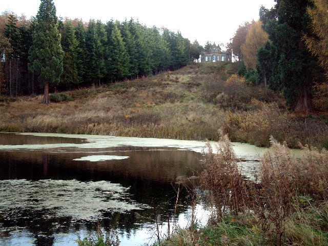
Banqueting House. In the grounds of Gibside Hall there is a small banqueting house, overlooking a lake. The house is reached by an uphill carriage ride. The building is in the care of the Landmark Trust. Although part of the National Trust estate, the Banqueting House is managed by the Landmark Trust for holiday lets (don't know the ownership position)
Chapel. Once owned by the Bowes-Lyon family, related to the late Queen Mother, complete with brass band. Gibside's origins trace back to the 17th century when the Blakiston family acquired the property around 1540. Sir William Blakiston constructed a spacious mansion between 1603 and 1620. In 1713, the estate passed to the Bowes family through marriage, significantly enhancing their wealth due to rich coal seams on the property. Sir George Bowes (1701–1760) played a pivotal role in developing Gibside, commissioning landscape designs by Stephen Switzer and William Joyce. Notable additions from this period include the Palladian chapel, built between 1760 and 1812, and the Column to Liberty, a 140-foot monument topped with a bronze female figure symbolizing British liberty.
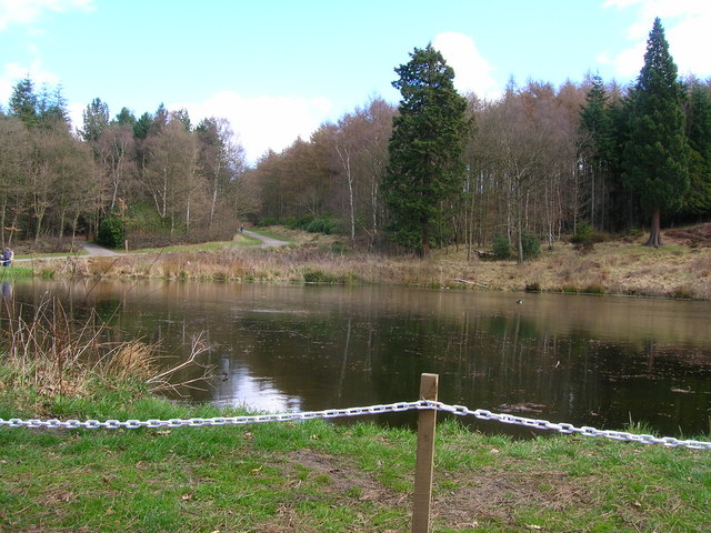
Lake near Gibside Hall. In 1767, Mary Eleanor Bowes, granddaughter of Sir George, married John Lyon, 9th Earl of Strathmore and Kinghorne, integrating the Bowes and Lyon families. The estate remained with the family until the early 20th century when financial difficulties led to its decline. The main house was vacated in the 1920s, stripped of its fittings, and partially demolished in 1958. Today, Gibside is managed by the National Trust, preserving its historical structures and natural landscapes for public enjoyment.
View from Bird Hide. On the estate you can look out for birdlife including birds of prey such as Red Kites. A good variety of small birds and woodland birds can also be seen including Jays, Siskin, Chiffchaff, Willow Warblers, Nuthatches and Treecreepers. Swallows and swifts can be seen feeding by the stables.


