Glasbury Walks
![]()
![]() This pretty riverside village is located in Powys near Hay on Wye.
This pretty riverside village is located in Powys near Hay on Wye.
It sits on the Wye Valley Walk, a long distance waymarked footpath exploring the beautiful valley of the River Wye. The village also lies just north of the Black Mountains and the Brecon Beacons where there are some wonderful hill climbs and lakeside trails to try.
This walk takes you along a pleasant section of the Wye Valley Walk to the neighbouring villages of Boughrood and Llanstephan. The route follows a fairly flat waymarked footpath which runs close to or along the river. It's about a 6 mile walk with some lovely views of the Wye Valley countryside to enjoy on the way.
Postcode
HR3 5NR - Please note: Postcode may be approximate for some rural locationsGlasbury Ordnance Survey Map  - view and print off detailed OS map
Glasbury Open Street Map  - view and print off detailed map
Glasbury OS Map  - Mobile GPS OS Map with Location tracking
Glasbury Open Street Map  - Mobile GPS Map with Location tracking
Walks near Glasbury
- Talgarth - This ancient market town sits on the edge of the Black Mountains in the Brecon Beacons National Park.
- Bronllys - This walk visits Bronllys Castle just south of the village of Bronllys in Powys
- Wye Valley Walk - This walk takes you through the beautiful Wye Valley in Gloucestershire, Herefordshire and Wales.
The walk begins on the mouth of the River Wye at Chepstow Castle in Monmouthshire and follows the River Wye north to Monmouth, passing the fascinating ruins of Tintern Abbey on the way - Hay on Wye - This circuit around Hay on Wye takes you into the Brecon Beacons National Park on the Offa's Dyke Path
- Hay Bluff - This is a popular climb to Hay Bluff hill in the Black Mountains
- Lord Hereford's Knob (Twmpa) - This is a short climb to Lord Hereford's Knob or Twmpa in the Black Mountains
- Radnor Forest Ride - A long distance shared walking and cycle path that runs from Llanfair Waterdine on the English-Welsh border to the Brecon Beacons Visitor Centre
- Waun Fach - Climb to the highest mountain in the Black Mountains on this challenging walk in the Brecon Beacons
- Mynydd Du Forest - This large area of woodland in the Black Mountains has miles of forest tracks suitable for walking and mountain biking
- Grwyne Fawr Reservoir - This is a lovely waterside walk along the Grwyne Fawr to Grwyne Fawr Reservoir in the Brecon Beacons
- Dragons Back - Climb the Dragons Back on this challenging circular walk in the Black Mountains, Wales
- Mynydd Troed - This circular walk climbs to Mynydd Troed and Cockit Hill in the Black Mountains section of the Brecon Beacons National Park
- Sugarloaf Mountain - Climb to the summit of this iconic mountain on this challenging circular walk in Monmouthshire, Wales
- Llangorse Lake - Follow good footpaths around the western side of this beautiful lake in the Brecon Beacons National Park
- Talybont Reservoir - This circular cycling and walking route takes you around the lovely Talybont Reservoir in the Brecon Beacons National Park
- Builth Wells - This small market town in Powys has some nice river trails and a pleasant local park to stroll through
Pubs/Cafes
The Harp Inn dates back to about 1720 and includes low ceilings, wood beams and a large horseshoe-shaped servery. They have a good selection of ales and a good menu. Outside there's a rear garden area and a veranda with lovely river views. You can find them at postcode HR3 5NR. The pub is dog friendly.
Further Information and Other Local Ideas
Just to the south in Talgarth there's ancient woodland and waterfalls to see in the Pwll-y-Wrach Nature Reserve. There's also some interesting local history with an 18th century watermill and the 11th century Bronllys Castle to visit.
Photos
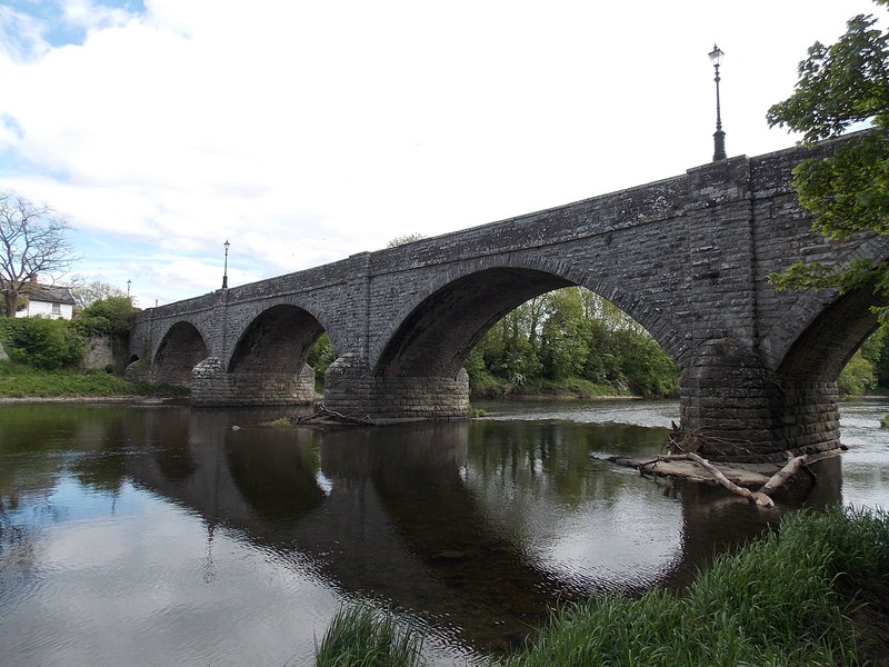
Islands in the Wye, Glasbury. The village lies at an important crossing point on the River Wye, connecting the historic counties of Brecknockshire and Radnorshire, and is located just outside the Brecon Beacons National Park, north of the Black Mountains


