Harefield Walks
![]()
![]() This Hillngdon based village is located in a lovely spot for canal and river walks through the Colne Valley. There's also miles of trails through the local woodland nature reserve and the popular Ruislip Lido within walking distance of the village centre. The village is also notable as the westernmost settlement in Greater London.
This Hillngdon based village is located in a lovely spot for canal and river walks through the Colne Valley. There's also miles of trails through the local woodland nature reserve and the popular Ruislip Lido within walking distance of the village centre. The village is also notable as the westernmost settlement in Greater London.
This circular route from the town visits some of the walking highlights of the area including Bayhurst Wood Country Park and Ruislip Woods, Ruislip Lido the Grand Union Canal, Denham Country Park and the lakes of the Colne Valley.
The route starts in the town centre where you can pick up the Hillingdon Trail. Follow the waymarked footpath south east and it will take you through the countryside to the Bayhurst Wood Country Park. You continue east through North Riding Wood and Mad Bess Wood before coming to Ruislip Lido.
The trail then heads south west through Ruislip before heading west to visit Denham Country Park in the Colne Valley. Here you pick up the Grand Union Canal and follow the towpath north along a series of lakes. The route then picks up the Hillingdon Trail again and follows it back east into Harefield.
Harefield Ordnance Survey Map  - view and print off detailed OS map
Harefield Open Street Map  - view and print off detailed map
Harefield OS Map  - Mobile GPS OS Map with Location tracking
Harefield Open Street Map  - Mobile GPS Map with Location tracking
Walks near Harefield
- Bayhurst Wood Country Park and Ruislip Woods - Bayhurst Wood Country Park and Ruislip Woods are located in the London Borough of Hillingdon and contain numerous walking and cycling trails
- Ruislip Lido - Enjoy an easy circular walk around this pretty reservoir on Ruislip Common
- Grand Union Canal Walk - Follow the towpath of Britain's longest canal from London to Birmingham on this fabulous waterside walk
- Hillingdon Trail - Travel through North London along the Hillingdon trail and enjoy parkland, countryside and waterside walking along the Grand Union Canal.
The walk starts in Cranford Country Park and heads through the borough of Hillingdon passing West Ruislip and Harefield before finishing at Springwell Lock on the Grand Union Canal - Yeading Brook - This lovely waterside walk follows the Yeading Brook through the London Borough of Hillingdon
- Colne Valley Trail - Follow the Colne Valley Trail from Uxbridge to Rickmansworth and enjoy riverside and canalside walking or cycling.
The trails follows the Grand Union Canal and the River Colne while also passing a series of pretty Lakes including Lynsters, Stocker's and Batchworth Lake - Denham Country Park - Enjoy waterside walking in this delightful park in Uxbridge
- Chalfont St Peter - This Buckinghamshire based village has some nice trails through the Colne Valley and into the surrounding Chiltern Hills.
- Gerrards Cross - This Buckinghamshire based town is in a nice location for exploring the Chiltern Hill AONB
- Rickmansworth - The town of Rickmansworth is ideally situated for some lovely waterside walking
- Croxley Green Boundary Walk - This circular walk in Rickmansworth explores the area around the village of Croxley Green.
- Uxbridge Canal Walk - This walk follows the Grand Union Canal from Uxbridge to Slough
- Chalfont St Giles - This pretty Buckinghamshire village sits in a nice rural spot on the edge of the Chilterns AONB.
Pubs/Cafes
The Old Orchard is a lovely place for some post walk refreshment. They have a smashing large garden area where you can enjoy a meal on finer days. From there's a wonderful view towards the surrounding countryside, rivers and lakes. They also have a charming interior with old photos on the wall. They serve a good range of high quality food and have a good drinks selection as well. You can find them at Park Lane with a postcode of UB9 6HJ for your sat navs.
Dog Walking
The woodland and waterside trails are ideal for a dog walk. There's even a doggy beach at the Lido for them to run around on. The Orchard mentioned above is also very dog friendly with water bowls and biscuits available for your canine friend.
Further Information and Other Local Ideas
Head west from the village and you can visit the neighbouring settlements of Chalfont St Peter and Gerrards Cross where there's a nice local common and pub to investigate. In Chalfont St Giles you'll find the former residence of John Milton, author of the epic poem 'Paradise Lost'. The cottage is now open as a museum and one of the literary highlights of the area.
Also in Hillingdon is the popular Celandine Route. The trail runs along the River Pinn from Cowley to Pinner. It is named after the pretty Lesser Celandine flowers you can see on the walk.
For more walking ideas in the area see the London Walks page.
Photos
Grand Union Canal in South Harefield. This is the Broad Water reach of the canal, upstream of Wide Water lock. The towpath forms part of the London Loop and is also the route of National Cycle Network 61.
The Countess of Derby's Almshouses. These Almshouses were founded by the will of Lady Alice, Countess of Derby, to provide for six poor women of the parish of Harefield. The Countess, who lived as the Lady of the Manor at Harefield Place, died in 1637. The almshouses are on Church Hill, and are Grade II* listed.
Harefield, Church of St Mary the Virgin. The church is in Countess Close, off Church Hill. The churchyard contains a large number of graves of Australian soldiers who died of their wounds at the hospital at Harefield Park during the First World War.
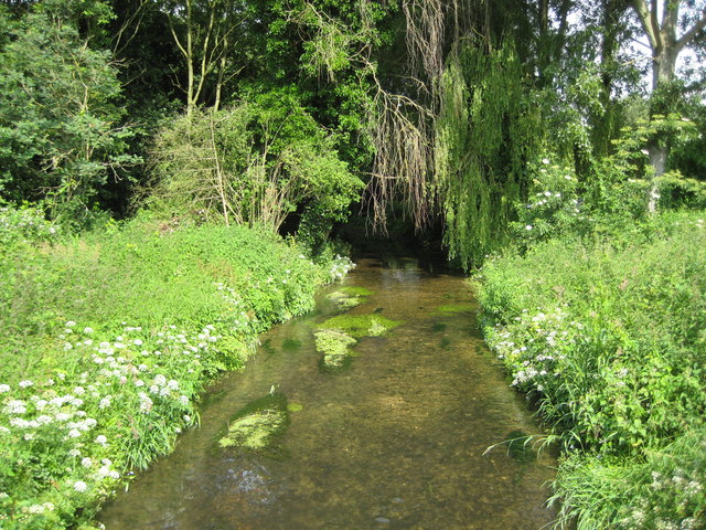
River Misbourne in Denham Country Park. The Misbourne is a chalk stream that rises northwest of Great Missenden in SP8902 and runs for about 23 kilometres, as the crow flies, before ending where it joins the River Colne in TQ0585. Here, only about 1 kilometre upstream of the confluence with the Colne, it is still very shallow. This view was taken from the Denham Court Drive bridge.


