Kentmere Horseshoe
![]()
![]() This challenging circular route explores the range of fells in the upper Kentmere valley area of the Lake District. The route visits some of the quieter areas of the national park while visiting a series of lesser known fells. There's wonderful views of several lakes, the surrounding fells, the Pennine Hills and the Lancashire coast. The path is generally pretty good for nearly all of the route.
This challenging circular route explores the range of fells in the upper Kentmere valley area of the Lake District. The route visits some of the quieter areas of the national park while visiting a series of lesser known fells. There's wonderful views of several lakes, the surrounding fells, the Pennine Hills and the Lancashire coast. The path is generally pretty good for nearly all of the route.
The walk starts from the village of Kentmere located a few miles east of Ambleside. You then climb towards Garburn Nook along Crabtree Brow and Garburn Pass. The route then turns north to Yoke Fell which stands at a height of 706 m (2,316 ft). From here there are great views of Lake Windermere, Morecambe Bay, Coniston and Langdale.
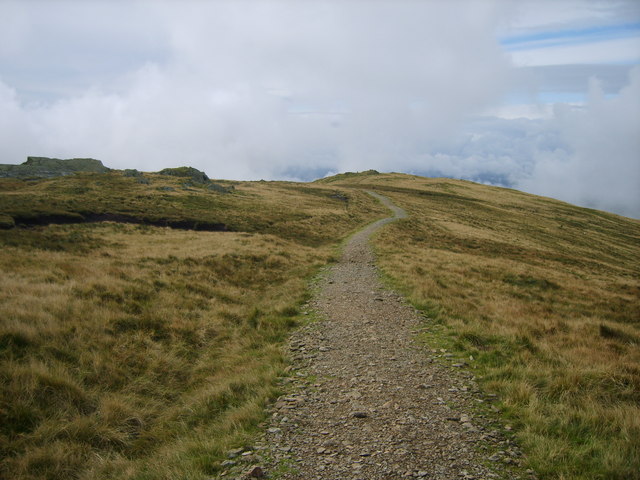
From Yoke Fell you continue to Ill Bell where you will find a number of columnar cairns and splendid views towards the Scafells. The path continues to Thornthwaite Fell via Froswick Fell with great views of Kentmere Common and Kentmere Reservoir below.
At Thornthwaite Fell you turn east towards Mardale Ill Bell and Harter Fell. Here you can enjoy nice views down towards Haweswater before turning south toward Kentmere Pike.
The path then descends to Shipman Knotts with its rocky outcrops and steep slopes. The final section descends to Wray Crag and High Lane before returning to the village.
To continue your walking in this area you could visit the nearby Brothers Water and Hayeswater. Also nearby is the excellent circuit of Haweswater.
Kentmere Horseshoe Ordnance Survey Map  - view and print off detailed OS map
Kentmere Horseshoe Open Street Map  - view and print off detailed map
Kentmere Horseshoe OS Map  - Mobile GPS OS Map with Location tracking
Kentmere Horseshoe Open Street Map  - Mobile GPS Map with Location tracking
Pubs/Cafes
There is not much on the walk for refreshments unfortunately but if you are in the car then a trip to nearby Haweswater is a nice idea. Here you'll find The Haweswater Hotel perched right on the eastern side of the lake. There's a lovely outdoor terrace with wonderful views over the lake, towards Kidsty Pike. It's the perfect place to relax on a warm day. As an additional attraction the hotel has some pretty gardens to explore. There's mature trees and shrubs, including rhododendrons, maples and azaleas, interspersed with rock gardens, heather and alpine plantings. You may also see some of the tame red squirrels. They also provide good quality accommodation if you need to stay over. The hotel is located about 3 miles north of Harter Fell at the northern end of the route. The parking area at the southern tip of the lake actually makes for an alternative start point and would provide more immediate access to the hotel.
Further Information and Other Local Ideas
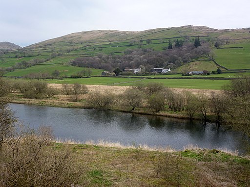
Kentmere Tarn is located just to the south of Kentmere village. You can follow a footpath south from Kentmere Hall to reach the tarn as an extension to the walk. It's a very pretty and peaceful area with the little tarn surrounded by rolling countryside. There's also the walk up to Kentmere Reservoir which lies just to the north of the village.


Above: Kentmere Tarn near the start of the walk
The Kentmere Horseshoe pases
Cycle Routes and Walking Routes Nearby
Photos
Kentmere Horseshoe Froswick and Ill Bell. Descending the ridge to the col between thornthwaite Crag and Froswick on the Kentmere Horseshoe Walk
Walkers leaving Overend. Heading north along the farm track to Tongue House. From left to right the hills are Yoke, Ill Bell and Froswick part of the Kentmere Horseshoe
Elevation Profile


