Litton Reservoir Walk
![]()
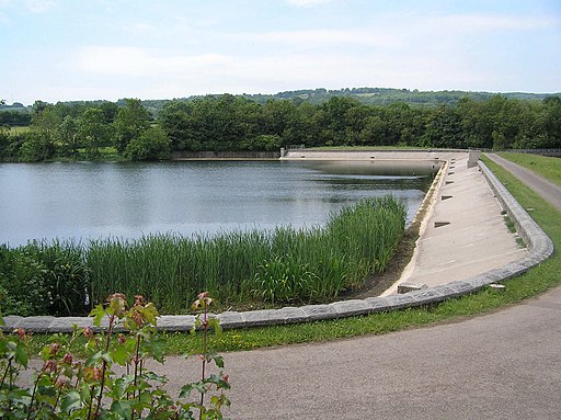
![]() This circular walk visits the Litton Reservoirs in the village of Litton in the Mendip Hills area of Somerset.
This circular walk visits the Litton Reservoirs in the village of Litton in the Mendip Hills area of Somerset.
You can start the walk in the village and then follow footpaths north along the River Chew to reach the two pretty lakes. Footpaths and country lanes can then be followed around the site, passing Coley and Sherborne before returning to the village. It's a picturesque area with an impressive dam and attractive woodland surrounding the water.
The area is good for flora and fauna with Violets, Primroses, Bluebell, Wood anemone and Campion among the plant species. Look out for Tufted duck, Swans, Mallards, Coot and Moorhen on the water.
Postcode
BA3 4PS - Please note: Postcode may be approximate for some rural locationsLitton Reservoir Ordnance Survey Map  - view and print off detailed OS map
Litton Reservoir Open Street Map  - view and print off detailed map
Litton Reservoir OS Map  - Mobile GPS OS Map with Location tracking
Litton Reservoir Open Street Map  - Mobile GPS Map with Location tracking
Pubs/Cafes
Back in the village head to The Litton for some post walk refreshment. The award winning pub includes a courtyard, landscaped gardens and a lovely riverside terrace next to the River Chew. They serve high quality food and can be found at postcode BA3 4PW.
Dog Walking
The waterside paths make for a pleasant dog walk and the Litton pub mentioned above is also dog friendly.
Further Information and Other Local Ideas
Just to the north you'll find the much larger Chew Valley Lake where there are more fine waterside trails. The expansive Blagdon Lake lies a little further west.
The long distance Limestone Link can also be picked up just to the north.
Just to the west is the neighbouring village of Compton Martin. Here you will find a noteworthy Norman church, an historic 16th century pub and the picturesque millpond which is the source of the Congresbury Yeo River. Just south of here there's also East Harptree Woods to explore. There's some peaceful woodland trails and the photogenic Smitham Chimney to visit here. In the nearby village of East Harptree there's also a fine 16th century pub.
For more walking ideas in the area see the Mendip Hills Walks page.


