Paulton Walks
![]()
![]() This former coal mining village is located north of the Mendip Hills in Somerset. There's some nice local woodland and country trails with waterside paths along the Cam Brook River which flows just to the north.
This former coal mining village is located north of the Mendip Hills in Somerset. There's some nice local woodland and country trails with waterside paths along the Cam Brook River which flows just to the north.
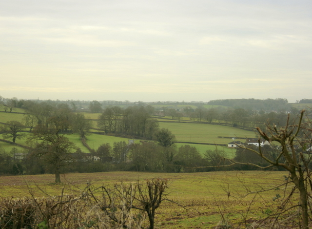
This walk from the village takes you to the nearby Greyfield Woods. On the way there's nice country views of the Cam Brook valley to enjoy.
You can reach the woods from the village by picking up the Limestone Link just to the north. Then follow it north west past Hallatrow to the site. The pretty woods have some nice walking trails, bluebells in the spring and a picturesque waterfall to admire. You could extend the walk by continuing on to Clutton.
Postcode
BS39 7NW - Please note: Postcode may be approximate for some rural locationsPaulton Ordnance Survey Map  - view and print off detailed OS map
Paulton Open Street Map  - view and print off detailed map
Paulton OS Map  - Mobile GPS OS Map with Location tracking
Paulton Open Street Map  - Mobile GPS Map with Location tracking
Walks near Paulton
- Limestone Link - Starting at Cold Ashton in St Catherine's Valley, Gloucestershire follow the Limestone Link from the Cotswolds to the Mendip Hills in Somerset.
The walk first heads south towards Batheaston where you join the River Avon and the Kennet and Avon Canal for a lovely waterside stretch to Monkton Coombe - Greyfield Woods - These pretty woods near the village of High Littleton have some nice woodland trails to try
- Chew Valley Lake - This walk follows the delightful nature trail which runs along the eastern side of this large lake in Chew Stoke
- Three Peaks Walk - This is a fairly hilly circular route taking you through some of the most peaceful and attractive countryside in Somerset.
The walk starts and finishes in the pretty village of Chew Magna and follows the path to Pensford and then back via Clutton.
You will climb Knowle Hill, Maes Knoll, and Blackberry Hill (three peaks) while enjoying excellent views of the Mendip Hills, Dundry Hill and the surrounding Chew Valley countryside - Mells River Walk - Enjoy an easy riverside stroll on this walk from the village of Mells to Frome in Somerset.
The pretty village is noted for several interesting old buildings including the 16th-century Mells Manor and the Talbot Inn which dates from the 15th century and is Grade II listed. The fine inn was voted Sunday Times Hotel of the Year in 2013.
Starting from Mells you follow the river east through the Wadbury Valley to Great Elm, passing the Old Iron Works on the way - Shepton Mallet - Visit the Charlton viaduct and the village of Doulting on this circular walk in the Somerset town of Shepton Mallet.
Just to the north of the town you can pick up the East Mendip Way on Barren Down - Frome - The Somerset town of Frome has some lovely trails to follow through the surrounding countryside
- Heaven's Gate Longleat - Enjoy wonderful views over the Longleat Estate and the surrounding Wiltshire countryside on this short walk near Warminster
- Trowbridge Park and River Walk - A short circular walk through Trowbridge Park and along the River Biss.
The walk starts in Trowbridge Park, just to the east of the train station - Bath Canal Walk - This is a popular walk along the Kennet and Avon Canal from Bath to Bradford on Avon
- Bath Skyline Walk - Enjoy wonderful views of the city of Bath on this popular circular walk
- Radstock - This Somerset based town is located on the northern slopes of the Mendip Hills and also close to the Cotswolds Hills AONB
- Somerset Coal Canal - Follow the Somerset Coal Canal from Tucking Mill to Combe Hay on this easy walk in the Cotswolds
- Midsomer Norton - This Somerset based town is located near the Mendip Hills where there are plenty of opportunites for walkers
- Litton Reservoir - This circular walk visits the Litton Reservoirs in the village of Litton in the Mendip Hills area of Somerset.
Pubs/Cafes
There are two pubs in the village where you can enjoy some post walk refreshments. The Red Lion is on the High Street at postcode BS39 7QQ and the Lamb Inn is on Park Road at BS39 7QQ.
Further Information and Other Local Ideas
The circular Timsbury Walk can be picked up from the neighbouring village which lies just to the north east.
For more walking ideas in the area see the Mendip Hills Walks and the Somerset Walks pages.
Photos
Amenity area at New Town, Paulton Playing fields to us though an open space here is a welcome sight.


