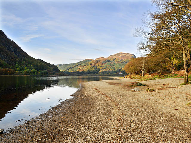
Loch Lubnaig
![]()
![]() This cycling and walking route follows National Cycle Route 7 from Callander to Strathyre along Loch Lubnaig. It's a great traffic free path, running for just over 9 miles along the Garbh Uisge river before heading through the woodland of Queen Elizabeth Forest Park alongside the loch. The route finishes at the little village of Strathyre at the northern end of the water.
This cycling and walking route follows National Cycle Route 7 from Callander to Strathyre along Loch Lubnaig. It's a great traffic free path, running for just over 9 miles along the Garbh Uisge river before heading through the woodland of Queen Elizabeth Forest Park alongside the loch. The route finishes at the little village of Strathyre at the northern end of the water.
It's a lovely area with the beautiful loch surrounded by attractive forestry and the mountains of the Trossachs. You'll also pass the wonderful Falls of Leny at the Callander end of the loch.
The loch is popular with fishermen while canoes can be rented at the north end. Car parks are available at the southern end of the water.
It's easy to extend your cycling and walking in this beautiful area. You could head a few miles west of Callander and visit Loch Venachar and Loch Drunkie.
.
If you are looking for a more challenging walk then you could climb to Ben Ledi for fabulous views back down to the loch.
Loch Lubnaig Ordnance Survey Map  - view and print off detailed OS map
Loch Lubnaig Open Street Map  - view and print off detailed map
Loch Lubnaig OS Map  - Mobile GPS OS Map with Location tracking
Loch Lubnaig Open Street Map  - Mobile GPS Map with Location tracking
Further Information and Other Local Ideas
Head north to Loch Earn and you can follow the Glen Ogle trail to nearby Loch Tay. The Glen Ample Walk also runs from the loch to Loch Earn along the pretty Burn of Ample.
To the north east there's the lovely Glen Turret and Loch Turret. There's a fine circular walk around this remote loch visiting Ben Chonzie mountain.
For more walking ideas in the area see the Loch Lomond and the Trossachs Walks page.


