Meriden Walks
![]()
![]() This West Midlands village is located in the Solihull area of the county.
This West Midlands village is located in the Solihull area of the county.
Meriden is thought to be the geographical centre of England. There is a stone cross in the village commemorating the claim.
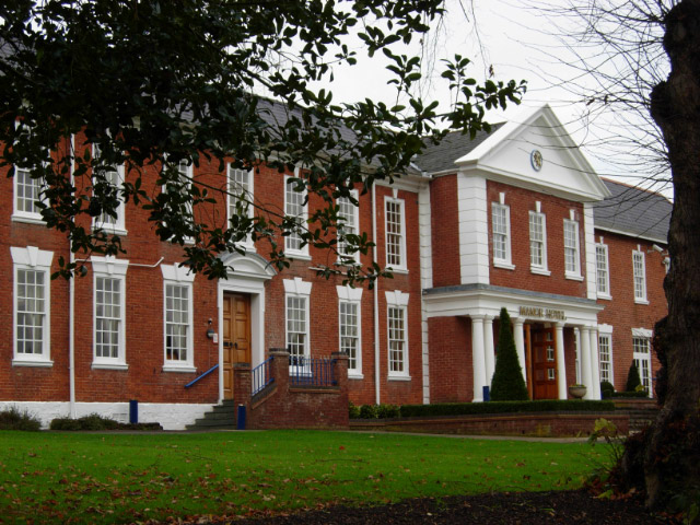
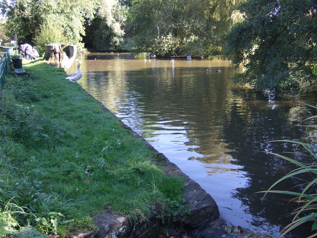
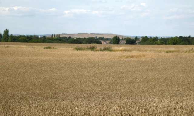
This circular walk takes you around the village, visiting some of the historical highlights. This includes the 15th-century Moat House, the 18th century Manor House Hotel and the old church. There's also a picturesque village pond and some fine views of the surrounding farmland to enjoy.
The Coventry Way and the Heart of England Way pass through the eastern side of the village. These long distance footpaths are a fine way of exploring the surrounding countryside. You could follow the waymarked trail south to visit neighbouring Berkswell which includes a Norman church, a Grade II listed 16th century inn and the Berkswell Windmill which dates back to 1826. The Coventry Way and the Warwickshire Millennium Way can also be picked up around here.
Postcode
CV7 7NN - Please note: Postcode may be approximate for some rural locationsMeriden Ordnance Survey Map  - view and print off detailed OS map
Meriden Open Street Map  - view and print off detailed map
Meriden OS Map  - Mobile GPS OS Map with Location tracking
Meriden Open Street Map  - Mobile GPS Map with Location tracking
Walks near Meriden
- Barston Lakes - This walk takes you around Barston Lakes near the village of Barston in the West Midlands.
- Berkswell Circular Walk - This village near Coventry has a number of good waymarked footpaths to try
- Hampton in Arden - This West Midlands based village includes a train station, a good 17th century village pub and a pleasant local nature reserve for easy walks.
- Coventry - This long circular walk uses a mixture of waymarked footpaths and minor roads to take you to some of the highlights of the city
- Balsall Common - This village near Coventry is surrounded by some lovely countryside with a major long distance trail running right through it.
- Coventry Canal - Enjoy waterside cycling and walking along the 38 mile long Coventry Canal towpath
- Brandon Woods - These woods near Coventry have a network of good footpaths to follow around the 178 acre site
- Kenilworth - A short circular walk around the Warwickshire town of Kenilworth, visiting St Mary's Abbey, Abbey Fields and Kenilworth Castle
- Coventry Way - This walk circles the countryside around Coventry taking you through some fine Warwickshire countryside and a series of interesting villages.
The walk starts at Meriden and heads towards Kenilworth with its impressive castle - described by architectural historian Anthony Emery as the 'finest surviving example of a semi-royal palace of the later middle ages, significant for its scale, form and quality of workmanship' - Brandon Marsh - This lovely nature reserve near Coventry has some nice footpaths taking you around a series of lakes and lagoons
- Ryton Pools Country Park - Enjoy a cycle or walk around this lovely park in Ryton, Warwickshire
- Hearsall Common - This area of common land is located just to the west of Coventry city centre and is a nice place for a peaceful afternoon stroll
- Heart of England Way - Follow the Heart of England Way through the Midlands of England
- Warwickshire Millennium Way - Follow the Millennium Way through the Warwickshire, Worcestershire and Northamptonshire countryside from Pershore to Middleton Cheney
- Solihull - This large town is located in the West Midlands, near Birmingham
Pubs/Cafes
The Bull's Head is an historic coaching inn dating back to the 1600s. They serve good food which you can enjoy in their lovely courtyard and garden area. You can find them on the Main Road at postcode CV7 7NN for your sat navs. The pub is dog friendly.
Photos
Meriden Green. A grade II listed sandstone monument on the village green carries a plaque commemorating Meriden's status as 'Centre of England'.
The Manor Hotel. 112 bedroom hotel on the edge of Meriden village. The building dates back to 1745 and has a fascinating history.


