Minehead Walk
![]()
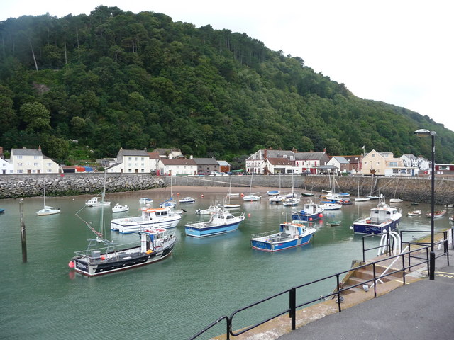
![]() Enjoy a coastal walk in this lovely Somerset town. The town includes a pretty harbour, quay and attractive beaches. This route takes you along the West Somerset Coast Path to one of the highlights of the area at Dunster Castle.
Enjoy a coastal walk in this lovely Somerset town. The town includes a pretty harbour, quay and attractive beaches. This route takes you along the West Somerset Coast Path to one of the highlights of the area at Dunster Castle.
The walk starts next to Minehead Train Station which is on the
West Somerset Railway. You can catch the historic steam locomotives and enjoy views of the Quantocks on the scenic railway. From here you head south past the golf course to Dunster Beach. The beach is a splendid place for a walk with fine sea views and a nature reserve where you can look out for a variety of birdlife.
After about a mile or so you can turn south and head past Dunster Station to Dunster Castle. The Norman Castle is surrounded by a lovely deer park where there are miles of footpaths to try. There's also some beautiful gardens and views toward the Bristol channel, the Quantock hills and Exmoor. After exploring the castle grounds the walk returns to the town centre on the same paths.
The town is also the start/end point for the epic South West Coast Path. You could extend your walking in the area by following the path north to visit Greenaleigh Point where there are some nice woodland trails.
Minehead Ordnance Survey Map  - view and print off detailed OS map
Minehead Open Street Map  - view and print off detailed map
Minehead OS Map  - Mobile GPS OS Map with Location tracking
Minehead Open Street Map  - Mobile GPS Map with Location tracking
Dog Walking
Dunster beach is an excellent place to walk the dog and you will probably see plenty of other owners on a fine day.
Further Information and Other Local Ideas
The walk can be extended by following the Macmillan Way west from Dunster onto Wootton Common where there are some nice woodland trails. In fact you could turn it into a longer circular walk by following the waymarked trail back into the town.
The town is located next to Exmoor where there's great opportunites for walkers. Just to the west you can enjoy miles of paths on the expansive Holnicote Estate where you can climb Selworthy Beacon. Also nearby is the remote Nutscale Reservoir and the climb to Dunkery Beacon where you can enjoy fine views over the area.
The Minehead to Porlock Walk will take you along the coast path to the delightful Porlock Weir.
If you head east along the West Somerset Coast Path you will come to the town of Watchet. The attractive town has an interesting maritime history with museums and a 16th century inn. There's also a picturesque harbour and a fossil rich beach to explore as well.
For more walking ideas in the area see the Exmoor Walks page.
Cycle Routes and Walking Routes Nearby
Photos
Sculpture marking start of South West Coast Path - Minehead. The path follows the coast to Land's End and then to Poole in Dorset, a total of over 630 miles.
This path, over National Trust land, leads from Greenaleigh Farm down to the beach at Greenaleigh Point. It's located just to the north of the town and provides some nice sea views


