Watchet Circular Coastal Walk
![]()
![]() This coastal Somerset town is in a great spot for exploring the nearby Exmoor and Quantock Hills AONB.
This coastal Somerset town is in a great spot for exploring the nearby Exmoor and Quantock Hills AONB.
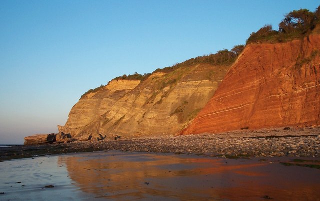
The town has an interesting maritime history with many old buildings including two museums and an ancient 16th century inn. There's also two beaches including Helwell Bay where you can go fossil hunting.
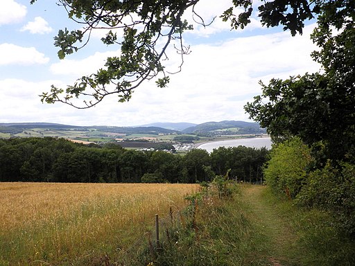
This circular walk starts at the harbour and then heads west along a section of the West Somerset Coast Path. You will pass the Iron Age fort Daw's Castle and Cridland's Copse before coming to Home Farm. Here you can pick up the Monk's Path to Home Farm Blue Anchor and follow it south east to Old Cleeve and the neighbouring village of Washford. The walk then picks up the route of the Old Somerset Mineral Railway, following it north along the Washford River to Watchet.
To extend the walk you could continue west along the coast path Dunster beach where you can also visit the historic Dunster Castle.
Postcode
TA23 0AN - Please note: Postcode may be approximate for some rural locationsWatchet Ordnance Survey Map  - view and print off detailed OS map
Watchet Open Street Map  - view and print off detailed map
Watchet OS Map  - Mobile GPS OS Map with Location tracking
Watchet Open Street Map  - Mobile GPS Map with Location tracking
Walks near Watchet
- Minehead - Enjoy a coastal walk in this lovely Somerset town
- Dunkery Beacon - This walk climbs to Dunkery Beacon on Dunkery Hill, the highest point in Exmoor and Somerset
- Brendon Hills - Explore the Brendon Hills range on this challenging walk in the Exmoor National Park
- West Somerset Coast Path - Follow the beautiful Somerset coast through the Quantock Hills Area of Outstanding Natural Beauty on this lovely coastal walk.
The walk begins at the car park at Steart, next to the Bridgwater Bay National Nature Reserve Nature Reserve - Nutscale Reservoir - This small reservoir is located on Exmoor near Minehead
- Channel to Channel - This walk takes you from the English Channel to the Bristol Channel, through the Devon and Somerset countryside
- Dunster Castle - Explore the parkland, woodland and Historic Deer Park surrounding this Norman Castle near Minehead
- South West Coast Path - This incredible 600 mile walk follows the coast from Minehead in Somerset, through Devon and Cornwall and onto the finish point at Poole in Dorset
- Coleridge Way - Travel through the Exmoor National Park and the stunning Quantocks Hills as you walk in the footsteps of poet Samuel Taylor Coleridge.
You start off in the pretty village of Nether Stowey, at the foot of the Quantock Hills and head west towards Holford, passing the iron age fort of Dowsborough on the way.
You continue through a wooded section at Alfroxton Woods and onto Stowborrow Hill with its resident deer before passing through Bicknoller and Monksilver where you enter Combe Sydenham Country Park - Kilve Beach and East Quantoxhead - This circular walk explores a beautiful area of coast and countryside in the Quantocks.
- Crowcombe - This Somerset based village makes a fine start point for exploring the surrounding Quantocks Hills and Brendon Hills.
- Blue Anchor To Dunster Beach Walk - This walk takes you along Blue Anchor Bay on the Somerset coast
Pubs/Cafes
Pebbles Tavern is a great choice for fans of real ale and cider. The pub has won many CAMRA awards for Cider Pub of the Year including 2020 and in 2015 was the 'runner-up' National Cider Pub of the Year. You can find them on Market Street at postcode TA23 0AN for your sat navs.
There's also the 16th century Bell Inn, the oldest pub in the town. They are located just 100 yards from Watchet's picturesque Marina at postcode TA23 0AN.
Dog Walking
The coast and country trails make for a fine dog walk. Both the Pebbles Tavern and the Bell mentioned above are also dog friendly.
Further Information and Other Local Ideas
The Channel to Channel Walk starts/finishes at the harbour in the town. The long distance route takes you from the English Channel to the Bristol Channel, through some lovely Devon and Somerset countryside. You could follow the trail south to visit Williton where you can pick up the Macmillan Way West.
If you head west to Minehead you could pick up the epic South West Coast Path which starts/finishes here.
Head a few miles east along the coast and you could explore Kilve Beach and East Quantoxhead. The beach is a great place for fossil hunting and walks along the cliff top path. There's also a lovely cafe for cream teas and a 17th century coaching inn in Kilve village.
Photos
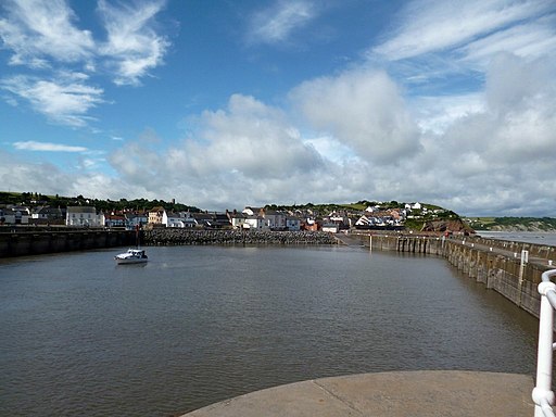
Watchet Harbour was a commercial port until 2000. Since then it has been redeveloped as a marina with the addition of a tidal lock gate. Samuel Taylor Coleridge's poem The Rime of the Ancient Mariner which was written in the area is commemorated by a statue on the harbourside. The Coleridge Way walking trail can be picked up to the south near Williton. The long distance trail explores the area associated with the famous poet.
The Esplanade. The current appearance of the Esplanade, alongside the previously shown Harbour dates from 2007/8 when improvement were made including new paving, lighting, benches and railings. The town has some interesting geology and lots of wildlife with Peregrine Falcons, Oyster Catchers and Egret often spotted in the area.
SDJR No. 88 at Watchet station. The locomotive is former Somerset & Dorset Junction Railway 7F 2-8-0, No. 88, built in 1925. No. 88 is owned by the Somerset & Dorset Railway Trust and is leased to the West Somerset Railway until 2020.


