Over Haddon Lathkill Dale Walk
![]()
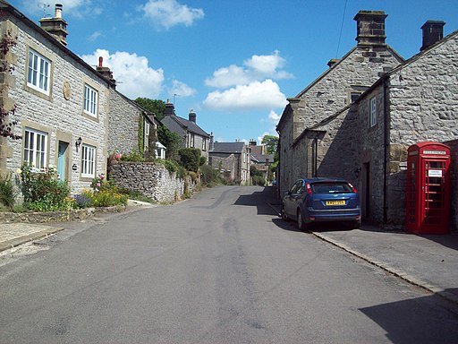
![]() This delightful little village sits in a lovely location in the Derbyshire Peak District.
This delightful little village sits in a lovely location in the Derbyshire Peak District.
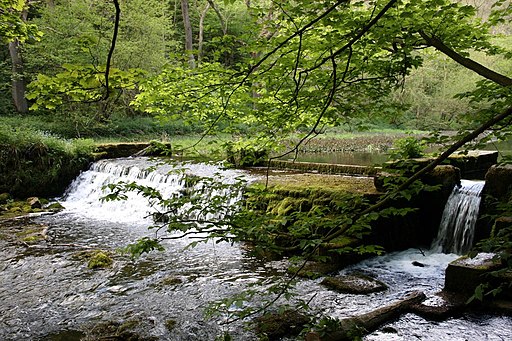
It's a popular place to start a walk with a good sized public car park, a nice local pub and easy access to Lathkill Dale, one of the area highlights. Here you can enjoy little waterfalls and weirs with lots of wildlife to look out for on the way.
This circular walk from the village explores the dale before picking up the Limestone Way to visit neighbouring Youlgreave and Alport. Here you can pick up another riverside trail heading to the ancient Conksbury Bridge before returning to the village.
Over Haddon Ordnance Survey Map  - view and print off detailed OS map
Over Haddon Open Street Map  - view and print off detailed map
*New* - Walks and Cycle Routes Near Me Map - Waymarked Routes and Mountain Bike Trails>>
Over Haddon OS Map  - Mobile GPS OS Map with Location tracking
Over Haddon Open Street Map  - Mobile GPS Map with Location tracking
Walks near Over Haddon
- Lathkill Dale - Enjoy a splendid riverside walk in the beautiful Lathkill Dale in the Peak District
- Limestone Way - Travel through the beautiful Peak District National Park on this walk through Derbyshire and into Staffordshire.
The walk starts at Castleton, passing through the scenic Cave Dale and past the remains of Peverill Castle - Stanton Moor - This upland area near the Derbyshire village of Stanon-in-Peak has good walking trails, attractive woodland and fascinating ancient historical sites to visit.
You can start the walk at the village of Stanon-in-Peak near Matlock - Bakewell River Circular Walk - The market town of Bakewell makes and excellent base for exploring the Derbyshire Dales area of the Peak District National Park.
This long circular walk visits some of the villages, parks, woods and hills surrounding the town - Peak District Inn Way - Visit 51 traditional country pubs on this circular walk through the Peak District.
- Arbor Low - Visit this Neolithic henge monument and enjoy some lovely moorland scenery on this fascinating circular walk in the Peak District
- Ashford in the Water - The pretty Peak District village of Ashford in the Water has some nice walking trails to try along the River Wye
- Bradford Dale - This lovely riverside walk from Youlgreave takes you along the River Bradford before climbing above the village for some great views.
Start the walk in the village and follow Hollywell Lane to the river - Nine Ladies Stone Circle Walk - This walk visits the fascinating Bronze Age stone circle of the Nine Ladies in the Derbyshire Peak District.
- Birchover - This Peak District village is a fine place to start a walk
- Robin Hood's Stride - This walk visits Robin Hood's Stride, a wonderful rock formation near Bakewell in Derbyshire.
- Magpie Mine - This walk visits the Magpie Mine from the Derbyshire village of Sheldon
- Youlgreave - A circular walk around the village of Youlgreave in the Derbyshire Peak District
- Haddon Hall - This walk visits Haddon Hall near Bakewell and Over Haddon in the Derbyshire Peak District.
Pubs/Cafes
Back in the village you can enjoy some post walk refreshment at The Lathkil Hotel. The hotel sits in a wonderful elevated position so you can enjoy panoramic views with your meal. If the sun is shining the outdoor area is one of the best in the country with tremendous country views.
Further Information and Other Local Ideas
To the east is the historic Haddon Hall. This stately home is well worth a visit with a grand Tudor hall and Elizabethan gardens. You can find them near Bakewell at postcode DE45 1LA.


