Paper Mill Lock Walk
![]()
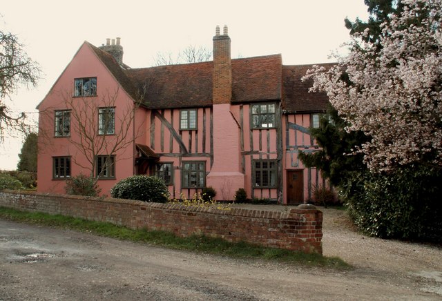
![]() Enjoy an easy stroll along the Chelmer and Blackwater Navigation on this circular waterside walk from Paper Mill Lock. The area is particularly picturesque with the popular Paper Mill Lock tea rooms making an ideal start and finish point to the walk. Head west along the river from here and you will soon pass a reservoir before coming to a footpath which heads south to Little Baddow Hall. This beautiful timber-framed hall, dates back to the 14th-15th century, and stands directly opposite the parish church of St Mary the Virgin. You can follow a footpath east from here, back through the countryside to Coleraines. Turn north here and follow the road back to the lock.
Enjoy an easy stroll along the Chelmer and Blackwater Navigation on this circular waterside walk from Paper Mill Lock. The area is particularly picturesque with the popular Paper Mill Lock tea rooms making an ideal start and finish point to the walk. Head west along the river from here and you will soon pass a reservoir before coming to a footpath which heads south to Little Baddow Hall. This beautiful timber-framed hall, dates back to the 14th-15th century, and stands directly opposite the parish church of St Mary the Virgin. You can follow a footpath east from here, back through the countryside to Coleraines. Turn north here and follow the road back to the lock.
After your walk enjoy refreshments at the canalside tea rooms. There's lovely outdoor seating next to the water with a good range of cakes and beverages to sample. You can also enjoy river cruises from here at reasonable prices.
If you would like to extend the walk you could continue west along the path to Little Baddow Lock and then on into Chelmsford. Heading east will take you into Maldon.
To continue your walking in the area head to Blake's Wood near Little Baddow. It's located just to the south of the lock and has some nice woodland trails to try. The circular Little Baddow starts from the nearby village and visits the lock before heading to the woods.
Postcode
CM3 4BS - Please note: Postcode may be approximate for some rural locationsPaper Mill Lock Ordnance Survey Map  - view and print off detailed OS map
Paper Mill Lock Open Street Map  - view and print off detailed map
Paper Mill Lock OS Map  - Mobile GPS OS Map with Location tracking
Paper Mill Lock Open Street Map  - Mobile GPS Map with Location tracking
Cycle Routes and Walking Routes Nearby
Photos
A view of Little Baddow Hall from the east. This beautiful timber-framed hall, that dates back to the 14th-15th century, stands directly opposite the parish church.


