Pirbright Circular Walk
![]()
![]() This Surrey based village has some nice trails through the local commons and woodland. The pretty village includes several old buildings including a grade II* listed medieval church. There's also the quintessential English village green with picturesque duck pond and cricket pitch.
This Surrey based village has some nice trails through the local commons and woodland. The pretty village includes several old buildings including a grade II* listed medieval church. There's also the quintessential English village green with picturesque duck pond and cricket pitch.
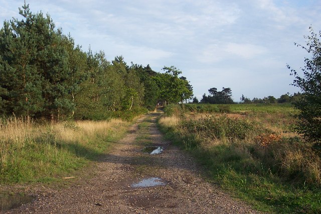
This circular walk explores Pirbright Common and Brookwood Heath just to the south east of the settlement. It's a pleasant area for a stroll with a network of footpaths taking you around the sites. On the way you'll pass heathland and woodland with lots of birdlife to look out for on the way.
On the eastern side of the route you will find the noteworthy Brookwood Cemetery. The cemetery is the largest in the UK and includes a 220 Acre park with some good walking trails.
Pirbright Ordnance Survey Map  - view and print off detailed OS map
Pirbright Open Street Map  - view and print off detailed map
*New* - Walks and Cycle Routes Near Me Map - Waymarked Routes and Mountain Bike Trails>>
Pirbright OS Map  - Mobile GPS OS Map with Location tracking
Pirbright Open Street Map  - Mobile GPS Map with Location tracking
Pubs/Cafes
Back in the village the Cricketers on the Green is a good choice for post walk refreshment. The award winning gastropub is in a fine location on the village green with its duck pond and cricket pitch. The pub includes alfresco terraces as well as a Yurt Cafe. You can find them at postcode GU24 0JT for your sat navs.
Dog Walking
The woodland and heathland on the common are ideal for a dog walk. The Cricketers mentioned above is also dog friendly outside.
Further Information and Other Local Ideas
Just to the east of the village there's some nice trails to follow around Whitmoor Common. The expansive common includes heathland, woodland, grassland and ponds.
You could also pick up the Wey South Path and enjoy a riverside stroll through Guildford. This will take you to the lovely Riverside Park Nature Reserve and Parsonage Water Meadows. You can also pick up the Guildford Canal Walk in the nearby town.
To the west you can pick up the Basingstoke Canal Walk. If you follow it west it will take you towards Farnborough, the lakes at Frimley Hatches Nature Reserve and Frimley Green.
For more walking ideas in the area see the Surrey Walks page.
Cycle Routes and Walking Routes Nearby
Photos
Brookwood Heath. The sandy free-draining soil of the heathland means that the pond in middle-distance only fills during times of prolonged rain, and dries up almost entirely during the summer months.
Pirbright pond and green. The village of Pirbright is spread out around the perimeter of an extremely large green on which is this attractive pond, lovingly maintained by the parish council. Even the presence of the busy A324 road running down one side of the green cannot detract from its beauty.
Pirbright Church. The church of St Michael and All Angels at Pirbright is tucked away along a narrow lane leading off the green. It was rebuilt late in the 18th century in the Georgian style, having been in a ruinous state after a fire many – some say 100 – years before. The villages couldn't afford the cost of rebuilding so they were granted a charter by George III to collect from house to house all over England the £2024 and five old pence that they needed.
The army training area on Pirbright Common. No longer a right of way, the Old Guildford Road (see SU9055) heads south-east through the army training area on Pirbright Common. Thanks to the army's presence thousands of acres of countryside have remained untouched in an area in which land is readily gobbled up for development.


