Selsey Bill
![]()
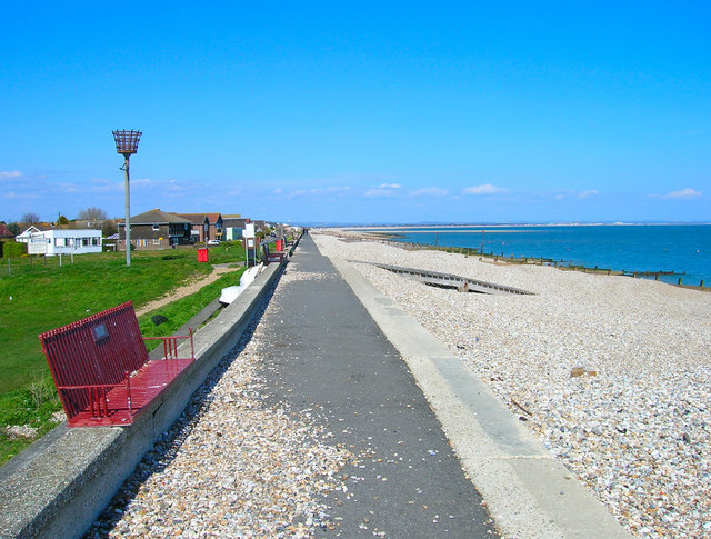
![]() This walk visits the southernmost point of Sussex in the town of Selsey. You can park at the East Beach car park to start your walk. From there it's a nice 1 mile walk along the pretty beach to Selsey Bill. After your walk you can enjoy refreshments in one of the cafes. The area is also well known for its excellent fresh fish huts.
This walk visits the southernmost point of Sussex in the town of Selsey. You can park at the East Beach car park to start your walk. From there it's a nice 1 mile walk along the pretty beach to Selsey Bill. After your walk you can enjoy refreshments in one of the cafes. The area is also well known for its excellent fresh fish huts.
The walk can be extended by visiting the nearby Pagham Harbour. It's located just to the north of Selsey and includes a fantastic nature reserve with thousands of wading birds.
If you head north west from the headland you can visit East Wittering and West Wittering with views of Bracklesham Bay. Here you can enjoy a walk through the sand dunes at East Head and pick up the long distance New Lipchis Way to take you into Chichester. You can also enjoy more nice walking trails around Chichester Harbour and Thorney Island.
Postcode
PO20 0DL - Please note: Postcode may be approximate for some rural locationsSelsey Bill Ordnance Survey Map  - view and print off detailed OS map
Selsey Bill Open Street Map  - view and print off detailed map
Selsey Bill OS Map  - Mobile GPS OS Map with Location tracking
Selsey Bill Open Street Map  - Mobile GPS Map with Location tracking
Pubs/Cafes
The Lifeboat Inn is positioned in a lovely spot close to the sea front. They serve good quality food which you can enjoy outside with a lovely view.
You can find them on Albion Road at postcode PO20 0DJ for your sat navs. The pub is dog friendly.
Further Information and Other Local Ideas
The Selsey To West Wittering Walk will take you west to West Wittering via the RSPB Medmerry Nature Reserve. The nearby reserve is a great place for cycling and walking with a wide variety of wildlife to see.
For more walking ideas in the area see the Sussex Walks page.
Cycle Routes and Walking Routes Nearby
Photos
Slipway, East Beach. At the northern end of the park that is located on the other side of the sea wall.


