St Illtyd's Walk OS Map
![]()
![]() A religous walk from Pembrey Country Park (Carmarthenshire) to Margam Country Park (Neath). The path runs through Hendry, Pontardawe and Bryn.
You will visit Penlle'r Castell ruin on the summit of Mynydd y Betws (with fabulous views), the spectacular Melincourt Falls on the Neath River and the Vale of Neath. There are also splendid views of the Black Mountains and peaceful wooded sections near Abercregan. The two splendid country parks at either end of the walk are also real highlights on this challenging walk.
A religous walk from Pembrey Country Park (Carmarthenshire) to Margam Country Park (Neath). The path runs through Hendry, Pontardawe and Bryn.
You will visit Penlle'r Castell ruin on the summit of Mynydd y Betws (with fabulous views), the spectacular Melincourt Falls on the Neath River and the Vale of Neath. There are also splendid views of the Black Mountains and peaceful wooded sections near Abercregan. The two splendid country parks at either end of the walk are also real highlights on this challenging walk.
Near Swansea the route also skirts the edge of the wonderful Cwm Clydach National Nature Reserve.
It's worth taking a small detour from the route to explore the reserve with it's woodland, wildlife, rivers and waterfalls.
The walk is waymarked with a white and yellow disc.
St Illtyd's Walk Ordnance Survey Map  - view and print off detailed OS map
St Illtyd's Walk Open Street Map  - view and print off detailed map
*New* - Walks and Cycle Routes Near Me Map - Waymarked Routes and Mountain Bike Trails>>
St Illtyd's Walk OS Map  - Mobile GPS OS Map with Location tracking
St Illtyd's Walk Open Street Map  - Mobile GPS Map with Location tracking
Further Information and Other Local Ideas
At the end of the route in Margam you could follow a footpath north to visit Brombil Reservoir. The picturesque turquiose coloured lake is a lovely place for a peaceful stroll. From the hills surrounding the lake there are fine views to the coast too. You can find the site just a mile north of the route end point in Margam Country Park.
Cycle Routes and Walking Routes Nearby
Photos
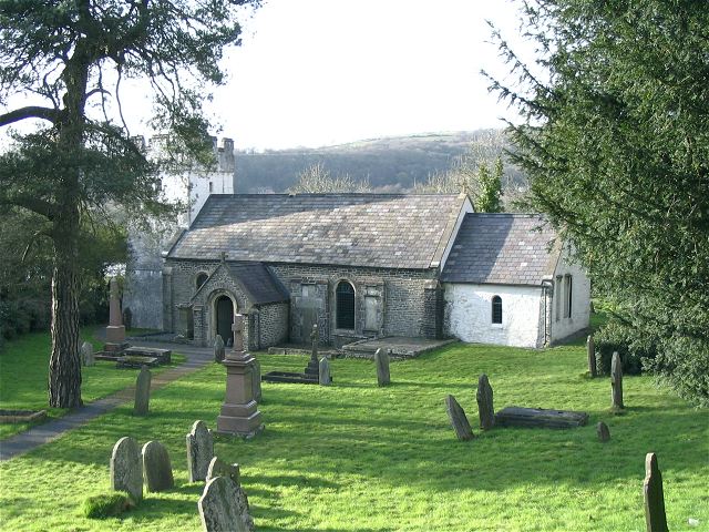
St Illtyd's Church. This church is the end point for St Illtyd's walk. The walk is finishes mid way along a canal tow path. The canal is the other side of the church and the tow path is on the far side of the canal. Thus the church cannot be reached from the path named after it.
Spoil heaps below Ffynnon Oer wind farm. All the spoil heaps from the abandoned mine at the head of Cwmcaca are visible together when viewed from St Illtyd's walk to the northeast. The heaps all seen to have been formed from one level at the height of the tramway
Concrete Pillar on Craig Y Llyn. A rather anonymous concrete pillar on St Illtyd's Way across the ridge over Llyn Fawr. There is a similar one in the picnic area southeast at SN9202
A ruin on Mynydd Nant-y-Bar. This ruin is in the middle of Forestry Commission land. Locals believe it to be the remains of an old farm that predates the forestry land. The path seen passing the ruin to the right is part of St. Illtyd's Walk footpath. Unusually, a solitary Monkey Puzzle tree (Araucaria araucana) stands in what would have been the building's front garden.
Sheep on a forestry commission road The road sign is to let forestry traffic know that one of the numerous mountain bike paths crosses the track ahead. These bike-only tracks don't appear on any Ordnance Survey map but form one of the best mountain bike networks in the world. The bike in the sign is obviously an outline of a mountain bike. This track also forms part of the St. Illtyd's Way walk.
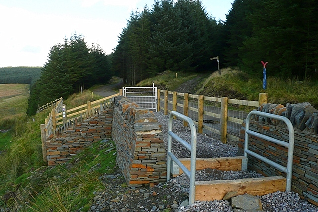
Meeting of the ways A series of options here, depending on your mode of transport. This intricate arrangement has been put in to allow horse riders and cyclists to use the bridleway, the Cefn Ffordd track that we are standing on, but prevent use by scramblers. The bridleway continues along either the road or the track ahead. The road is the exit for vehicles from the Ffynnon Oer wind farm behind us, and was presumably the route for construction vehicles about 3 or 4 years ago. The road and the adjacent track are a dog-leg in the Coed Morgannwg Way. The St Illtyd's Walk also comes up the track we are standing on, and goes off on the track to the right.


