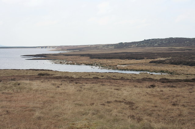
Warland Reservoir
![]()
![]() This walk takes you to a series of reservoirs in the Calderdale area of West Yorkshire. On the route there's lovely views across the picturesque lakes to the heather moors and rolling hills beyond.
This walk takes you to a series of reservoirs in the Calderdale area of West Yorkshire. On the route there's lovely views across the picturesque lakes to the heather moors and rolling hills beyond.
The walk starts from the public car park at Blackstone Edge. From here you can pick up a section of the Pennine Way and follow it north to Blackstone Edge Reservoir, White Holme Reservoir, Light Hazzles Reservoir and Warlands Reservoir. You can then follow a footpath around Warland Reservoir before returning on the same paths.
If you head just a mile north of the lake you could visit the pretty Gaddings Dam. The small reservoir is notable for having the highest beach in Britain.
Warland Reservoir Ordnance Survey Map  - view and print off detailed OS map
Warland Reservoir Open Street Map  - view and print off detailed map
Warland Reservoir OS Map  - Mobile GPS OS Map with Location tracking
Warland Reservoir Open Street Map  - Mobile GPS Map with Location tracking
Further Information and Other Local Ideas
Head north east and you can visit Withens Clough Reservoir and the interesting little village of Cragg Vale.
The climb to the gritstone escarpment of Blackstone Edge also starts from the reservoir car park. There are wonderful views over Greater Manchester and Yorkshire from the elevated position of the Edge.
The circular Centenary Walk around Todmorden passes along the western side of the reservoir. The long distance trail explores the area around the town. Just to the west of Todmorden there's also some nice peaceful trails around the woodland of Gorpley Clough and the adjacent Gorpley Reservoir.
For more walking ideas in the area see the South Pennines Walks page.
Cycle Routes and Walking Routes Nearby
Photos
Pennine Way alongside Warland Reservoir. Walking northwest alongside the reservoirs shortly after crossing the A58 at the White House is quite a tedious section of the long distance trail. The railings of the reservoir are right of shot. View into West Yorkshire from a point very close to the county boundary.


