Wingerworth Walks
![]()
![]() This attractive Derbyshire village is located just to the south of Chesterfield.
This attractive Derbyshire village is located just to the south of Chesterfield.
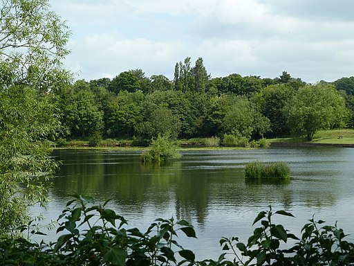
This walk in the village visits two pretty bodies of water in the area. You start off at the Wingerworth Lido where there's a short circular footpath around the water. The route then heads north west following Birkin Lane and Pearce Lane to The Great Pond of Stubbing. There's footpaths running around the large pond with woodland trails and lots of wildlife to see. On the way you'll also pass the village's Garden centre which is worth popping into.
After exploring the pond the route then heads east back to the Lido.
Just to the south of the village there's some walking trails around Bole Hill and the Press Reservoirs.
Postcode
S42 6LN - Please note: Postcode may be approximate for some rural locationsPlease click here for more information
Wingerworth Ordnance Survey Map  - view and print off detailed OS map
Wingerworth Open Street Map  - view and print off detailed map
Wingerworth OS Map  - Mobile GPS OS Map with Location tracking
Wingerworth Open Street Map  - Mobile GPS Map with Location tracking
Pubs/Cafes
The Smithy Pond pub overlooks the lido and is a nice place for some post walk refreshment. They serve good value meals which you can enjoy outside with a view of the ducks/swans on the water. You can find them at Nethermoor Rd, S42 6LN.
Dog Walking
The lakeside paths and the woodland trails around Stubbing make for a pleasant dog walk. The Smithy Pond mentioned above is also dog friendly.
Further Information and Other Local Ideas
Just to the east you can continue your walking around Grassmoor Country Park where there's woodland trails and lots of pretty lakes to see. You can also pick up the Five Pits Trail here and follow it east to the Williamsthorpe Ponds Nature Reserve.
Head north into Chesterfield and you can enjoy more waterside walking along the
Chesterfield Canal and the Cuckoo Way.
To the west there's the noteworthy Pleasley Pit Country Park. Here you will find a number of walking trails taking you to ponds, reed beds, grassland and woodland. The area also includes the picturesque Pleasley Vale where there's a nature trail running along the River Meden to the old mill buildings.
For more walking ideas in the area see the Derbyshire Walks page.


