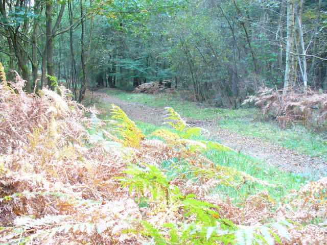
Winterfold Forest
![]()
![]() This lovely area of the Surrey Hills is a popular place for walkers and cyclists. Winterfold Wood and the adjacent Hurt Wood have many miles of footpaths and bridleways which are suitable for mountain bikers.
This lovely area of the Surrey Hills is a popular place for walkers and cyclists. Winterfold Wood and the adjacent Hurt Wood have many miles of footpaths and bridleways which are suitable for mountain bikers.
There are Hurtwood Control car parks on Greensand Lane where you can start your walk or ride. The car park is near to a number of mountain bike trails including the Charles Bronson and the Northern Monkey. These are located just south of the car park. You can see them marked on the open street map link below. There's also the Secret Santa trail. See the video below to give you an idea of what you can expect on this exhilarating ride.
For walkers there are miles of woodland trails with some decent climbs, picnic areas and great viewpoints.
This circular route starts at the Hurtwood Control car park on Winterfold Hill and follows bridleways to the northern part of the forest, visiting Winterfold Heath and Reynards Hill.
The Greensand Way long distance footpath passes through the woods. If you follow it east you can visit Hurt Wood, Pitch Hill and climb to Holmbury Hill. The hill stands at an impressive 856 feet (261 m), giving fine views over the surrounding area.
Postcode
GU5 9EN - Please note: Postcode may be approximate for some rural locationsWinterfold Forest Ordnance Survey Map  - view and print off detailed OS map
Winterfold Forest Open Street Map  - view and print off detailed map
*New* - Walks and Cycle Routes Near Me Map - Waymarked Routes and Mountain Bike Trails>>
Winterfold Forest OS Map  - Mobile GPS OS Map with Location tracking
Winterfold Forest Open Street Map  - Mobile GPS Map with Location tracking
Explore the Area with Google Street View 
Pubs/Cafes
On the southern side of the forest there's the pretty village of Cranleigh where you could visit the 17th century Three Horseshoes pub. The old fashioned village inn has a delightful interior with wooden floors, nooks, crannies and beams and even an inglenook fireplace with a roaring fire in winter. Outside there's a lovely garden area with lots of plants and herbs and private "wine huts" available for booking.
They serve good quality food and have a fine selection of real ales too.
You can find them on the High Street with postcode GU6 8AE for your sat navs.
Further Information and Other Local Ideas
A few miles to the east of the forest then you could enjoy a climb to the noteworthy Leith Hill, the highest point on the Greensand Ridge. Around here you'll also find the expansive Abinger Common and Holmwood Common with miles of good walking trails to try. The circular Friday Street Walk can be picked up on nearby Abinger Common. It explores the pretty Friday Street Mill Pond and the 17th century Wotton House Estate before heading to the Tillingbourne Waterfall on the River Tillingbourne.
To the west you can pick up the Shamley Green Circular Walk and visit the Wey and Arun Canal Walk. The village has a couple of nice pubs overlooking the village green too.
Cycle Routes and Walking Routes Nearby
Photos
Winterfold Forest. Bridleway flanked by bracken and birchwoods, heading gently uphill towards Ewhurst Windmill.
Madgehole Lane. Attractive vernacular tile-hung cottage amongst grassy fields and pieces of woodland on the Greensand Ridge.


