Wirral Circular Trail
![]()
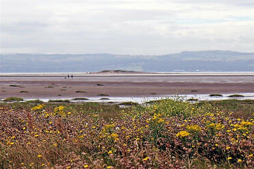
![]() Explore the beautiful Wirral Peninsula on this circular cycling and walking trail. The 60 km (37 mile) trail starts at the Seacombe Ferry Terminal and visits Wallasey, Hoylake, Heswall and Neston. Along the way there's splendid views over the Mersey to the city of Liverpool on the eastern side of the peninsula. At the northern end around Hoylake you can look out upon the estuary of the River Dee and the Irish Sea. On the western side you will pass West Kirby and the splendid Wirral Country Park with boulder-clay cliffs and more great views of the Dee Estuary and the lovely Hilbre Island. You can visit the island at low tide and look out for grey seals.
Explore the beautiful Wirral Peninsula on this circular cycling and walking trail. The 60 km (37 mile) trail starts at the Seacombe Ferry Terminal and visits Wallasey, Hoylake, Heswall and Neston. Along the way there's splendid views over the Mersey to the city of Liverpool on the eastern side of the peninsula. At the northern end around Hoylake you can look out upon the estuary of the River Dee and the Irish Sea. On the western side you will pass West Kirby and the splendid Wirral Country Park with boulder-clay cliffs and more great views of the Dee Estuary and the lovely Hilbre Island. You can visit the island at low tide and look out for grey seals.
Other highlights include Eastham Country Park on the eastern side of the Wirral. Here you'll find 100 acres of broadleaf woodland with surfaced walking paths and a cycle track. You will also pass the fascinating model village at Port Sunlight and the delightful village of Parkgate with its marshes and wide variety of birdlife.
Wirral Circular Trail Ordnance Survey Map  - view and print off detailed OS map
Wirral Circular Trail Open Street Map  - view and print off detailed map
Wirral Circular Trail OS Map  - Mobile GPS OS Map with Location tracking
Wirral Circular Trail Open Street Map  - Mobile GPS Map with Location tracking
Further Information and Other Local Ideas
The Burton Marshes Greenway starts just south of Neston train station. The shared cycling and walking trail will take you south through the RSPB's Burton Mere Wetlands where you can look out for a wide variety of birdlife on the River Dee Estuary.
Cycle Routes and Walking Routes Nearby
Photos
These signs on the Wirral Way (part of the Circular Trail) are at the junction of Station Road, Davenport Road and Riverbank Road, Heswall.


