Shipley Country Park
![]()
![]() This large country park near Ilkeston boasts 700 acres of attractive and varied landscape. In the park you'll find a number of lovely walking trails while the Nutbrook Trail cycle route also runs through the park.
This large country park near Ilkeston boasts 700 acres of attractive and varied landscape. In the park you'll find a number of lovely walking trails while the Nutbrook Trail cycle route also runs through the park.
The trails visit Porter Wood, Mapperley Wood, Shipley Lake, the Shipley Hill viewpoint and Mapperley Reservoir. There's excellent facilities with a visitor centre, play areas, and a wildlife garden. The park is not far from both Derby and Nottingham.
You can extend your walk from Ilkeston by picking up the Centenary Way waymarked trail. It heads west from the town to West Hallam.
Postcode
DE75 7GX - Please note: Postcode may be approximate for some rural locationsPlease click here for more information
Shipley Country Park Ordnance Survey Map  - view and print off detailed OS map
Shipley Country Park Open Street Map  - view and print off detailed map
Shipley Country Park OS Map  - Mobile GPS OS Map with Location tracking
Shipley Country Park Open Street Map  - Mobile GPS Map with Location tracking
Pubs/Cafes
The Nutbrook Coffee Shop is located right on the Nutbrook Trail, minutes from Shipley Park. It's about a 30 minute walk from the Shipley Country Park Visitor Centre (1.7 miles), following the Nutbrook Trail past Osbournes Pond. There's a great selection of freshly made sandwiches, panini’s, pies, pasties and a fantastic range of cakes. There's also a very pretty garden area to sit out in on warmer days. You can find it on the trail at postcode DE7 6BQ for your sat navs.
Dog Walking
The wide open fields and woodland in the park are popular with dog walkers. You'll probably bump into other owners on a fine day. The cafe mentioned above is also dog friendly.
Further Information and Other Local Ideas
Just east of Ilkeston there's some nice trails along the Nottingham Canal Nature Reserve at Cossall. The pretty village also includes a noteworthy 13th century church and the 17th century Willoughby Almshouses.
A few miles to the north east there's the lovely Collier's Wood Nature Reserve and Moorgreen Reservoir. The reserve is worth visiting with a large pond and good surfaced paths. Just over a mile to the north of the reservoir there's also the noteworthy Felley Priory. The historic 15th century house is surrounded by some beautiful gardens with herbaceous borders, splendid topiary and bluebell woodland. Hucknall's Bestwood Country Park can also be found in this area.
For more walking ideas in the area see the Derbyshire Walks page.
Cycle Routes and Walking Routes Nearby
Photos
Osborne's Pond, Shipley Park. Originally a feeder reservoir to the Nutbrook Canal which served the Shipley Hall collieries. Now part of Shipley Country Park.
Osborne's Pond. This small body of water was originally created as a feeder for the Nutbrook Canal, which was constructed in 1791. The canal is now defunct, but the pond remains as an integral part of Shipley Park and is popular with fishermen.
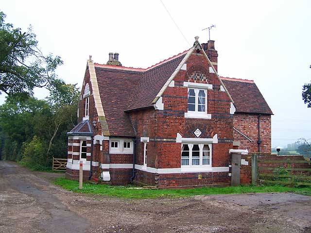
Smalley Lodge. A Grade 2 listed building this was built as a gatehouse to the former Shipley Hall estate. It carries the date 1861, the estate being owned for many years by the Miller-Mundy family who were big noises in the coal industry. Much of the estate now forms the Shipley Country Park and part of it, where one of the mines stood, is the American Adventure Theme Park.


