Union Canal
![]()
![]() Follow the Union Canal towpath from Falkirk to Edinburgh on this super, waterside cycling and walking route. The route follows National Cycle Network Routes 75 and 754 so is well signed throughout. At Falkirk you can link up with the Forth and Clyde Canal which will take you into Glasgow. See the Glasgow to Edinburgh route for full details of this.
Follow the Union Canal towpath from Falkirk to Edinburgh on this super, waterside cycling and walking route. The route follows National Cycle Network Routes 75 and 754 so is well signed throughout. At Falkirk you can link up with the Forth and Clyde Canal which will take you into Glasgow. See the Glasgow to Edinburgh route for full details of this.
The route starts at Falkirk near the train station and follows the canal to Linlithgow, passing Polmont and Muiravonside Country Park. Here you will find 170 acres of woodland and parkland with views of the River Avon. Also in Linlithgow you'll pass the splendid Beecraigs Country Park which has miles of woodland cycling and walking trails. You can also enjoy a stroll around Linlithgow Loch.
The next section runs from Linlithgow to Ratho, passing farmland, woodland and the settlements of Broxburn, Winchburgh and Philpstoun. You also pass the Almond Aqueduct which carries the canal 23 metres above the wooded River Almond gorge. Not far from here you will find the pretty Almondell and Calderwood Country Park with peaceful woodland and a lovely waterside trail running along the River Almond.
The final section takes you from Ratho in Edinburgh. The first few miles take you through farmland before entering the suburbs of Edinburgh. You soon come to Slateford Aqueduct which carries the canal over the Water of Leith.
It is the second largest aqueduct in Scotland at 180 metres long and 18 metres tall. The route ends at Lochrin Basin in the city centre of Edinburgh.
Union Canal Ordnance Survey Map  - view and print off detailed OS map
Union Canal Open Street Map  - view and print off detailed map
Union Canal OS Map  - Mobile GPS OS Map with Location tracking
Union Canal Open Street Map  - Mobile GPS Map with Location tracking
Pubs/Cafes
In Linlithgow you will find the Linlithgow Canal Centre. The centre is a nice place for a pit stop with an interesting museum where you can learn about the history of the canal. There's also a nice tea room for refreshments, relaxing boat trips and boat hire.
Further Information and Other Local Ideas
Near the start you can take a small detour to visit Callendar Park, just south of Falkirk. The 14th century French chateau styled house is surrounded by lovely parkland and woodland with a fascinating museum and a Roman Antonine Wall to see.
Cycle Routes and Walking Routes Nearby
Photos
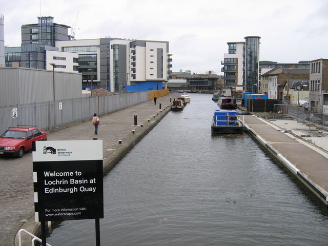
Lochrin Basin, Union Canal, Edinburgh, March 2008. A view along Lochrin Basin, essentially the eastern terminus of the Union Canal, from the footbridge accompanying the Leamington Lift Bridge. On the left the brewery site is a contractor's store, a pile of rubble and a new office block, but reminders of the former occupancy are still on the fence showing where brewery workers should assemble in the event of an emergency requiring evacuation of the site. On the right the old workshop buildings in Lower Gilmore Place now sit incongruously alongside the modern architecture of Fountain Court and Edinburgh Quay — or is it the latter that are incongruous by their domineering height?
Union Canal, Greenbank, Falkirk. Port Maxwell, a short arm of the Union Canal, at the Greenbank Aqueduct over Greenbank Road. The arm leads to a small mooring basin by Greenbank Road.
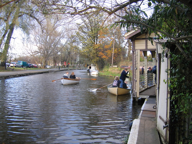
Exercise in the fresh air and keeping warm in winter. Remembrance Sunday and families have eschewed the rowing-machine in the gym in favour of the real thing on the Union Canal at Harrison Park, Edinburgh. No previous experience necessary! Just put the flat end in the water and pull on the other end.
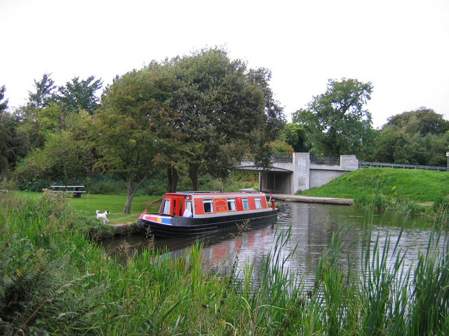
Thistledown on Union Canal at Vellore Road, Maddiston. The hired narrow boat "Thistledown", based at Linlithgow, berthed for the night at a picnic spot and winding hole adjacent to Vellore Road bridge No 51. After the Union Canal was formally abandoned in 1964, Vellore Road, which linked Lilnlithgow Bridge and Maddiston and served a major brick works, was improved and the original bridge was demolished and replaced by a pipe culvert through an embankment. When the canal was re-opened in 2001, Bridge 51 was one of several new bridges that had to be provided.


