Wimpole Hall
![]()
![]() This 17th century country house near Cambridge is surrounded by 3,000 acres of parkland and farmland.
This 17th century country house near Cambridge is surrounded by 3,000 acres of parkland and farmland.
There are miles of walking paths taking you to the walled garden with glasshouse and vegetable plots, the glorious parterre with 12,000 plants and the delightful pleasure gardens. There's also the opportunity for a quiet woodland stroll through Cobbs Wood where you can look out for eight species of woodland bat.
The site includes Home Farm with its donkeys, shire horses and rare breed livestock. It's great for families as children can groom the donkeys and have a drive on a mini tractor. There are also 18th century farm buildings including cart sheds, stables, cattle yards and deer pens.
You can also explore the house with its grand rooms and collections of furniture, porcelain and paintings.
If you would like to continue your walk you could pick up the Wimpole Way and head north to visit the Hardwick Wood nature reserve. The long distance trail will eventually lead you into Cambridge.
Please click here for more information
Wimpole Hall Ordnance Survey Map  - view and print off detailed OS map
Wimpole Hall Open Street Map  - view and print off detailed map
Wimpole Hall OS Map  - Mobile GPS OS Map with Location tracking
Wimpole Hall Open Street Map  - Mobile GPS Map with Location tracking
Further Information and Other Local Ideas
The Clopton Way starts at the hall. This long distance trail will take you to Gamlingay via the abandoned medieval village of Clopton.
Head a few miles east of the hall and you could visit the worthy village of Haslingfield. Here you'll find pleasant walks along the River Rhee, rows of quaint thatched cottages, a church dating back to the 12th century and a noteworthy Tudor Manor House where Queen Elizabeth I stayed during the 16th century.
Just to the north is the new settlement of Cambourne. There's some pleasant walks around this modern village with a lovely local nature reserve to explore. The wildlife rich reserve includes pretty lakes, wildflower meadows and wetland areas. On the walk you can also visit the ancient Bourn Windmill, the oldest surviving windmill in the United Kingdom.
Just to the south there's the pretty village of Therfield and the popular Royston Heath. The heath is well worth a vist with its fine viewpoint and interesting wildlife. The site also includes a decent on site cafe with outdoor seating overlooking the heath.
Just to the east is Shepreth where you could visit the Shepreth Wildlife Park. The park includes some exotic animals including red pandas, llamas, monkeys and tigers.
Cycle Routes and Walking Routes Nearby
Photos
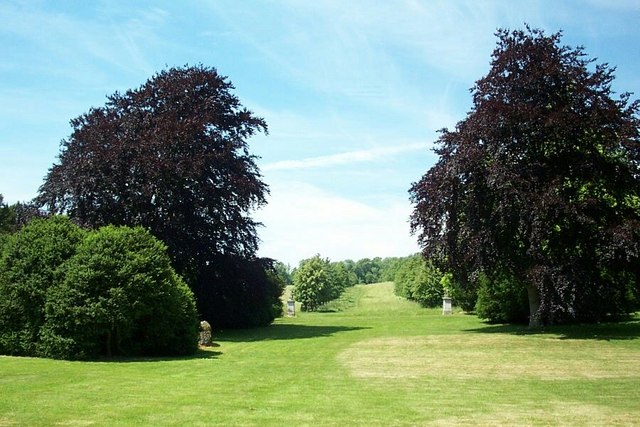
Wimpole Hall the grounds, looking west - the wall which surrounds the estate is hidden in a ditch between the pillars in the centre of the photo and this gives the impression that the estate extends to the horizon


