Cornish Way
![]()
![]() This is the complete National Cycle Network route from Land's End to Bude. The ride follows National Cycle Route 3 and 27 through some of the most beautiful countryside in Cornwall. The ride passes through Camborne, Redruth, Penzance, Truro, St Austell and Bodmin with several fantastic coastal sections to enjoy.
This is the complete National Cycle Network route from Land's End to Bude. The ride follows National Cycle Route 3 and 27 through some of the most beautiful countryside in Cornwall. The ride passes through Camborne, Redruth, Penzance, Truro, St Austell and Bodmin with several fantastic coastal sections to enjoy.
The route has been split into 3 sections:
Cornish Way - section 1 - Land's End to Truro
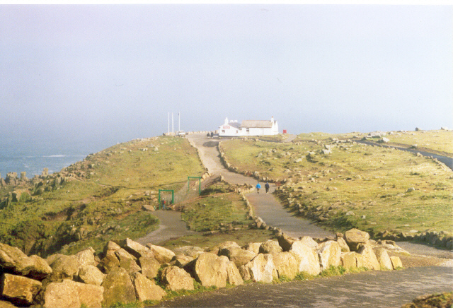
Starting at the most westerly tip of the mainland by the Trevescan cliff follow National Cycle route 3 to Truro. The route starts with a traffic free section near the coast before heading inland on a series of country roads. Shortly after St Buryan you will pass the Merry Maidens Stone Circle (below) before ariving at Mousehole with its stunning harbour.
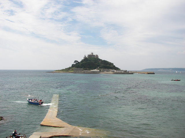
You'll then follow an off road track along the coast to Newlyn and then onto the popular tourist destination of Penzance. From here follow the off road St Michael's way along the coast to Marazion, where you will find the splendid St Michael's Mount.
The route then heads inland towards the Hayle Estuary and then Camborne. You continue east through Redruth on a mixture of on and off road sections passing the lovely Bissoe Valley Nature Reserve. You'll then continue on quiet roads before a pleasant off road section takes you into the finish point in Truro.
Cornish Way - section 2 - Truro to St Austell
Follow National Cycle Network route 3 from Truro through some spectacular Cornish scenery and a beautiful coastal stretch to the popular town of St Austell. The route starts with a lovely off road stretch by the Truro river before boarding the King Harry Ferry to take you across the river Fal. You continue to the coast with fantastic views of Pendower and Carne Beach before coming to the beautiful Portloe (pictured below). The route then passes through St Michael Caerhays before arriving at the beautiful port of Mevagissey and the nearby world renowned Lost Gardens of Heligan. A short on road stretch then takes you onto the finish point at St Austell.
Cornish Way - section 3 - St Austell to Bude
Follow national cycle network route 3 from St Austell to Bude via Bodmin. Highlights include the delightful Camel Trail which runs in part along the River Camel and a lovely coastal stretch into the finish at Bude including views of Widemouth Bay. Also take time to see the wonderful Eden Project which is located near St Austell and Lanhydrock-a magnificent country house owned by the National Trust and situated near Bodmin.
Cornish Way Ordnance Survey Map  - view and print off detailed OS map
Cornish Way Open Street Map  - view and print off detailed map
Cornish Way OS Map  - Mobile GPS OS Map with Location tracking
Cornish Way Open Street Map  - Mobile GPS Map with Location tracking
Pubs/Cafes
The Beach House Hotel at Widemouth is a gem of a place, with great food and an outdoor seating area on the beach. It was listed in the top 20 beachside bars & restaurants in the UK in The Times (2018). There's seafood & spices, chargrilled steaks & skewers, little dishes & sweet treats. You can find the bar right on the beach at postcode EX23 0AW.
Another noteworthy potential pit stop can be found in Mevagissey at the Sharksfin. The pub is ideally located next to the quay with great views across the harbour. They do excellent seafood including a particularly popular fish and chips. The interior is very attractive too, being decorated with works by local artists. You can find them at a postcode of PL26 6QU for your sat navs. A stroll around the pretty fishing village is also recommended with lots of quaint little shops and old cottages to see on the narrow streets.
In Camborne there's The Beacon Inn. The friendly inn is set in the old mining district above Camborne and includes an interesting mural depicting local mining scenes. Outside there is a beer garden used in summer for barbecues and a cider frestival. They are located at postcode TR14 7SE for your sat navs.
Further Information and Other Local Ideas
In St Austell the trail links up with the Pentewan Trail. This shared cycling and walking trail runs along an old railway line to the coast at Mevagissey.
Part of the route follows National Cycle Route 32 which runs from Bodmin to Truro via St. Columb Major, Padstow and Newquay.
Cycle Routes and Walking Routes Nearby
Photos
Sundial sculpture, Park, St Austell. The small park, which contains recovered gravestones arranged around its perimeters, also contains a sundial sculpture as a focal point. The beech tree trunk obscures a group of people. The white dog was waiting for instructions from its master. Long afternoon shadows reach across the park in the late January afternoon, but the days are starting to lengthen a little.
National Cycle Route 32 - Camel Trail. This picnic bench is at the point where the trackbed of the old North Cornwall Railway (from Launceston and Camelford) joins the Camel Trail (the old Bodmin and Wadebridge railway). Also seen in the photo is a Mills-type milepost. The Camel Trail forms only part of NCR32 - after Wadebridge and Padstow the NCR continues to Newquay and Truro, forming part of the Cornish Way
Family of Cyclists on the Camel Trail approaching Padstow. Looking east along the Camel Estuary adjacent to one of the many rest stops along the trail.
The Bude Light and Bude town at the end of the route. Looking north-east from the Lower Wharf towards the town centre. The Bude Light monument was built in 2000 as a millennium tribute to Sir Goldsworthy Gurney (1793-1875), a prolific Cornish inventor. 30 feet high, it was designed by Carole Vincent and Anthony Fanshawe, and uses fibre optics to light up at night. Gurney invented the Bude Light, a brilliant light created by introducing oxygen into the centre of a gas or oil flame, in 1830. It was used in the Houses of Parliament, for lighthouses, and to illuminate Gurney's house, now Bude Castle.
Elevation Profile


