Camelford Walks
![]()
![]() This Cornish town sits in a lovely spot in the River Camel Valley, close to Bodmin Moor.
This Cornish town sits in a lovely spot in the River Camel Valley, close to Bodmin Moor.
This walk from the town follows the Camelford Way south to the nearby village of Blisland where you can link up with the popular Camel Trail.
The walk starts in the village where you can pick up the Camelford Way long distance walking trail which is marked on the OS map below. Follow the trail south and it will take you to Valley Truckle, Tresinney and the site of the medieval village of Carwether.
You continue south to Tuckingmill, Lamphill Woods and St Breward where there are nice views of the River Camel. You'll pass Wenford Dries before turning east to Blisland where the walk finishes. Here you can enjoy some well earned refreshment at the noteworthy Blisland Inn. The award winning pub is a great place for connoisseurs of real ale, having been voted three times Cornwall CAMRA Pub of the Year and in 2001 becoming the campaign's national Pub of the Year.
Near here the route links up with the Camel Trail, a shared cycling and walking path which runs along a disused railway line to Padstow.
Postcode
PL32 9PG - Please note: Postcode may be approximate for some rural locationsCamelford Ordnance Survey Map  - view and print off detailed OS map
Camelford Open Street Map  - view and print off detailed map
Camelford OS Map  - Mobile GPS OS Map with Location tracking
Camelford Open Street Map  - Mobile GPS Map with Location tracking
Pubs/Cafes
In Camelford you can enjoy refreshment at the Masons Arms. The 18th century pub includes a restaurant and a nice garden area which backs onto the River Camel. They serve a good selection of Cornish Ales and have a decent food menu as well. You can find them in the Market Place at postcode PL32 9PB for your sat navs.
Dog Walking
The woodland and country trails make for a fine dog walk. The Masons Arms mentioned above also welcomes dogs on leads.
Further Information and Other Local Ideas
Just to the east of the village you can enjoy some pleasant waterside paths around Crowdy Reservoir. Near here you can also enjoy the climbs to Rough Tor and Brown Willy the two highest points on Bodmin Moor.
For more walking ideas in the area see the Bodmin Moor Walks page.
Cycle Routes and Walking Routes Nearby
Photos
Site of Carwether Medieval Village. This open area is the site of the Medieval village of Carwether. On the ground, the village is only now visible as jumbled stones and low mounds. From the air, however, its outline is clearly visible, and the ancient sunken lane in the foreground aligns with the modern farm track and road to the east. (The village site is not designated as Access Land under 'Right to Roam' legislation, but can be well viewed from the public footpath.)
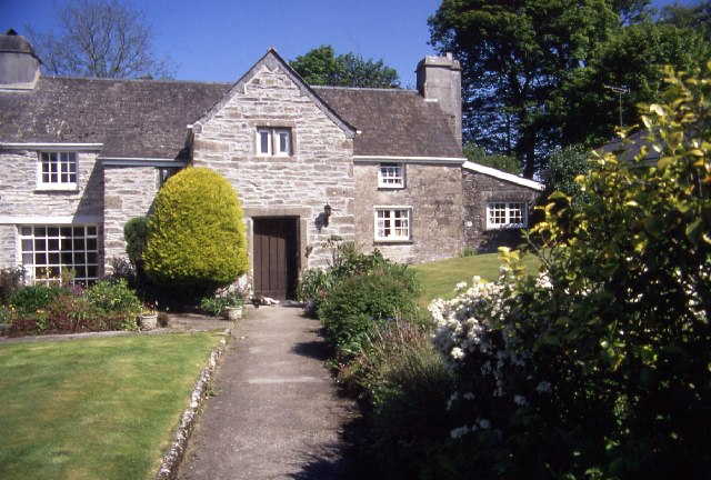
Trethin Manor. This fine old building is situated on the narrow lane between Tresinney and Pencarrow, in the Upper Camel Valley
Wenford Bridge. Wenford Bridge was the terminus of a former railway line from Wadebridge that was originally built by the Bodmin and Wadebridge Railway in 1834. The line was built in order to facilitate the transport of sea sand for agricultural use from the estuary of the Camel to the local farms, and never carried passengers. Other traffic included granite and china clay from local quarries, and the line survived to carry the latter until 1983. Today the route of the line forms part of the Camel Trail, a recreational route for walkers, cyclists and horse riders


