Charfield Walks
0.6 miles (1 km)
![]()
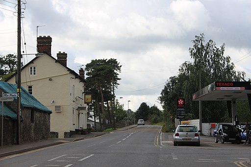
![]() Charfield is a pretty Gloucestershire village located just to the east of Kingswood and Wotton-under-Edge.
Charfield is a pretty Gloucestershire village located just to the east of Kingswood and Wotton-under-Edge.
See the maps and links below for walking ideas around the village.
Charfield Ordnance Survey Map  - view and print off detailed OS map
Charfield Open Street Map  - view and print off detailed map
*New* - Walks and Cycle Routes Near Me Map - Waymarked Routes and Mountain Bike Trails>>
Charfield OS Map  - Mobile GPS OS Map with Location tracking
Charfield Open Street Map  - Mobile GPS Map with Location tracking
Walks near Charfield
- Kingswood - This pretty Gloucestershire village is located just south of Wotton-under-Edge in the Cotswolds.
- Wotton-under-Edge Circular Walk - A circular walk around this pretty Cotswolds town using the Cotswold Way and other public footpaths
- Tyndale Monument - This is a climb to the Tyndale Monument from the popular Cotswolds town of Wotton-under-Edge
- Newark Park - Explore the 700 acre estate of this Grade I listed building in Wotton-under-Edge, Gloucestershire
- Hawkesbury Upton - This pretty village in South Gloucestershire is surrounded by some beautiful rolling Cotswolds countryside
- Chipping Sodbury - This market town in South Gloucestershire is surrounded by some lovely Cotswolds countryside
- Frome Valley Walkway - This pleasant and fairly easy walk takes you from Eastville Park on the outskirts of Bristol to the village of Old Sodbury along the River Frome
- Westonbirt Arboretum - Enjoy a woodland walk through this beautiful Arboretum near Tetbury in the Cotswolds.
- Badminton House and Estate - Enjoy a walk through the Duke of Beaufort's estate on this easy circular walk in the Cotswolds
- Dyrham Park - A circular walk through this lovely 270 acre deer park near Bath
- Berkeley - This small Gloucestershire town has some nice local river and canalside trails to try
- Stinchcombe Hill - This circular walk climbs to the lovely viewpoint at Stinchcombe Hill in the Cotswolds
- Dursley - The market town of Dursley is located in an excellent position on the edge of the Cotswolds escarpment and near to the countryside of the Severn Vale
- Leighterton to Westonbirt Walk - This walk takes you from the rural village of Leighterton to the splendid Westonbirt Arboretum.


