Church Minshull Walks
![]()
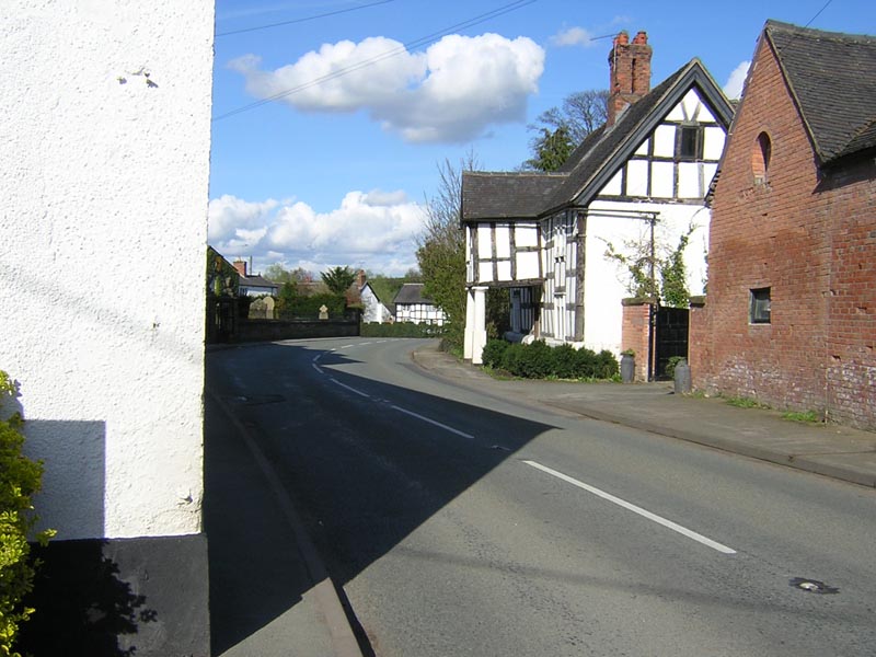
![]() This pretty Cheshire village is located next to the Shropshire Union Canal near Crewe.
This pretty Cheshire village is located next to the Shropshire Union Canal near Crewe.
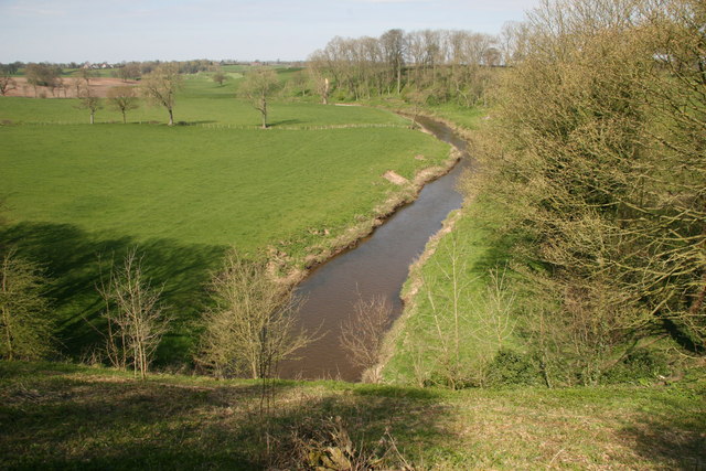
This walk from the village takes you along the Middlewich Branch of the Shropshire Union Canal to Barbridge. On the way there are nice views of the River Weaver and the surrounding countryside.
Part of the walk uses a section of the Crewe and Nantwich Circular Walk. You can use this popular waymarked trail to further explore the highlights of the area. Scroll down for the full list of walks around Church Minshull.
Church Minshull Ordnance Survey Map  - view and print off detailed OS map
Church Minshull Open Street Map  - view and print off detailed map
Church Minshull OS Map  - Mobile GPS OS Map with Location tracking
Church Minshull Open Street Map  - Mobile GPS Map with Location tracking
Walks near Church Minshull
- Crewe and Nantwich Circular Walk - This circular walk takes you through the countryside and villages surrounding Crewe and Nantwich.
You start off at Coppenshall just north of Crewe and first head to Weston - Shropshire Union Canal - Travel from the ourskirts of Wolverhampton to Ellesmere Port on this long distance waterside walk along the Shropshire Union Canal.
The route starts at Autherley Junction in the Oxley area of Wolverhampton - Hurleston Reservoir - This small reservoir sits in a lovely spot on the Llangollen branch of the Shropshire Union Canal near Nantwich.
- Winsford - This Cheshire based town sits in a nice spot next to the canalised section of the River Weaver
- Middlewich - This Cheshire based town has some nice waterside walks along the two canals and the river which flow through the area
- Llangollen Canal - Enjoy a waterside walk or cycle along the Llangollen Canal
- Chester Canal Walk - Follow the route of the old Chester Canal on this waterside walk in Cheshire
- Nantwich - Nantwich is located in Cheshire, next to two branches of the Shropshire Union Canal
- Wrenbury - This attractive village in Cheshire includes a conservation area with a number of historic properties including an early 16th century church overlooking the pretty village green
- Bunbury - This delightful Cheshire based village is a lovely place for a stroll
- Nantwich Riverside Loop - This waterside route in Nantwich uses sections of the River Weaver and the Shropshire Union Canal to create a circular walk through the western part of the town.
- Weaver Way - Follow the Weaver Way through Cheshire from Audlem to Frodsham on this delightful 40 mile walk
- Northwich - A lovely circular walk around Northwich, taking in the River Weaver, the Trent and Mersey Canal and several parks including the splendid Marbury Country Park
- Dane Valley Way - Follow the River Dane through Derbyshire and Cheshire on this fabulous walk from Buxton to Middlewich.
Highlights on the route include the wonderful Three Shires Head where the counties of Cheshire, Derbyshire and Staffordshire meet - Trent and Mersey Canal - Follow the Trent and Mersey Canal through Derbyshire, Staffordshire and Cheshire on this long distance waterside walk
- Marbury Country Park - This splendid country park is in a beautiful location in Northwich, Cheshire
- North Cheshire Way - Starting at Hooton Station, near Ellesmere Port, follow the North Cheshire Way through Frodsham, Northwich, Knutsford and Wilmslow to the finish point at Disley
- Holmes Chapel - This Cheshire based village has some nice riverside trails and a local country park to visit.
- Sandbach - This Cheshire based market town has an interesting history and a number of fine local walks to try
- Congleton - This Cheshire based town is great for waterside walking with a delightful local mere and canalside paths to enjoy
- Little Budworth Country Park - Explore woodland, lowland heath, ponds and boggy mires in this country park near Winsford
- Pickmere Lake - This pretty lake is located just north of Northwich in the Cheshire village of Pickmere.
- Whitegate Way - A lovely, short cycle or walk on a disused railway line, running from Cuddington to Winsford through the Cheshire countryside.
Pubs/Cafes
The Badger Inn is a traditional 18th century Coaching Inn in the village. In warmer weather there is a glorious hidden garden over looked by the distinctive St Bartholomew’s Church. There's a cosy interior with real log fires for colder days. There's good quality food and a car parking area too. You can find them at postcode CW5 6DY. The pub is dog friendly.
Photos
Approaching Minshullhill Bridge near Church Minshull, Cheshire. The ten mile long Middlewich Branch is well worth navigating, (or walking). It runs mostly at a high level giving very good views over the surrounding countryside, as here where it crosses the River Weaver by an aqueduct. The Weaver itself is navigable, but not up here.


