Gomshall Walks
![]()
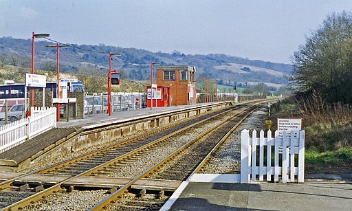
![]() This pretty Surrey based village is a great place to start a walk. There's numerous trails to follow into the surrounding woodland and countryside of the North Downs and the Surrey Hills. There's also a train station making the area accessible to those of you coming by public transport.
This pretty Surrey based village is a great place to start a walk. There's numerous trails to follow into the surrounding woodland and countryside of the North Downs and the Surrey Hills. There's also a train station making the area accessible to those of you coming by public transport.
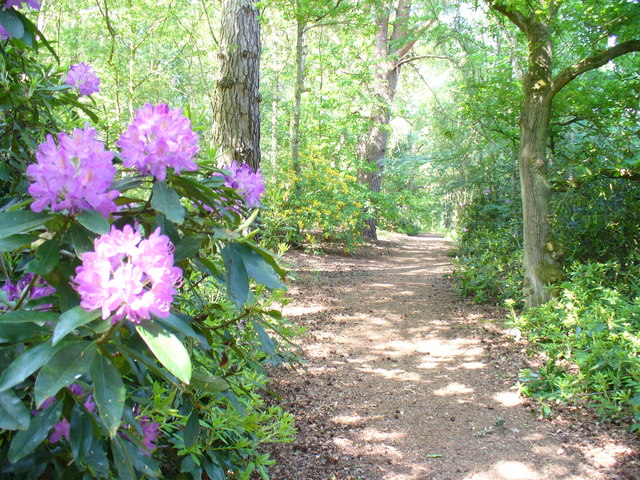
This circular walk from the village visits the neighbouring settlement of Shere before linking up with the North Downs Way and exploring Netley Heath and Hackhurst Downs. The route then goes on to visit Abinger Roughs, another popular place for local walks. The Roughs lie just east of the village and include some peaceful woodland trails with carpets of bluebells and Rhododendrons to see in the spring months.
It's easy to extend the walk by heading into the nearby Ranmore Common and Abinger Common.
Postcode
GU5 9LA - Please note: Postcode may be approximate for some rural locationsGomshall Ordnance Survey Map  - view and print off detailed OS map
Gomshall Open Street Map  - view and print off detailed map
*New* - Walks and Cycle Routes Near Me Map - Waymarked Routes and Mountain Bike Trails>>
Gomshall OS Map  - Mobile GPS OS Map with Location tracking
Gomshall Open Street Map  - Mobile GPS Map with Location tracking
Walks near Gomshall
- Shere - The attractive Surrey village of Shere is in a great location for exploring the Surrey Hills and the North Downs
- Abinger Roughs - This circular walk in Abinger Hammer takes you around an attractive, elevated woodland area.
Start your walk from the car park at the eastern end of the site - St Martha's Hill - This circular walk visits the lovely St Martha's Hill in the North Downs, near Guildford
- Albury Park - Explore the Albury Estate on this pleasant walk in Surrey
- Newlands Corner - This lovely beauty spot on the North Downs is great for walking with a number of footpaths to try
- Fox Way - This circular walk takes you on a tour of the countryside, woodland and canals surrounding Guildford in Surrey
- Chantry Wood - Explore 200 acres of woodland and meadows on this circular walk to Chantry Wood and Chantries Hill in Guildford
- Ranmore Common - This circular walk explores Ranmore Common in the North Downs, near Dorking
- Abinger Common - Enjoy a walk across Abinger and Wotton Commons before a climb to Leith Hill on this circular walk in the Mole Valley
- Friday Street - This pretty little hamlet sits in a pleasant location on the slopes of Leith Hill in Surrey.
- Holmwood Common - This National Trust managed common has miles of walking trails to try
- Polesden Lacey - A walk around the beautiful grounds of this Edwardian house at Great Bookham, near Dorking, Surrey
Pubs/Cafes
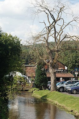
The Compasses Inn is a lovely place for some rest and refreshment after your exercise. The pub includes a delightful riverside garden where you can it out on warmer days. They serve good quality food and also have a large parking area. You can find them on Station Road at postcode GU5 9LA for your sat navs.
Dog Walking
The country and woodland trails are ideal for dog walking. The Compasses Inn mentioned above is also dog friendly.
Photos
Tilling Bourne, Gomshall. This pretty stream flows through the village. Taken from the road bridge beside Gomshall Mill.
Gomshall Mill. Now a public house and restaurant, the river flows beneath the right-hand part of the building.
Netley Heath. Looking down to Netley House from the Pilgrims Way. This is a lower, parallel, path to the North Downs Way which tends to follow the ridge.


