Lastingham Walks
![]()
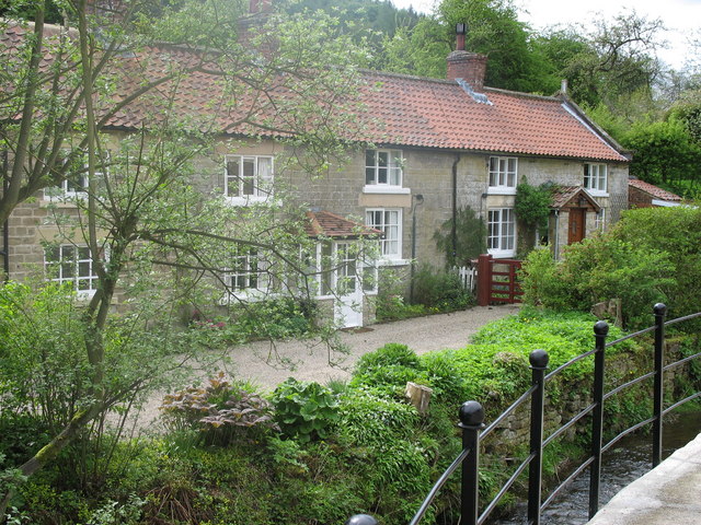
![]() This pretty North York Moors village is a fine place to start a walk. In the village there's lots of picturesque cottages, views of the Ings Beck and the noteworthy St Mary's Church. The ancient church is well worth investigating with its exquisite interior and an eleventh-century crypt.
This pretty North York Moors village is a fine place to start a walk. In the village there's lots of picturesque cottages, views of the Ings Beck and the noteworthy St Mary's Church. The ancient church is well worth investigating with its exquisite interior and an eleventh-century crypt.
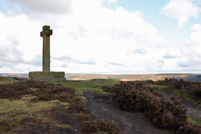
This circular walk from the village takes you north along the Lastingham Ridge up to the Ana Cross. The wayside cross marks a medieval route way across the moor between Lastingham and the site of Rosedale Priory. The current cross dates from 1949 with the original moved to St Mary's church mentioned earlier. From the elevated position of the cross there are wonderful views across the moor.
The route then heads south across Spaunton Moor before descending back to the village. You could extend the walk at the northern end by continuing north into Rosedale where you could explore the historic abbey. Near here there's also Rosedale Chimney Bank where you can explore the wonderful old kilns at Bank Top and explore the old mineral railway on the Rosedale Railway Walk.
A small detour to the west would take you to neighbouring Hutton-le-Hole where you could visit the excellent Ryedale Folk Museum.
Postcode
YO62 6TN - Please note: Postcode may be approximate for some rural locationsLastingham Ordnance Survey Map  - view and print off detailed OS map
Lastingham Open Street Map  - view and print off detailed map
Lastingham OS Map  - Mobile GPS OS Map with Location tracking
Lastingham Open Street Map  - Mobile GPS Map with Location tracking
Walks near Lastingham
- Hutton-le-Hole - This delightful village in the North York Moors is a splendid place for a stroll
- Cropton Forest - This large area of coniferous woodland on the North York Moors has miles of footpaths and bridleways for walkers and mountain bikers
- Levisham Circular Walk - A circular walk exploring the North York Moors around the village of Levisham
- Pickering - This ancient market town is in a good position for walkers wishing to explore the North York Moors National Park.
- Hole of Horcum - Enjoy a circular walk around this beautiful natural amphitheatre in the North York Moors
- Farndale Daffodil Walk - Explore beautful Farndale on this lovely circular walk in the North York Moors National Park
- Kirkbymoorside - This market town is located in a lovely spot on the edge of the North York Moors in Ryedale.
- Rosedale - This circular walk explores Rosedale, a beautiful valley in the middle of the North York Moors
- Blakey Ridge - This circular walk explores Blakey Ridge in Rosedale
- Rosedale Chimney Bank - This circular walk visits the wonderful old kilns at Rosedale Chimney Bank near Rosedale Abbey on the North York Moors.
- Rosedale Railway Walk - This walk explores the old Rosedale Mineral Railway near Rosedale Abbey in the North York Moors.
- Appleton Le Moors - This historic, attractive village is located in North Yorkshire near Lastingham, Pickering and Kirkbymoorside.
- Rudland Rigg - This circular walk or cycle takes you along Rudland Rigg, a long, unsurfaced byway in the North York Moors that extends from Bloworth Crossing to Moorend.
Pubs/Cafes
Back in the village you can enjoy some post walk refreshments at the 18th century Blacksmiths Arms. It's an attractive stone pub with a fine menu, a lovely garden area and a pizza oven. You can find them opposite the old church on Anserdale Lane at postcode YO62 6TN for your sat navs.
Dog Walking
The moorland trails make for a fine dog walk and the Blacksmiths Arms mentioned above is also dog friendly.
Further Information and Other Local Ideas
Just to the north east of the settlement you'll find the expansive Cropton Forest. The forest is a fine place for walking and cycling with miles of wide trails and deer to look out for as well.
To the south there's neighbouring Appleton Le Moors. It's another quaint place with a notable Grade I listed church and an excellent pub dating to the 17th century. There's also some lovely walks along the scenic River Seven to Sinnington to enjoy here.
For more walks in the area see the North York Moors Walks page.
Photos
Low Street, Lastingham. This view looks south along the street, the low autumn sunshine picking out the trees. The footpath through Hagg Wood can be seen leaving the road beyond the houses. The bridge crosses Ings Beck.
Rainbow over Spring Heads. The track runs north via Ana Cross to Rosedale Abbey (village). The heathery moor is called Spring Heads.
Large rock on Spaunton Moor. This tabular rock is some 15 feet long by 5 feet wide. There are a large number of rocks of various shapes and sizes scattered here and they are indicated on the OS map at 1/25,000.


