Litlington to Alfriston and White Horse Walk
![]()
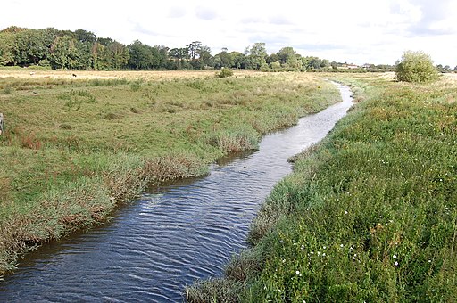
![]() This small East Sussex based village sits in a lovely spot in the River Cuckmere Valley.
This small East Sussex based village sits in a lovely spot in the River Cuckmere Valley.
The village is located just south of Alfriston and includes some lovely riverside walks and fine local pub dating back to the 1600s. As such it's a fine place to start a walk around the surrounding countryside of the South Downs.
This circular walk from the village uses a section of The South Downs Way and other local footpaths to explore the area to the east of the settlement. On the way you will visit neighbouring Alfrisotn, the Long Man of Wilmington hill figure, Lullington Heath, Charleston Manor and the Litlington White Horse which is located just to the south west of the village.
The route starts with a riverside walk to nearby Alfriston before heading east to climb to the Long Man of Wilmington where there's the famous white hill figure and some wonderful views over the area.
You then loop round to explore the Lullington Heath National Nature Reserve where there's a wide variety of interesting flora and fauna to see.
Atfer passing through the reserve the route then passes Westdean and rejoins the river at Exceat Bridge. Follow the river north and you will soon come to the Litlington White Horse. The large chalk figure dates from the 19th century and provides some fine views from its elevated location.
Postcode
BN26 5RE - Please note: Postcode may be approximate for some rural locationsLitlington Ordnance Survey Map  - view and print off detailed OS map
Litlington Open Street Map  - view and print off detailed map
Litlington OS Map  - Mobile GPS OS Map with Location tracking
Litlington Open Street Map  - Mobile GPS Map with Location tracking
Walks near Litlington
- Alfriston - The riverside village of Alfriston is located in a wonderful spot for exploring the South Downs
- Firle Beacon - This circular walk takes you to the splendid Firle Beacon in the South Downs
- The South Downs Way - This beautiful 100 mile long trail runs from Winchester to the coastal town of Eastbourne
- Vanguard Way - This 66 mile trail runs from the outskirts of London, through Ashdown Forest, Alfriston and Cuckmere Valley to the stunning East Sussex coast.
Route highlights include the lovely Ashdown Forest, the White Horse near Alfriston and the wonderful final coastal stretch that gives views of the Seven Sisters Cliffs and Tidemills beach - Lewes to Alfriston - A lovely walk from Lewes to Alfriston, first following the River Ouse before picking up the South Downs Way
- Cuckmere River and Cuckmere Haven - This lovely waterside walk takes you along the Cuckmere River from Alfriston to the beautiful Cuckmere Haven on the south coast
- Seven Sisters Country Park - Explore nearly 700 acres of parkland and coast on this delightful circular walk through the South Downs
- Long Man of Wilmington - Climb to this iconic hill figure on Windover Hill on this splendid circular walk in the South Downs
- Friston Forest - Enjoy miles of cycling and walking trails in this large forest on the South Downs near Eastbourne
- Seaford to Eastbourne - This is a popular coastal walk between these two East Sussex towns
- Iford - A circular walk from the Sussex village of Iford, visiting the River Great Ouse and the neighbouring villages of Southease and Rodmell.
The village sits just a couple of miles south of Lewes on slopes of the South Downs in the valley of the River Ouse - Seaford - This East Sussex based town is a great place for cliff top coastal walking
- Castle Hill Nature Reserve - This circular walk visits the Castle Hill National Nature Reserve on the eastern outskirts of Brighton in the South Downs National Park
Pubs/Cafes
Back in the village you can enjoy some post exercise refreshments at the Plough & Harrow. The historic 17th century country pub serves good quality meals and has a fine selection of ales. The pub includes a splendid large garden area where you can relax in warmer weather. You can find them at postcode BN26 5RE for your sat navs.


