LLanwrtyd Wells Walks
![]()
![]() This settlement in Powys is notable as the smallest town in Britain. There's some pleasant riverside trails, historic buildings and some beautiful rolling countryside to explore in the area.
This settlement in Powys is notable as the smallest town in Britain. There's some pleasant riverside trails, historic buildings and some beautiful rolling countryside to explore in the area.
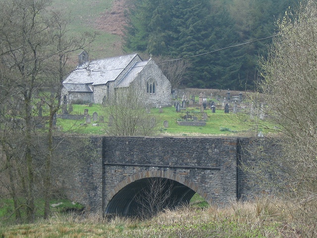
This circular walk from the village heads west along the River Irfon to visit Pontnewydd bridge. It's a lovely peaceful place with fine views across the Irfon Valley to enjoy. Near the bridge you can also see the picturesque old parish church of St David's which sits in a lovely spot near the river.
To continue your walking in the area head a few miles north west to visit the beautiful Llyn Brianne. The expansive lake has some nice waterside cycling and walking trails. You can also access the glorious Tywi Valley and enjoy waterfalls and riverside trails along the Towy River from the northern end of the lake.
LLanwrtyd Wells Ordnance Survey Map  - view and print off detailed OS map
LLanwrtyd Wells Open Street Map  - view and print off detailed map
*New* - Walks and Cycle Routes Near Me Map - Waymarked Routes and Mountain Bike Trails>>
LLanwrtyd Wells OS Map  - Mobile GPS OS Map with Location tracking
LLanwrtyd Wells Open Street Map  - Mobile GPS Map with Location tracking
Further Information and Other Local Ideas
The .Cambrian Woollen Mill is one of the highlights of the area and well worth a visit. The early 19th century mill is one of the few remaining operational woollen mills in Wales. It is known for its line of Welsh tartans.
Head south and you can pick up the Epynt Way. The long distance cycling and walking trail explores the area around Mynydd Epynt.
Head west and you could visit nearby Rhandirmwyn and explore the Upper Towy Valley and pick up the Cwm Rhaeadr Waterfall Walk.
Cycle Routes and Walking Routes Nearby
Photos
Llanwrtyd Wells. Looking northeast into the centre of the town. The rise in the road is the bridge over the river Irfon.
Pontnewydd bridge & church, There is little more here than this bridge and church. Strangely, the map names this area as Llanwrtyd, whilst Llanwrtyd Wells is over a mile to the southeast. This would not be a problem, except that all the signs in the area pointing to Llanwrtyd Wells omit the "Wells".
Road bridge over the River Irfon in the centre of Llanwrtyd Wells, the Methodist church can be seen in the background.


