Norbury Park
![]()
![]() This large area of woodland, grassland and farmland has miles of tracks and trails suitable for cyclists and walkers.
This large area of woodland, grassland and farmland has miles of tracks and trails suitable for cyclists and walkers.
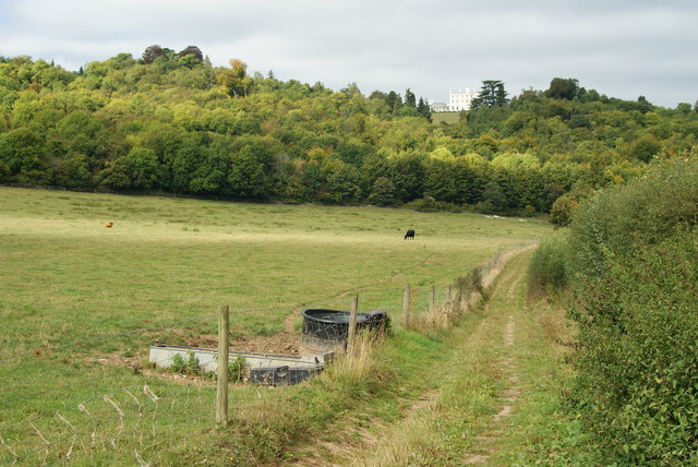
In the park you'll find a Georgian manor house, peaceful woodland trails and chalk grassland with lots of wildflowers and butterflies to see. Look out for wildlife which includes roe deer, badgers, foxes and woodpeckers.
The route starts from Box Hill and Westhumble Train Station although you could also start from the nearby car park. Follow the trails up to Denshire Hill and Fetcham Downs where there are splendid views over the Surrey Hills.
Continue north towards Hawk's Hill on the outskirts of Leatherhead before turning round. The trails then take you south through Druids Grove and Beechy Wood before returning you to Westhumble.
The Mole Gap Trail runs along the eastern edge of the park. It's a great way to extend your walking with nice riverside trails along the River Mole. You can follow it north to Leatherhead or south to Dorking.
Just to the south east you will find Ranmore Common and Denbies Hillside where there's miles more trails to try.
The park is also very close to the popular Box Hill Country Park. It's a great place for walking and cycling with more great views and the lovely stepping stones on the River Mole.
Norbury Park Ordnance Survey Map  - view and print off detailed OS map
Norbury Park Open Street Map  - view and print off detailed map
Norbury Park OS Map  - Mobile GPS OS Map with Location tracking
Norbury Park Open Street Map  - Mobile GPS Map with Location tracking
Pubs/Cafes
Right next to the park you will find the excellent King William IV pub. The main draw here is a wonderful garden terrace where you can enjoy your meal with panoramic views of the Mole Valley. On colder days you can sit inside next to the crackling log fire. You can find the pub at Byttom Hill, Mickleham with a postcode of RH5 6EL for your sat navs.
Further Information and Other Local Ideas
The Leatherhead Walk starts from the town's train station and visits Norbury Park before continuing to Box Hill.
A couple of miles north west you'll find the Bookham Commons. This National Trust owned area has miles footpaths taking you to grassland, ponds and ancient woodland. It's a particularly good area for wildlife with several species present at the site.
For more walking ideas in the area see the Surrey Hills Walks page.


