Polden Hills Way Walk
![]()
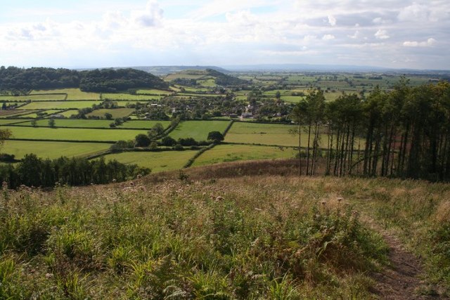
![]() This walk follows the Polden Way from Walton Hill to Hurcot in Somerset. The 6 mile route explores the Polden Hills, a low ridge running almost parallel to the more well known Mendip Hills . There's much to enjoy on the route with peaceful woodland trails, lots of wildlife and splendid views from the high points.
This walk follows the Polden Way from Walton Hill to Hurcot in Somerset. The 6 mile route explores the Polden Hills, a low ridge running almost parallel to the more well known Mendip Hills . There's much to enjoy on the route with peaceful woodland trails, lots of wildlife and splendid views from the high points.
The route starts at the National Trust's Walton Hill just west of the town of Street. It's a lovely spot with a converted windmill and some interesting vegetation that attracts a diversity of butterflies and insects.
The trail then heads east to Ivythorn Hill, and Collard Hill before coming to the Admiral Hood Monument, near Combe Hill Wood and Compton Dundon. The photogenic monument is another fine spot to enjoy the views over the Somerset Levels.
The trail then continues south past Hatch Hill, a good place to spot butterflies during the summer months.
The final section runs through Great Breech Wood before finishing at Hurcot near Somerton.
Polden Way Ordnance Survey Map  - view and print off detailed OS map
Polden Way Open Street Map  - view and print off detailed map
Polden Way OS Map  - Mobile GPS OS Map with Location tracking
Polden Way Open Street Map  - Mobile GPS Map with Location tracking
Pubs/Cafes
You could head into Street and visit The King Alfred for a rest from your exercise. The pub has a fine interior with a cosy fire and historic memorabilia on the wall. Outside there's a lovely garden area for warmer days. You can find them as postcode BA16 0HB for your sat navs.
At the other end of the route there's the Kingsdon Inn in Somerton. The picturesque thatched pub has a 300 year old history and fine menu. There's a charming interior with a cosy fire for colder days. Outside there's a lovely garden area to relax in during the summer months. You can find them at a postcode of TA11 7LG for your sat navs.
Further Information and Other Local Ideas
To continue your hill climbing in the area head to Glastonbury Tor. The iconic local landmark is one of the area's major highlights, providing more wonderful views over the area.
Cycle Routes and Walking Routes Nearby
Photos
The Hood Monument in Autumn. The monument dates from 1831 and is dedicated to Sir Samuel Hood. The Tuscan column stands at 110 feet (33.5 m) and is something of a local landmark.


