Street Somerset Walks - Near and Around
![]()
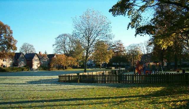
![]() This pretty Somerset based village is a great place from which to explore the nearby Polden Hills and Mendip Hills . The village is known as the birthplace of Clarks shoes which started off 200 years ago. There's also the Grade I listed 14th century church and the pretty Merriman Park to explore in the village.
This pretty Somerset based village is a great place from which to explore the nearby Polden Hills and Mendip Hills . The village is known as the birthplace of Clarks shoes which started off 200 years ago. There's also the Grade I listed 14th century church and the pretty Merriman Park to explore in the village.
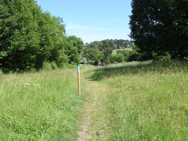
This circular walk from Street takes you to the viewpoint at Walton Hill before visiting the neighbouring village of Walton. You'll also pass the National Trust's Ivy Thorn Hill part of the Polden Hills.
Start the walk from Stone Hill and follow footpaths south to Teazle Wood. Just east of here you can visit Ivy Thorn Hill where there are some nice woodland trails.
Head west from here and you will soon come to Walton Hill which rises to 80 metres (260 ft). Here you'll find a converted windmill with fine views over the surrounding countryside.
The route then heads north to visit Walton village before turning east and returning to Street.
This walk uses part of the Polden Way to explore the area. To extend your outing the 6 mile trail could be followed east to visit the distinctive Admiral Hood Monument and Combe Hill Wood near Compton Dundon.
Postcode
BA16 0HB - Please note: Postcode may be approximate for some rural locationsStreet Somerset Ordnance Survey Map  - view and print off detailed OS map
Street Somerset Open Street Map  - view and print off detailed map
Street Somerset OS Map  - Mobile GPS OS Map with Location tracking
Street Somerset Open Street Map  - Mobile GPS Map with Location tracking
Walks near Street Somerset
- Polden Way - This walk follows the Polden Way from Walton Hill to Hurcot in Somerset
- Glastonbury Tor - This popular walk takes you from the ruins of Glastonbury Abbey to the summit of the iconic Glastonbury Tor
- Glastonbury Canal - Follow the Glastonbury Canal through the Somerset Levels on this waterside walk through the Avalon Marshes
- Shapwick Heath - Explore this lovely nature reserve in the Somerset's Levels
- Ham Wall - Ham Wall Nature Reserve is part of the Avalon Marshes in the beautiful Somerset Levels
- Shepton Mallet - Visit the Charlton viaduct and the village of Doulting on this circular walk in the Somerset town of Shepton Mallet.
Just to the north of the town you can pick up the East Mendip Way on Barren Down - Wells - The cathedral city of Wells is located in North Somerset in the Mendip Hills AONB
- Burrow Mump - This walk climbs this small hill overlooking the village of Burrowbridge in the Somerset Levels
- Brent Knoll - This nice circular walk climbs to a prominent hill on the Somerset Levels
- River Parret Trail - Follow the River Parrett from the source in Chedington in Dorset to the mouth in Bridgwater Bay, Somerset.
The route first heads to Langport passing Haselbury and the 16th century English Heritage owned Muchelney Abbey - Lytes Cary - Visit this National Trust owned manor house and enjoy walks around the grounds and the surrounding countryside
- Westhay Moor - This walk visits the Westhay Moor National Nature Reserve on the Somerset Levels.
- Avalon Marshes - The Avalon Marshes is an expansive nature reserve set in the Somerset's Levels
- Combe Hill Wood - This circular walk explores the area around the Somerset village of Compton Dundon.
Pubs/Cafes
The King Alfred is a nice place for some post walk refreshment. The pub has a fine interior with a cosy fire and historic memorabilia on the wall. Outside there's a lovely garden area for warmer days. You can find them as postcode BA16 0HB for your sat navs.
Dog Walking
The woods and hills are a fine place for a dog walk.
Further Information and Other Local Ideas
Head north east and you could enjoy a climb to the famous Glastonbury Tor or enjoy a waterside walk along the Glastonbury Canal.
Just to the south you'll find the neighbouring village of Compton Dundon where you can try the Compton Dundon and Combe Hill Wood Walk. The circular walk includes a climb to Iron Age Hillfort on Dundon Beacon and a visit to the Hood Monument, which is something of a historic local landmark.
For more walking ideas in the area see the Mendip Hills Walks page.


