Ham Wall
![]()
![]() Ham Wall Nature Reserve is part of the Avalon Marshes in the beautiful Somerset Levels. There are several easy walking trails in the reserve. The Ham Wall walk runs along the Glastonbury Canal on a nice grassy path from the car park on Ashcott Road. From here you pick up the trail and head east along the water. Look out for lots of wildlife including otters, dragonflies, butterflies, marsh harriers, water voles, bitterns and roe deer. Ham Wall consists of a variety of habitats including reedbeds, wetland, grassland and woodland. There's four short walking trails in all. They are nicely laid out and include a number of bird hides and seating areas dotted along the way.
Ham Wall Nature Reserve is part of the Avalon Marshes in the beautiful Somerset Levels. There are several easy walking trails in the reserve. The Ham Wall walk runs along the Glastonbury Canal on a nice grassy path from the car park on Ashcott Road. From here you pick up the trail and head east along the water. Look out for lots of wildlife including otters, dragonflies, butterflies, marsh harriers, water voles, bitterns and roe deer. Ham Wall consists of a variety of habitats including reedbeds, wetland, grassland and woodland. There's four short walking trails in all. They are nicely laid out and include a number of bird hides and seating areas dotted along the way.
Just to the west of the reserve you will find Shapwick Heath Nature Reserve which has more great trails to try.
The reserve is located just a few miles west of Glastonbury. You could visit by bike by following National Cycle Route 3 from Glastonbury.
If you'd like to extend your walking in the area you could climb to the famous Glastonbury Tor. The tor is actually visible in the distance from the reserve and makes a worthy extension to your outing.
Just to the north there's Westhay Moor another of the reserves on the marshes.
Postcode
BA6 9SX - Please note: Postcode may be approximate for some rural locationsPlease click here for more information
Ham Wall Ordnance Survey Map  - view and print off detailed OS map
Ham Wall Open Street Map  - view and print off detailed map
Ham Wall OS Map  - Mobile GPS OS Map with Location tracking
Ham Wall Open Street Map  - Mobile GPS Map with Location tracking
Further Information and Other Local Ideas
Just to the east you'll find the nearby village of Street. Here you can enjoy a lovely climb along the Polden Way to the National Trust's Walton Hill in the Polden Hills. Just to the south of Street you'll also find the neighbouring village of Compton Dundon where you can try the Compton Dundon and Combe Hill Wood Walk. The circular walk includes a climb to Iron Age Hillfort on Dundon Beacon and a visit to the Hood Monument, which is something of a historic local landmark.
For more walking ideas in the area see the Somerset Walks page.
Cycle Routes and Walking Routes Nearby
Photos
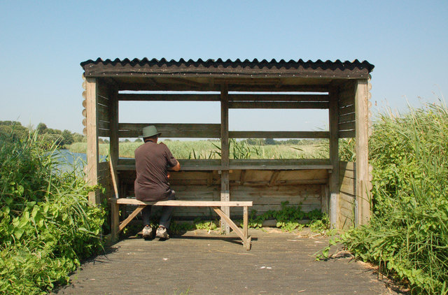
Ham Wall Viewpoint. The RSPB's Ham Wall reserve has lots of good vantage points overlooking the marsh.


