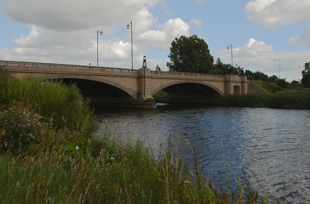
Warrington River and Canal Walk
![]()
![]() This circular walk around Warrington includes nice waterside stretches along the River Mersey, the Woolston Cut Canal and the Manchester Ship Canal. There's also a visit to some pretty local parks and nature reserves.
This circular walk around Warrington includes nice waterside stretches along the River Mersey, the Woolston Cut Canal and the Manchester Ship Canal. There's also a visit to some pretty local parks and nature reserves.
The walk starts next to Warrington Bridge where you pick up the start of the Mersey Way long distance footpath.
Follow the riverside path east past Victoria Park to the Paddington Meadows Nature Reserve. There are footpaths to follow around the reserve which includes meadow grassland, grazing cattle and a wildflower meadow. Look out for wildlife including skylark, fieldfares and redwing in this area.
The route then follows the towpath of the Woolston Cut Canal, before turning south at Woolston Weir. You then pick up the Manchester Ship Canal which you follow west to Latchford Locks and the Knutsford Road Swing Bridge. Follow the canal towards Wilderspool where you turn right to follow roads back to the town centre and the finish point.
Part of the route along the Ship Canal follows a section of the Trans Pennine Trail. You can extend your walking in the Warrington area by heading west along the Sankey Canal to Widnes. Heading east will take you to Lymm where you can enjoy an easy stroll around the tranquil waters of the Lymm Dam.
Just to the south of the town you can also pick up the Cheshire Ring Canal Walk and follow the towpath of the Bridgewater Canal towards Runcorn or Lymm.
Sankey Valley Park is another nice place for walkers with nice paths along the Sankey Canal, meadows, mature woodland and a wetland nature reserve with a variety of birdlife.
The Delamere Way also passes through the town. The long distance trail can be followed all the way to Delamere Forest.
Warrington Ordnance Survey Map  - view and print off detailed OS map
Warrington Open Street Map  - view and print off detailed map
Warrington OS Map  - Mobile GPS OS Map with Location tracking
Warrington Open Street Map  - Mobile GPS Map with Location tracking
Further Information and Other Local Ideas
Follow the Mersey Way west and it will take you to Widnes before coming to two other local highlights at Hale Lighthouse and Speke Hall. The lighthouse is in a splendid position with great views over the Mersey to Ellesmere Port. The National Trust owned Speke Hall includes a Grade I listed house surrounded by lovely parkland and gardens.
Just south of the river you'll find the worthy village of Daresbury. The village is notable as the birthplace of of Alice's Adventures in Wonderland author Lewis Carroll who was born there in 1832. It includes the Lewis Carroll visitor centre where you can learn all about his life and try the 'Lewis Carroll's Boyhood Walk' which runs from Daresbury church to the site of the parsonage, passing through fields and lanes that the young Carroll would have known.
St Helens lies just to the north west. On the southern edge of the town there's Sutton Manor Park to explore. The popular park includes the iconic Dream Sculpture which is a local highlight and well worth seeing. There's also a great viewpoint and the adjacent Clock Face Country Park to visit here.
On the south western outskirts of the town there's the picturesque Moore Nature Reserve. It's a lovely place for a walk with lakes, peaceful woodland and attractive meadows to explore. The reserve is also great for wildlife with a wide range of birds to look out for on the water. You can find them next to the Manchester Ship Canal at postcode WA4 6XE for your sat navs.
For more walking ideas in the area see the Cheshire Walks page.


