West Tanfield Walk
![]()
![]() This attractive North Yorkshire village has some lovely riverside paths, a popular long distance trail and a delightful local woodland park to explore.
This attractive North Yorkshire village has some lovely riverside paths, a popular long distance trail and a delightful local woodland park to explore.
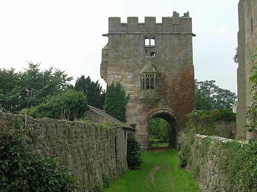
The settlement also includes the Marmion Tower a 15th-century gatehouse, three storeys high and with a beautiful oriel window. The site is owned by English Heritage and a good place to learn about some of the history of the village. Just to the north east there's Nosterfield Nature Reserve to explore. There's lakes, lots of wildlife and the nearby Thornborough Henge to visit in this area.
This circular walk from the village uses sections of the Ripon Rowel and other public footpaths to explore the countryside and villages to the south. On the way you'll visit the neighbouring village of North Stainley, enjoy riverside paths along the River Ure and vist the lovely Hackfall Woods which lies just to the west of the settlement.
The walk starts in the village on Tanfield Bridge over the River Ure. Here you can pick up the Ripon Rowel and follow the footpath east to Sleningford Watermill and North Stainley. Just to the south west of the village you'll find the Lightwater Valley Theme Park. The park is home to 'The Ultimate' one of the world's longest rollercoasters.
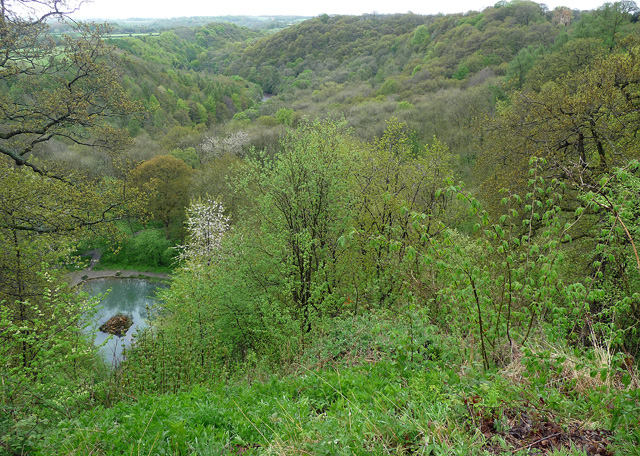
From the village head north west to pick up a pleasant country lane which will lead you west to Musterfield and Frizer Hill. You continue north west to Coal Bank Wood before rejoining the river at High Bank. Follow the trail west and it will take you to Mickley Barras and then on into Hackfall Woods near Grewelthorpe. The delightful woods are something of a local highlight with grottos, ponds, fountains, old temples, follies, waterfalls and pretty bluebells in the spring months.
Postcode
HG4 5JQ - Please note: Postcode may be approximate for some rural locationsWest Tanfield Ordnance Survey Map  - view and print off detailed OS map
West Tanfield Open Street Map  - view and print off detailed map
West Tanfield OS Map  - Mobile GPS OS Map with Location tracking
West Tanfield Open Street Map  - Mobile GPS Map with Location tracking
Walks near West Tanfield
- Ripon Rowel - This is a circular walk around the Yorkshire city of Ripon, visiting South Stainley, Markington and Masham
- Ripon Canal - Enjoy a short, waterside stroll along the Ripon Canal, on this easy walk in North Yorkshire
- Hackfall Woods - These peaceful woods near Grewelthorpe have miles of nice walking trails to try
- Nosterfield Nature Reserve - This walk visits the lovely Nosterfield Nature Reserve near West Tanfield.
- Studley Park and Fountains Abbey - This marvellous attraction boasts 800 acres of beautiful parkland set in the Yorkshire countryside
- Masham - A circular walk exploring the countryside and rivers around the small town of Masham in North Yorkshire
- Druids Temple - Visit this fascinating replica of Stonehenge, on this lovely circular walk from Masham
- Leighton Reservoir - This circular walk visits Leighton and Roundhill Reservoirs before climbing into the surrounding moors for great views back down to the water
- Kirkby Malzeard - This North Yorkshire based village is located in the Harrogate district just south of Grewelthorpe.
- Grewelthorpe - This circular walk around Grewelthorpe uses the Ripon Rowel long distance trail to visit Hackfall Woods and the River Ure
- Masham Leaves Walk - A circular walk around the North Yorkshire town of Masham, visiting a series of stone sculptures.
Pubs/Cafes
Back in the village The Bull Inn is a nice place for some post walk refreshment. The popular pub was the runner up in the Yorkshire's Favourite Pub competition in 2014 and 2015. The historic inn dates back to the 17th century with some sections formed from what was once the ferryman’s cottage. Outside there's a Garden Marquee and Terrace where you can enjoy outdoor dining all year round. The garden is right next to the River Ure so you can enjoy your meal with a fine view over the water. You can find them on Church Street at postcode HG4 5JQ for your sat navs.
Dog Walking
The woodland and country trails on the route make for a fine dog walk. The Bull Inn mentioned above is also dog friendly with treats available at the bar.
Photos
View west from Tanfield Bridge, West Tanfield, North Yorkshire, toward Marmion Tower (centre left) and the tower of the parish church of St Nicholas (centre right). Set in the bridge parapet in the foreground is a boundary stone inscribed "Division of the W & E Riding".
Lane from Grewelthorpe towards Mickley. Lane just about to drop down off Tower Hill on its descent towards Mickley and the River Ure. In the distance one can look over the Vale of Mowbray towards Beacon Hill in the North York Moor National Park


