Wildboarclough Walks
![]()
![]() This Cheshire based village is located in a fine scenic spot in the Peak District National Park.
This Cheshire based village is located in a fine scenic spot in the Peak District National Park.
It's a popular place for walkers with miles of trails to follow around the surrounding Macclesfield Forest and Trentabank Reservoir. There's also a fine village pub dating back to the 17th century.
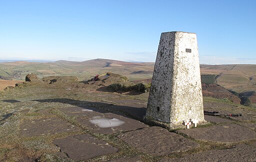
This walk from the village climbs to the nearby Shutlingsloe hill before heading into the forest and visiting its series of pretty reservoirs. You can reach the hill by following a footpath north west from the village. This will take you to the 560 metre high summit where you can enjoy wonderful views over the Cheshire Plain and the Peak District hills.
Continue north west and you will soon come to the peaceful woodland trails of the forest. These will lead you to Trentabank Reservoir where you can enjoy lovely waterside trails to Ridgegate and Bottoms Reservoir. The walk then climbs into the popular Tegg's Nose Country Park another walking highlight of the area. Here you can enjoy more amazing vistas from the park's multiple viewpoints.
To continue your walking in the area head east to visit Three Shires Head on the expansive Axe Edge Moor. It's a significant location where the counties of Cheshire, Derbyshire and Staffordshire meet. There's also a photogenic Grade II-listed packhorse bridge over the River Dane and lots of pretty waterfalls to see here too.
Wildboarclough Ordnance Survey Map  - view and print off detailed OS map
Wildboarclough Open Street Map  - view and print off detailed map
Wildboarclough OS Map  - Mobile GPS OS Map with Location tracking
Wildboarclough Open Street Map  - Mobile GPS Map with Location tracking
Walks near Wildboarclough
- Shutlingsloe - Enjoy fabulous views over Cheshire on this climb to Shutlingsloe Hill in the Peak District
- Macclesfield Forest and Trentabank Reservoir - This circular walk explores Macclesfield Forest and also pays a visit to the pretty Trentabank Reservoir on the western edge of the Peak District.
The walk starts at the Standing Stone car park on the eastern edge of the forest - Tegg's Nose Country Park - This lovely country park in Macclesfield has splendid views of the Peak District National Park and the Cheshire plain
- Gritstone Trail - This beautiful, challenging walk runs through the Peak District from Disley to Kidsgrove.
The walk begins at the train station at Disley and soon comes to the wonderful Lyme Park (video below) with its mansion house and Medieval deer park - Sutton Reservoir and Danes Moss - This walk visits Sutton Reservoir and the and Danes Moss Nature Reserve in Macclesfield.
- Lamaload Reservoir - This circular walk takes you around the pretty Lamaload Reservoir near Macclesfield in the Peak District National Park
- Gradbach - This little hamlet in the Peak District is an ideal place to start a walk with several Peak District highlights nearby
- Cheeks Hill - This circular walk climbs to Cheeks Hill on Axe Edge Moor in the Peak District National Park.
- Axe Edge Moor - This expansive area of moorland near Buxton has some fine walking trails to try
- Three Shires Head - Explore this beautiful section of the Dane Valley and enjoy rivers, old stone bridges and waterfalls on this lovely walk in the Peak District.
Three Shires Head is a point on Axe Edge Moor where the counties of Cheshire, Derbyshire and Staffordshire meet - Lud's Church - This walk visits the fascinating deep chasm of Lud's Church on the edge of the Staffordshire Peak District
- The Roaches - This circular walk is one of the most popular in the Peak District and a favourite for many
Pubs/Cafes
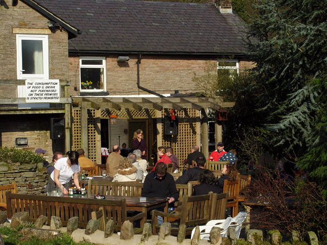
The Crag Inn is an historic pub in the village. It was originally a farm built in 1629 and then later converted to a beer house 1825. There's two cosy real fires indoors and a nice garden area for warmer days. They have a car park and are also dog friendly. You can find them at postcode SK11 0BD for your sat navs.
Further Information and Other Local Ideas
Just to the south you can pick up the Gradbach Walk. It visits the eery chasm at Lud's Church before heading to The Roaches, Hen Cloud and Three Shires Head. It's a nice way of seeing several of the highlights of the area on one trail loop. On the way you'll also pass the picturesque Gradbach Mill on the River Dane. The 18th century mill was used to manufacture sewing silk and is an interesting reminder of the historic past of Gradbach.
Photos
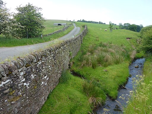
The village is thought to be named due to its surrounding deep valley (or clough) being frequented by wild boar. According to old legend it was the place where the last wild boar in England was killed. The local pronunciation of the village name is Wilbercluff with the accent on the first syllable.
Crag Hall - a Georgian mill-owner's house. Situated by the road which ascends the hill past Wildboarclough church. Crag Mill in Wildboarclough was built in 1793 and operated intermittently for the spinning and printing of calico and other cloths. Designs were printed at the mill on plain carpets provided by John Bright, one of which was exhibited at the Great Exhibition of 1850. Crag Hall was built in 1796 by the mill owner, while Crag Lodge housed the mill manager and Edinboro Cottages housed mill workers. 3 mills were eventually built on the site, but they were mostly demolished by 1957.


