Geopark Way - Abberley and Malvern Hills - Bridgnorth to Gloucester
![]()
![]() Meandering its way for 109 miles through the Abberley and Malvern Hills Geopark from Bridgnorth to Gloucester, the Geopark Way passes through stunning countryside as it explores 700 million years of geological history. The trail offers varied walking alongside rivers, through forests, along ridges and across valley floors; all with majestic views to match. Passing through an assortment of habitats there is a plethora of wildlife adding to the occasion. Quaint villages and towns dot the route bringing further elements of exploration and enchantment.
Meandering its way for 109 miles through the Abberley and Malvern Hills Geopark from Bridgnorth to Gloucester, the Geopark Way passes through stunning countryside as it explores 700 million years of geological history. The trail offers varied walking alongside rivers, through forests, along ridges and across valley floors; all with majestic views to match. Passing through an assortment of habitats there is a plethora of wildlife adding to the occasion. Quaint villages and towns dot the route bringing further elements of exploration and enchantment.
Highlights on the route includes a stretch through the lovely Eastnor Deer Park next to the 19th century mock castle. The climb through the Malvern Hills is also wonderful with splendid views over the countryside of Herefordshire, Worcestershire and Gloucestershire.
Walk submitted by SrBrook.
Geopark Way Ordnance Survey Map  - view and print off detailed OS map
Geopark Way Open Street Map  - view and print off detailed map
*New* - Walks and Cycle Routes Near Me Map - Waymarked Routes and Mountain Bike Trails>>
Geopark Way OS Map  - Mobile GPS OS Map with Location tracking
Geopark Way Open Street Map  - Mobile GPS Map with Location tracking
Cycle Routes and Walking Routes Nearby
Photos
Waymark for The Geopark Way, by River Severn. The Geopark Way opened in 2009. It is described on the site of The Long Distance Walkers Association as: "A route devised to highlight geology, landscape and associated heritage by linking geological sites in the Abberley and Malvern Hills Global Geopark". This particular marker is on a stile by the River Severn.
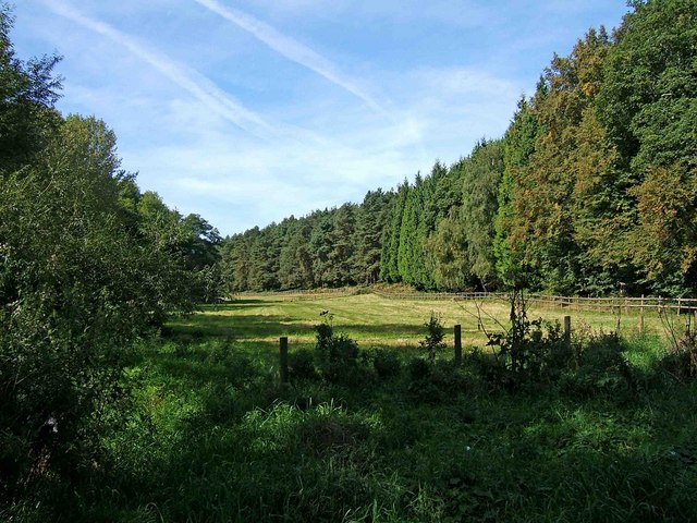
Near Lower Astley Wood. After leaving Shrawley Woods by the footbridge over the Dick Brook, this open grassed area is on the left. On the right is part of Lower Astley Wood. There is a fence just in front of the wood and behind this runs a public bridleway. This also forms part of the recently opened long distance path known as The Geopark Way.
Stile on the trail by the River Severn, near Hampton Loade. The public footpath on this side of the river forms part of The Geopark Way. After crossing this stile, the footpath immediately crosses a small watercourse. It then takes a small detour to avoid the local water company's bridge and premises.
Dudmaston Hall. The trail passes this 17th-century country house in the Severn Valley, just north of Hampton Loade. The grounds are full of daffodils and magnolias during the spring months. The area also includes the adjacent Comer Woods. The tranquil woods have their own car park and entrance and are free to access. There's a number of picturesque pools and lots of woodland birds to see in this area.
Eastnor Deer Park. The trail passes through varied landscapes, including woodlands, riversides, heathland, and limestone grasslands, supporting a rich diversity of flora and fauna. Wooded sections feature oak, beech, and ash, with an understorey of holly, hazel, and ferns. In spring, bluebells, wood anemones, and wild garlic carpet the forest floor. Heathland areas in the Malvern Hills support heather, gorse, and bilberry, while limestone grasslands are home to rare wildflowers such as orchids, rockrose, and harebell. Wetland areas along the Severn and Teme Valleys contain reedbeds and marsh plants like meadowsweet and yellow flag iris.
Black Hill, The Malvern Hills. The Geopark Way also highlights significant geological features, including ancient rock formations, fossil sites, and dramatic landscapes shaped by millions of years of geological activity. The Malvern Hills, formed from some of the oldest rocks in England, offer stunning views and a unique mix of plant and animal life.
Bird species on the walk vary by habitat, with woodlands hosting great spotted woodpeckers, nuthatches, and treecreepers, while skylarks and meadow pipits are common in open grasslands. Birds of prey, including buzzards, kestrels, and peregrine falcons, can often be seen hunting along the ridgeways. The river valleys attract kingfishers, herons, and wagtails, while wetlands provide breeding sites for reed warblers and snipe.
The Geopark Way approaching Eastnor. Mammals along the route include badgers, foxes, and roe deer in woodlands, while otters have been recorded in the River Severn. Bats, such as pipistrelles and Daubenton’s bats, are often seen at dusk over water. Reptiles like adders and slow worms inhabit heathland areas, and butterflies, including marbled whites and common blues, thrive in the meadows.


