Shrawley Woods

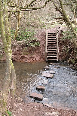
 Enjoy a circular walk around this attractive area of woodland near Worcester. There are miles of good woodland trails, a riverside path along the River Severn and several large ponds to enjoy. The woods are very popular with walkers during the springtime as you will find carpets of pretty bluebells. The area near the village hall is known as the grove and has a stream running through a lovely wooded valley, with lots of pretty flowers and vegetation.
The Severn Way runs past the woods so you can pick this up to extend your walk. The woods are located close to Stourport-on-Severn where you will find Hartlebury Common which has more nice woodland trails to try. Our Stourport Circular Walk visits the common, the River Severn and the Staffordshire and Worcestershire Canal.
You could also visit Witley Court which is located only a few miles to the west. Here you will find a palatial 19th century mansion surrounded by beautiful gardens.
Postcode
WR6 6TE - Please note: Postcode may be approximate for some rural locationsShrawley Woods Ordnance Survey Map  - view and print off detailed OS map
Shrawley Woods Open Street Map  - view and print off detailed map
Shrawley Woods OS Map  - Mobile GPS OS Map with Location tracking
Shrawley Woods Open Street Map  - Mobile GPS Map with Location tracking
Further Information and Other Local Ideas
Just to the south east is the worthy village of Ombersley where you'll find a number of interesting timber framed properties, an ancient 15th century pub and the historic Ombersley House Estate.
Cycle Routes and Walking Routes Nearby
Photos
Farmland adjacent to Shrawley Wood. This view is from one of the paths on the edge of the wood. The woodland in the far distance is another part of Shrawley Wood. Although difficult to see, there is a tractor working in the field (towards the left of the picture).


