Shanklin Walks - Sandown to Shanklin Walk
![]()
![]() Shanklin is a popular tourist village located on the southern part of the island. With a sandy beach, charming old village, cliff tops trails and a wooded chine it's a popular place for starting or ending a walk.
Shanklin is a popular tourist village located on the southern part of the island. With a sandy beach, charming old village, cliff tops trails and a wooded chine it's a popular place for starting or ending a walk.
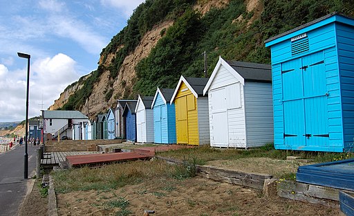
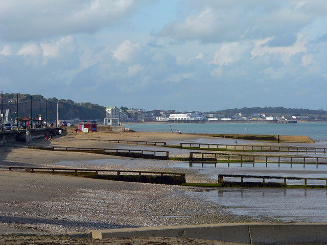
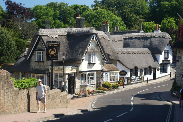
This walk takes you from Sandown to Shanklin using a section of the Isle of Wight Coast Path. The walk starts in Sandown next to the pier where you can pick up the waymarked footpath and follow it south along Sandown Bay to Welcome Beach, Little Stairs Point, Hope Beach and Shanklin. It's about 2 miles on a fairly flat path so should take about an hour. There are some climbs on the way with nice views from the cliff tops sections. The route finishes near Shanklin Chine where you can enjoy a stroll through a pleasant wooded area up to the old village. Here you'll find a number of attractive old thatched buildings and a decent tourist information centre. There's also a number of fine cafes and quaint gift shops to explore here.
Shanklin Ordnance Survey Map  - view and print off detailed OS map
Shanklin Open Street Map  - view and print off detailed map
Shanklin OS Map  - Mobile GPS OS Map with Location tracking
Shanklin Open Street Map  - Mobile GPS Map with Location tracking
Pubs/Cafes
At the end of the walk head up the hill into Old Shanklin and you could pay a visit to the Old Thatched Tea Shop. This quaint old tea room is located in a delightful Grade II listed cottage dating from the 17th century. It was originally built in 1690 as two or three fishermans cottages and it is believed to be the oldest building in Shanklin. Underneath the building is an original tunnel which takes you about 500 meters further on towards Ventnor. The tunnel was used by the Fishermen/Pirates to hide their contraband and as a get-a-way when Custom & Excise came knocking on the door. They serve delicious cream teas which you can enjoy in the beautiful fairy garden. You can find them at 4 Church Road, Shanklin with a postcode of PO37 6NU for your sat navs.
Dog Walking
The coastal trail is a nice one to do with your dog and the tea room mentioned above is also dog friendly.
Further Information and Other Local Ideas
To continue your walking in the area you could try the popular Shanklin to Ventnor Coastal Walk and climb to Ventnor Downs for more great views.
If you follow the coast path north then you can visit Culver Down and the historic Bembridge Fort. There's pretty wildflowers, a 19th century hill fort and marvellous views over Sandown Bay, Shanklin Bay and the Solent from here.
Head west and you can visit the most southerly point on the island at St Catherine's Lighthouse. It's another highlight of the area and has interesting historical links with Guglielmo Marconi, the inventor of the radiotelegraph system.
The Ventnor to Steephill Cove Walk takes you to a popular little cove with kiosks, self catering cottages and a beach. The circular walk also visits the splendid Ventnor Botanical Gardens where you can enjoy a variety of Mediterranean plants and flowers.
The Shanklin to Ventnor Railway Walk starts from Shanklin train station and will take you to Wroxall and Ventnor via the old railway line. The first section to Wroxall is also suitable for cyclists.
For more walking ideas in the area see the Isle of Wight Walks page.


