Walk around Corbridge - River and Fort
![]()
![]() This Northumberland village is in a lovely spot on the River Tyne, just east of Hexham. It's a fine place for a stroll with a historic Roman Fort and a pleasant riverside trail to try.
This Northumberland village is in a lovely spot on the River Tyne, just east of Hexham. It's a fine place for a stroll with a historic Roman Fort and a pleasant riverside trail to try.
This walk from the town explores the Roman Fort before heading along the River Tyne and visiting the nearby Dilston Castle.
The walk starts from the Roman Fort, just to the west of the village centre and the train station. The fort is one of the historical highlights of the area and well worth exploring. Here you will find information boards detailing the Roman occupation which ran until the 5th century. You can also discover Roman armour and trinkets uncovered with the Corbridge Hoard at the museum. The Hoard was one of the most significant finds in Roman history, providing a fascinating insight into the life of a soldier on the Hadrian's Wall.
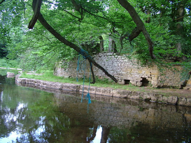
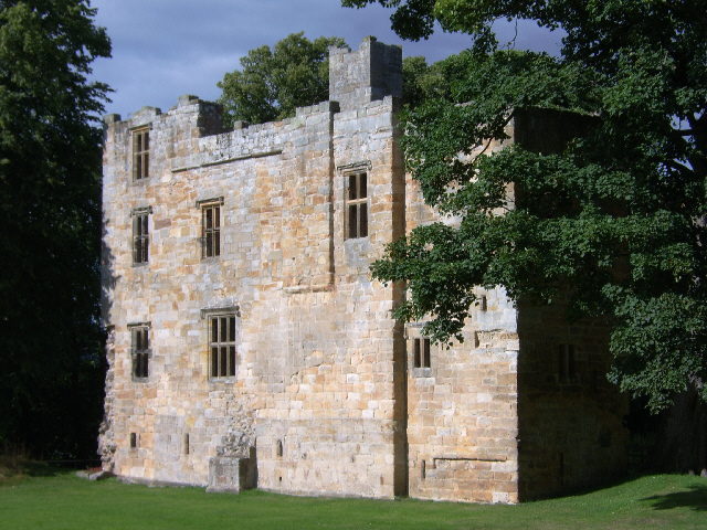
From the fort you can pick up a riverside path heading east towards the 17th century bridge over the Tyne. Cross to the other side and head west and you will come to the point where the river meets with Devil's Water. Here you'll find a number of pretty waterfalls and a weir. You can pick up a footpath heading south along the water to Dilston where there's a notable old chapel and Dilston Castle. This photogenic 15th century ruin is designated as a Scheduled Ancient Monument.
After exploring Dilston the route returns to Corbridge on the same paths.
Corbridge Ordnance Survey Map  - view and print off detailed OS map
Corbridge Open Street Map  - view and print off detailed map
Corbridge OS Map  - Mobile GPS OS Map with Location tracking
Corbridge Open Street Map  - Mobile GPS Map with Location tracking
Walks near Corbridge
- Hexham - This walk takes you along the Weardale Way long distance trail from Hexham to Chester's Roman Fort on Hadrian's Wall
- Tyne Green Country Park - Enjoy a riverside walk or cycle along the River Tyne in this country park in Hexham
- Allen Banks and Staward Gorge - Enjoy a waterside walk along the River Allen and through a beautiful wooded gorge on this easy walk in the North Pennines AONB
- Weardale Way - Follow the River Wear from the coast at Sunderland to Killhope Lead Mining Museum in the Pennines
- Slalely Forest - This large area of coniferous woodland is located a few miles south of Hexham
- Blanchland - Enjoy a circular river walk on this easy route in the pretty Northumberland village of Blanchland
- Hexham to Corbridge - A lovely walk from Hexham to Corbridge with some nice woodland trails and a riverside section in Corbridge
- Aydon Castle - This circular walk visits the historic Aydon Castle before exploring the surrounding countryside on a series of footpaths and country lanes.
The site is located near Corbridge and includes a fine 13th century English manor house surrounded by peaceful woodland - Whittle Dene Reservoir - Enjoy a circular walk around this scenic group of reservoirs next to Hadrian's Wall
- Haydon Bridge - This Northumberland based village has some nice river and country trails to try
- Colt Crag Reservoir - This walk visits the lovely Colt Crag Reservoir near Hexham and Corbridge in Northumberland.
- Hallington Reservoir - This walk visits the Hallington Reservoirs in Northumberland, near Hexham.
- Bardon Mill - This Northumberland based village is close to several county highlights including Hadrian's Wall and the Housesteads Roman Fort
- Sweethope Loughs - This walk visits the Sweethope Loughs in Northumberland, near Bellingham.
- Riding Mill - This walk from the Northumberland village of Riding Mill takes you along a pleasant section of the River Tyne to Dilston via Corbridge
Pubs/Cafes
Back in the village the Black Bull is a good choice for some post walk refreshments. The historic pub dates back to 1755 and includes a cosy interior with a coal fire. Outside there's a pretty garden area for warmer days. They do very good food and can be found at Middle Street with a postcode of NE45 5AT for your sat navs.
The Dyvels Inn is another good option if the weather is good. They have a larger garden area and also provide accommodation. You can find them on Station Road at postcode NE45 5AY.
Dog Walking
The river paths make for a fine dog walk and the Dyvels Inn mentioned above is also dog friendly.
Further Information and Other Local Ideas
A stroll through the town is also very pleasant with a number of fine little shops. Another must see here is the Church of Saint Andrew which dates back to the 7th century. The Church was built largely from stone taken from Hadrian's Wall. The entrance to the Church is through glass doors given by actor Rowan Atkinson and etched in memory of his mother, a parishioner of the church. The site also includes a 14th century Vicar's Pele, one of only three fortified vicarages in the county.
Head north of the village and you will soon come to the famous wall where you can pick up the epic Hadrian's Wall Path. If you follow the waymarked trail west you can visit Chester's Roman Fort, one of the highlights on the wall. Also known as Cilurnum it is considered to be the best preserved Roman cavalry fort along Hadrian's Wall. The site is now preserved by English Heritage an includes a museum, housing finds from the fort and elsewhere along the wall.
If you follow the wall east it will take you to Welton and the Whittle Dene Reservoir where there are good wildlife watching opportunities.
Also of note is the nearby Aydon Castle. The 13th century castle has delightful grounds with a circular walk along the Cor Burn and the walled orchard. It's located just a mile north east of the village centre.
If you follow the river south east it will take you to the neighbouring village of Riding Mill. There's a train station and a 17th century pub here.
For more walking ideas in the area see the Northumberland Walks and North Pennines Walks pages.
Photos
Corbridge Bridge. Completed with seven arches in 1674, it was the only bridge over the River Tyne to survive the very destructive floods of 1771.
Mouth of Devils Water as it reaches River Tyne. Located near Dilston, home of the jacobite Earl of Derwentwater


