Rudgwick Walks
![]()
![]() This walk explores the countryside around the West Sussex village of Rudgwick.
This walk explores the countryside around the West Sussex village of Rudgwick.
The village is located just west of Horsham in the Low Weald, near to the border with Surrey. Rudgwick includes a noteworthy 14th century church and a fine 16th century pub to relax in after your exercise.
Two waymarked footpaths pass the village in the shape of the Downs Link and the Sussex Border Path. These waymarked trails are a good way of exploring the area on foot.
This walk from the village takes you east through the fields towards the pretty Furnace Lakes. On the way there's lots of woodland trails and fine countryside views to enjoy.
Rudgwick Ordnance Survey Map  - view and print off detailed OS map
Rudgwick Open Street Map  - view and print off detailed map
Rudgwick OS Map  - Mobile GPS OS Map with Location tracking
Rudgwick Open Street Map  - Mobile GPS Map with Location tracking
Walks near Rudgwick
- Cranleigh - This Surrey based village is located near Guildford in the north-west corner of the Weald.
- Horsham - This fine circular walk around Horsham makes use of three of the walking trails running through the town
- Horsham Riverside Walk - This popular circular walk around Horsham includes some lovely waterside trails and fine scenery
- Guildford - The town of Guildford has a huge selection of walks to choose from with several long distance trails, hill climbs, parks, rivers and canals to explore.
This long circular walk makes use of some of the waymarked footpaths running through the area, showcasing the best of the surrounding North Downs countryside - Winterfold Forest - This lovely area of the Surrey Hills is a popular place for walkers and cyclists
- Holmbury Hill - Climb to the 856 feet (261 m) summit of Holmbury Hill on this circular walk in the Surrey Hills
- Abinger Common - Enjoy a walk across Abinger and Wotton Commons before a climb to Leith Hill on this circular walk in the Mole Valley
- Friday Street - This pretty little hamlet sits in a pleasant location on the slopes of Leith Hill in Surrey.
- Guildford Canal Walk - A nice waterside walk from Guildford to Godalming along the River Wey Navigation Canal
- Wey South Path - Follow the Wey River and the Wey and Arun Canal on this wonderful waterside walk through Surrey and Sussex
- Chiddingfold - This pretty Surrey based village is located in the Waverley area of the county
- Hydon's Ball and Hydon Heath - This National Trust owned hill is one of the high points of Surrey and a great place to stretch your legs
- Witley Common - This large area of common land in Surrey consists of heathland, ponds and birch, oak and pine woodland
- River Wey Navigation - Follow the River Wey Navigation towpath from Godalming to the River Thames at Weybridge on this super waterside walk
- Fox Way - This circular walk takes you on a tour of the countryside, woodland and canals surrounding Guildford in Surrey
- Puttenham Common - Enjoy a peaceful walk through the woodland and heathland of Puttenham Common in the North Downs, near Guildford
- Chinthurst Hill - This walk visits a lovely nature reserve and viewpoint in the Surrey Hills AONB
Pubs/Cafes
In the village you can enjoy some post walk refreshments at The Fox Inn. The historic inn dates back to the 16th century and includes low beams and wooden floors. They serve a fine Sunday Roast and also have an extensive garden area and car parking. You can find them at Bucks Green with postcode RH12 3JP for your sat navs.
Photos
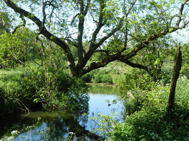
Furnace Lakes. Modern carp fishery using former furnace ponds from a medieval Wealden iron-making industry.


