Cirencester to Moreton-in-Marsh
30 miles (48 km)

 This ride takes you along National Cycle Route 48 through the beautiful Costwolds district. You start near the tourist information centre in Cirencester and head along minor roads to the lovely Bourton-on-the-Water - Venice of the Cotswolds and the perfect place to stop for some refreshments. From here you continue to Stow-on-the Wold, another lovely village in the region before the final stretch takes you into Moreton-in-Marsh, finishing at the train station.
Cirencester to Moreton-in-Marsh Ordnance Survey Map  - view and print off detailed OS map
Cirencester to Moreton-in-Marsh Open Street Map  - view and print off detailed map
Cirencester to Moreton-in-Marsh OS Map  - Mobile GPS OS Map with Location tracking
Cirencester to Moreton-in-Marsh Open Street Map  - Mobile GPS Map with Location tracking
Further Information and Other Local Ideas
In Moreton the trail links with the Cotswold Line Cycle Route which runs through the AONB from Worcester to Long Hanborough, just outside Oxford.
Cycle Routes and Walking Routes Nearby
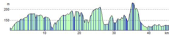
Elevation Profile