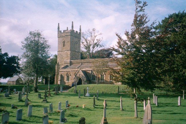
Cotswolds Walks

Use the filter to show walks of a certain type such as woods, reservoirs, hills, long distance, country parks, canals and rivers.
In the spring walkers flock to the beautiful bluebell woods in the Cotswolds area. Click the 'Woodland' button below to see these.
Use the links to view full route information including elevation profiles, interactive maps and GPS downloads.
You can also view an overview map of all the routes in the using the Cotswolds Walk Map>>
*New* - Walks and Cycle Routes Near Me Map - Waymarked Routes and Mountain Bike Trails>>
| Filter: |
| Route Name | Photo | Distance | Description |
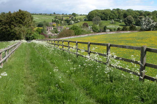
| Badminton House and Estate | 5 miles (8 km) | Enjoy a walk through the Duke of Beaufort's estate on this easy circular walk in the Cotswolds. The walk starts in Great Badminton and heads to Little Badminton through Badminton Park. In the park there are two large ponds, several deer, attractive parkland and the 17th century Badminton House. At Little Badminton you will pass the pretty Dovecote before heading into the surrounding countryside. You'll pass along the woodland of the Seven Mile Plantation before returning to Great Badminton via a countryside bridleway and a short woodland section. The area is best known for the annual Badminton Horse Trials held here since 1949. The game of Badminton was also invented in the house in 1863. The Macmillan Way long distance trail runs just to the east of the estate. To extend your walking in the area you could pick it up and head south to the delightful village of Castle Combe. View Full Details>> | |
| Barrington Park | 4.3 miles (7 km) | This circular walk takes you around the delightful Barrington deer park in the Great Barrington area of the Cotswolds. The walk starts in the village of Barrington Parkand follows footpaths around the deer park before a waterside section along the River Windrush returns you to the village. There are splendid views of the Cotswolds hills to enjoy also. The village is located just a short distance east of the National Trust's Sherborne Park. If you head west you could visit the pretty Windrush Mill and then continue on to the park. There's nice footpaths here with pleasure grounds, wildlife sculptures, woodland trails and waterside paths along the Sherborne Brook. Near here you will also find Lodge Park where there are more good National Trust footpaths. The Cotswold Way and Monarch's Way long distance trails can also be picked up to the west of the village. View Full Details>> | |
| Bath Canal Walk | 5 miles (8 km) | This is a popular walk along the Kennet and Avon Canal from Bath to Bradford on Avon. It's about a 10 mile walk along the towpath taking you from Somerset into Wiltshire on the southern fringes of the Cotswolds AONB. On the way you'll pass pretty locks, lots of barges, delightful little cottages, interesting villages, and attractive parks and gardens. The walk starts at Bath locks situated at the start of the Kennet and Avon Canal. You then head north towards Bathwick passing through tunnels as you go. At Bathwick you pass the lovely Sydney Gardens which are worth a slight deviation from the canal to explore. The gardens are the only remaining eighteenth-century pleasure gardens in England. The path continues to the village of Bathampton where you can take a small detour to visit the Toll Bridge over the River Avon. The bridge and toll house are both Grade II listed. There's splendid views from the bridge down to the beautiful weir below. At Bathampton you turn south to Claverton. The little village has a Grade II listed pumping house and a church which dates from the 13th century. You continue south towards Monkton Combe, passing the Dundas Aqueduct which carries the Kennet and Avon Canal over the River Avon on the Somerset Wiltshire border. It's a real highlight of the walk with great views over the river and the surrounding countryside from the elevated position of the aqueduct. You can virtually explore this section of the canal using the google street view link below. The route then heads to Limpley Stoke and Freshford, passing Conkwell Wood on the way. The final section takes you into Wiltshire where you will pass the impressive Avoncliff Aqueduct and Barton Farm Country Park before finishing in Bradford Upon Avon. Barton Farm is worth exploring if you have time. It includes historic buildings, craft shops and tea rooms while the farmhouse, granary and tithe barn of the original Barton Farm date back to the 14th century. There's lots of good options for extending your walking around the canal. At Bathampton you can pick up the tremendous Bath Skyline Walk where you can enjoy fabulous views over the city. View Full Details>> | |
| Bath Skyline Walk | 5.6 miles (9 km) | Enjoy wonderful views of the city of Bath on this popular circular walk. The walk has been devised by the National Trust so takes place on waymarked, well maintained footpaths. The walk begins on Bathwick Hill and then heads south to Widcombe passing Smallcombe Wood. The wood is an excellent place for birdwatching with nuthatch, wrens and blackcap to look out for. The route continues past the stunning Prior Park with its beautiful lakes and Palladian Bridge. You then cross Claverton Down before turning north towards Claverton where you will find the excellent American musuem. The path continues north towards Bathampton where there is a nice woodland section through Bathampton Woods. You then turn south through more woodland to Sham Castle, an 18th-century folly which makes a good spot to rest and enjoy the wonderful views. The final section takes you from the castle to Bathwick Hill and the finish point. It's a splendid walk with varied scenery and consistently wonderful views over Bath towards the Mendip Hills. At Bathampton you can pick up the Kennet and Avon Canal and try the Bath to Bradford Upon Avon Canal Walk. View Full Details>> | |
| Batsford Arboretum | 1.2 miles (2 km) | This beautiful arboretum and botanical garden near Moreton-in-Marsh is perfect for a peaceful afternoon stroll. There are 56 acres to explore on a series of good footpaths with woodland consisting of Japanese maples, magnolias and pines. It's a special collection with many rare trees and plants, particularly from the Far East. There are over 2,850 specimens including Bamboo, Acer and Pinus, all with helpful labels. There is also a lovely wildflower meadow which attracts a variety of insects, butterflies and birds. Other highlights include the Japanese bridge, streams, a number of statues and a lake. Batsford Arboretum is located just over a mile from Moreton-in-Marsh in the Cotswolds. You could walk to Batsford from Moreton-in-Marsh or Blockley by following the Monarch's Way long distance trail. You could also head south along the Heart of England Way to the nearby Sezincote House where you'll find beautiful gardens surrounding an unusual Neo-Mughal house. View Full Details>> | |
| Battlefields Trail | 19.9 miles (32 km) | This interesting walking trail links three of England's most significant Battlefields: Edgcote (1469) in Northamptonshire Cropredy Bridge (1644) in Oxfordshire Edgehill (1642) in Warwickshire It runs from Chipping Warden, Northamptonshire and ends in Kineton, Warwickshire, passing through some beautiful countryside along the way. The first section of the walk takes you from Chipping Warden to Upper Wardington. On the way you will pass the site of the Battle of Edgecote Moor which was fought during the Wars of the Roses in July 1469. The battle pitted the forces of Richard Neville, 16th Earl of Warwick, against those of King Edward IV. From Upper Wardington you continue west to Warmington, passing Cropedy where the Battle of Cropredy Bridge was fought on 29th June 1644 between a Parliamentarian army under Sir William Waller and the Royalist army of King Charles. This section also includes views of the Oxford Canal Walk and the River Cherwell. The final section then runs from Warmington to Kineton, passing through the beautiful Edghill Country Park. The park is set in the Cotswolds Area of Outstanding Natural Beauty and includes sixteen acres of mixed grass and primary Bluebell woodland. After passing through Ratley you soon come to the site of Battle of Edgehill. The battle was fought on Sunday, 23rd October 1642 and was the first pitched battle of the First English Civil War. Shortly after the walk then comes to at an end at the village of Kineton in Warwickshire. The Battlefields Trust Website has a wealth of information on this route and the history of the Battlefields of Britain. View Full Details>> | |
| Belas Knap | 5 miles (8 km) | This circular walk visits the Belas Knap neolithic, chambered long barrow, on Cleeve Hill. The fascinating scheduled ancient monument dates from around 3000 BC and includes a false entrance and independently accessible side chambers. Excavations in 1963 found the remains of 38 human skeletons, animal bones, flint implements and pottery dating from the Neolithic period (New Stone Age), circa 2000 BC. Start the walk from the car park on Corndean Road just to the north of the site. From here it's a short climb along a section of the Cotswold Way to the long barrow. You can explore the fascinating English Heritage site where there are also fine views over the surrounding Cotswolds countryside. The walk then continues west along the Cotswold Way to Wontley Farm and Cleeve Common. Follow the route round past Postlip Warren to the Royal Naval Air Station Merryfield. You pass the River Isbourne and the Postlip Hall Tithe Barn, before picking up a country lane to take you to Corndean Hall and the car park. View Full Details>> | |
| Bibury-River Coln-Arlington Row | 6.2 miles (10 km) | This circular walk takes you around the delightful village of Bibury and the surrounding countryside. Bibury is a typically lovely Cotswolds village with pretty stone cottages and a wonderful Saxon church. This walk takes you through the village and then along a riverside footpath to the nearby village of Coln St Aldwyns. You'll follow the River Colne into the village before returning to Bibury through the countryside on footpaths and bridleways. You'll also pass the famous Arlington Row cottages, built in the 14th century. The picturesque dwellings are one of the most photographed Cotswold scenes. View Full Details>> | |
| Blockley | 13 miles (21 km) | This walk explores the Cotswolds countryside to the south of the pretty village of Blockley. It uses the North Cotswold Diamond Way and Heart of England Way long distance trails to create a circular walk from the village. On the way you'll visit two of the highlights of the area at Batsford Arboretum and Sezincote House. There's also some nice woodland trails and a visit to the villages of Condicote and Bourton on the Hill. Start the walk from Blockley village which has an interesting late Norman Church built in about 1180. In the village you can pick up the waymarked Diamond Way and follow the footpath south west to Far Upton Wold Farm. You continue south from here to the village of Condicote where you turn east toward Donnington. The route then turns north to Longborough where you follow the Heart of England Way a short distance to Sezincote. Here you'll find a Mogul Indian palace surrounded by beautiful gardens which include a curving orangery, spring-fed pools, canals and a large lake. From the house you continue north to Bourton-on-the-Hill and Batsford Aboretum. Here you'll find 56 acres to explore on a series of good footpaths with woodland consisting of Japanese maples, magnolias and pines. The final section follows the Monarch's Way north west, back into Blockley. View Full Details>> | |
| Bourton on the Water | 3.1 miles (5 km) | Enjoy a walk through this lovely village known as the 'Venice of the Cotswolds'. The High Street is particularly picturesque with the River Windrush running through it with several pretty little stone bridges crossing. This walk makes use of the North Cotswold Diamond Way and the Oxfordshire Way to take you through the countryside to the nearby fishing lakes. You could also extend your walk by following the Windrush Way west along the river. View Full Details>> | |
| Bredon Hill | 4.7 miles (7.5 km) | Climb to the 299 m (981 ft) summit of this hill in the Cotswolds and enjoy fine views over the surrounding countryside. The walk starts from the Worcestershire village of Overbury and climbs to Bredon Hill on good footpaths, passing woodland and streams on the way. At the summit you will find the Iron Age Hill Fort of Kemerton Camp and a small stone tower known as Parsons Folly or Banbury Stone Tower. There's also Roman earthworks and several ancient standing stones. The hill is also a nature reserve so there is a wide variety of flora and fauna to look out for. This includes wild thyme, common rock rose, pyramidal orchid and dwarf thistle. These attract butterflies such as marbled white, brown argus and dingy skipper. Bredon hill is mentioned in a poem of A. E. Housman's anthology A Shropshire Lad: 'In summertime on Bredon, The bells they sound so clear, Round both the shires they ring them, In steeples far and near, A happy noise to hear.' The whole of this circular walk is more suited for walkers as it uses some public footpaths but much of it uses bridleways which cyclists can also use. The Wychavon Way long distance footpath passes close to the hill so you could pick this up to extend your walking. View Full Details>> | |
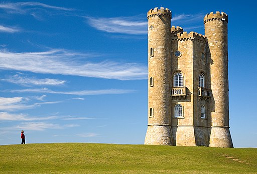
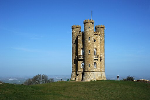
| Broadway Tower Country Park | 4.7 miles (7.5 km) | Enjoy fabulous views of the Cotswolds AONB in this beautiful park in Broadway, Worcestershire. This 5 mile circular walk takes you up to the focal point of the park at the 65ft high Broadway Tower. The tower was the brainchild of Capability Brown and designed by James Wyatt in 1794 in the form of a Saxon castle. It is the second highest point in the Cotswolds so there are wonderful views as far as the Welsh Mountains in one direction and Buckinghamshire in the other. From the top of the tower, on a clear day, as many as 16 English counties can be identified. The park is also home to a herd of Red Deer and includes several peaceful woodland trails. The circular trail starts from the Fish Hill car park, just to the north east of the tower, at a postcode of WR12 7LD for your sat navs. From here you can pick up the Cotswolds Way National Trail to take you south up to the tower before exploring the woodland and country trail around the wider park. The Cotswold Way provides and opportunity for continuing your walking in the area. The nearby Chipping Campden is a good option or you could visit the delightful Snowshill village and manor house on the Broadway to Snowshill Circular Walk. Our 10 mile Cotswold Way Circular Walk from Chipping Campden uses a lovely section of the national trail to visit the tower and nearby Dover's Hill. View Full Details>> | |
| Burford Circular Walk | 5.6 miles (9 km) | This circular walk explores the countryside and woodland surrounding the Oxfordshire town of Burford. The interesting medieval town is situated in the Cotswold Hills near to the Gloucestershire border. There are nice footpaths to follow along the River Windrush and then into the farmland and woodland above the town. There is a good sized parking area just of the High Street in the town from which you can start your walk. Nearby is the Grade II Listed Burford Methodist Church, built in the early 18th century. If you head east out of the town you can pick up a public footpath along the River Windrush to Widford. Here you turn north and cross the river and head to the pretty village of Swinbrook. The village includes the church of Saint Mary the Virgin which dates from about 1200. After visiting Swinbrook the walk passes the site of the medieval village of Widford. St Oswald's church in Widford is Early English Gothic and dates from the 13th century. Widford was a substantial village in the Middle Ages but only the 16th-century manor house and a few other houses remain today. The route heads north from Widford, visiting some small woodland areas before arriving at the village of Fulbrook with its Norman church. The final section returns you to the finish point at Burford. You can extend your walk by continuing east from Swinbrook to Minster Lovell. It's a nice stroll along the river with the option of exploring the atmospheric ruins of the 15th century Minster Lovell hall. Just to the west of Burford you can pick up the Donnington Way long distance footpath in Great Barrington. Also nearby is the attractive town of Witney where you can visit the pretty lake and Church Grenn on our Witney Circular Walk. View Full Details>> | |
| Cam Peak Dursley | 3.7 miles (6 km) | Enjoy a circular walk across Cam Long Down to Cam Peak on this lovely walk in Dursley. The down is on a splendid section of the Cotswold Escarpment with marvellous views, wildflower rich limestone grassland and attractive woodland. You can start the walk from the centre of Dursley and follow the Cotswold Way across the down. It climbs from the town to Cam Peak, reaching a height of over 700ft at the high points. From here there are really lovely views over the River Severn to the Forest of Dean, May Hill and the Welsh mountains. The route takes you over Cam Long Down with the option of continuing a little further east and visiting Uley Bury. This long, flat-topped hill is an impressive multi-vallate, scarp-edge Iron Age hill fort dating from around 300 BC. If you would prefer a shorter walk then you can start from the car park on the down. It's easy to extend your walk by continuing along the Cotswold Way. If you follow it north east you can visit Coaley Peak for more great views. Also nearby is the expansive Woodchester Park which includes a series of lakes and woodland trails. View Full Details>> | |
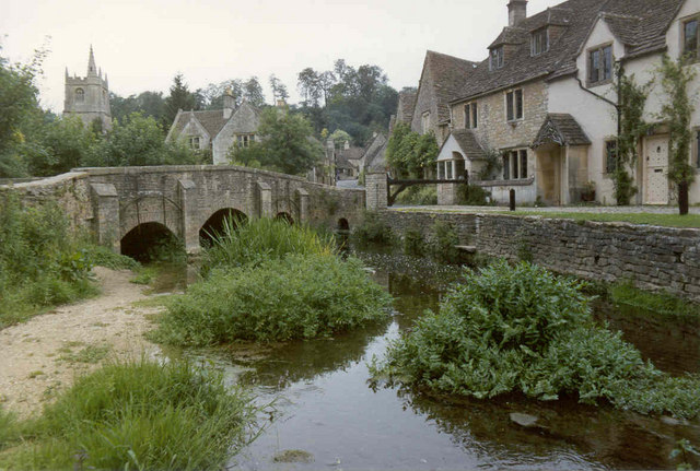
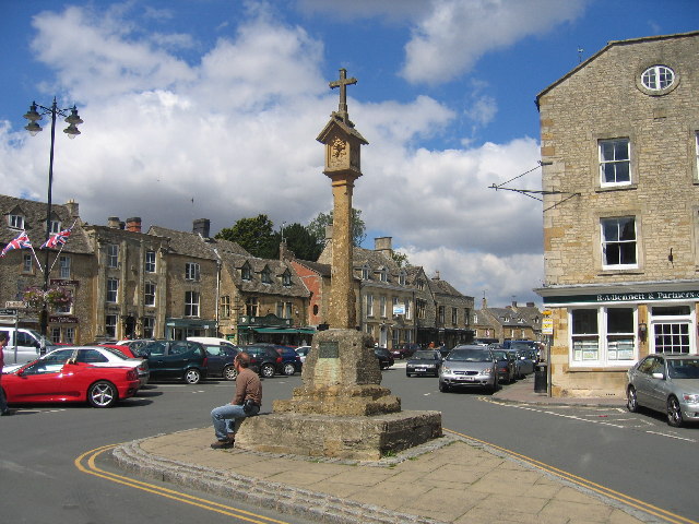
| Castle Combe | 1.2 miles (2 km) | Enjoy a short circular walk around this delightful Cotswolds village. It's like stepping back in time with its pretty little thatched cottages, a beautiful old church with a medieval clock and traditional country pubs. The lovely Bybrook River also runs through the village with little footbridges to cross. All in all Castle Combe generally ranks very high in any 'prettiest English village' polls! This short circular walk starts in the centre of the village, near the Castle Inn and church. You then pass through the village and along the river before returning to the car park through woodland. The Macmillan Way long distance walk runs through the village so you can easily pick this up to extend your walk into the surrounding Cotswolds countryside. You could follow it further south along the Bybrook to Slaughterford or west along the Broadmead Brook. Heading north will take you towards the Badminton House and Estate where there are two large ponds, several deer, attractive parkland and the 17th century Badminton House. The Palladian Way also runs through the village. The long distance trail runs from Buckingham to Bath through the beautiful countryside of Buckinghamshire, Gloucestershire, Oxfordshire and Wiltshire. The trail is named after Andre Palladio's Italian architecture and visits several pretty villages and includes waterside sections along the Oxford Canal and the River Windrush. You could follow the trail north east and visit nearby Hullavington. Heading south west will take you to Colerne where there's nearly 90 historic listed buildings including a 13th century church and a noteworthy 17th century stone pub. View Full Details>> | |
| Chalford and the Toadsmoor Valley | 6.8 miles (11 km) | Enjoy a walk along the Thames and Severn Canal before exploring the woodland of the Toadsmoor Valley on this walk from Chalford. There's nice views of the River Frome and interesting old mills to see in the area. The walk starts at Chalford Bottom and heads through the Golden Valley, passing along the canal and the River Frome. Near Brimscombe you turn north, heading through the wooded Toadsmoor Valley before finishing at Toadsmoor Pond. View Full Details>> | |
| Charlbury Circular Walk | 4 miles (6.5 km) | This circular walk uses part of the Oxfordshire Way long distance trail to explore the area around the Oxfordshire town of Charlbury. View Full Details>> | |
| Chedworth Roman Villa | 4.3 miles (7 km) | This circular walk around the village of Chedworth visits the fascinating Chedworth Roman Villa and Chedworth Woods. The walk starts in Chedworth and follows the Macmillan Way long distance trail to the National Trust owned villa. Here you will find the ruins of a large, 4th century Romano-British villa complete with wonderful mosaics, bathhouses and latrines. You can also see costumed guides bring Roman history to life and join a free tour of the site. The walk then continues through the lovely Chedworth woods, returning to Chedworth on public footpaths. For much of the walk you are also surrounded by some beautiful Cotswolds countryside. If you'd like to continue your walking in the area then you could pick up the Macmillan Way or the Monarch's Way which both run through the area. View Full Details>> | |
| Cheltenham Circular Footpath | 24.9 miles (40 km) | Situated on the edge of the Cotswolds this large spa town is a fantastic base for walkers. There's woods, hill climbs, reservoirs and several waymarked trails running through the beautiful countryside that surrounds the Gloucestershire town. This circular walk was devised by Cheltenham Borough Council and takes you around the town giving wonderful views of the Cotswolds escarpment. The walk starts and ends near Pittville Park and passes Cheltenham racecourse and the pretty Dowdeswell Reservoir. The route starts from the Pitville Park just to the north of the town centre. The ornamental park has a magnificent Pump Room and lakes. The Grade I listed Pump Room was the last and largest of the spa buildings to be built in Cheltenham. From the park you head north past Cheltenham racecourse. The course hosts the the Cheltenham Festival, held in March, which features several Grade I races including the Cheltenham Gold Cup, Champion Hurdle, Queen Mother Champion Chase, Ryanair Chase and the Stayers' Hurdle. Follow the footpaths round the racecourse and then head south through Prestbury, Oakley and Charlton Kings to Dowdeswell Reservoir. There's some nice waterside trails here with woodland paths in the adjacent Dowdeswell Wood and Lineover Wood as well. The route then turns west past as series of hills including Wistley Hill, Hartley Hill and Leckhampton Hill. View Full Details>> | |
| Chipping Campden to Broadway Tower Cotswold Way Walk | 10.3 miles (16.5 km) | This splendid circular walk uses the Cotswold Way and the Donnington Way to explore the countryside and landmarks surrounding the Cotswold villages of Chipping Campden and Broadway. It's a great one to try if you are staying in either of these villages as it uses well maintained waymarked footpaths to take you to such highlights as Broadway Tower Country Park and Dover's Hill. The route runs for just over 10 miles taking you through some beautiful Gloucestershire and Worcestershire countryside. View Full Details>> | |
| Chipping Campden to Dover's Hill | 3.1 miles (5 km) | This walk climbs to Dover's Hill from the lovely market town of Chipping Campden in the Cotswolds. The hill is a high point on the limestone escarpment that effectively forms the northern edge of the Cotswolds. There is a spectacular view northwards across the Avon valley from here. You start off in the centre of Chipping Campden with its wonderful limestone terraced main street which dates from the 14th century to the 17th century. The 17th century market hall arches are a particularly iconic Cotswolds piece of architecture. From Chipping Campden you pick up the Cotswold Way and follow it out of the town to Dover's Hill. The hill stands at a height of 754 feet (230 metres) with splendid views over the surrounding Cotswolds countryside. On a clear day you can also see the Black Mountains of South Wales and the Long Mynd in Shropshire. If you would like to continue your walking from Chipping Campden then you could follow the Monarch's Way to the nearby Hidcote Manor Garden. You can also follow the path to the village of Ebrington where you can pick up the Ebrington and the Foxcote Estate circular walk. View Full Details>> | |
| Chipping Norton | 23 miles (37 km) | This popular Oxfordshire market town is a great base for exploring the Cotswold Hills. This long circular walk makes use of three long distance waymarked trails which run through the area surrounding the town. You will follow sections of the Wychwood Way, the Shakespeare's Way and the D'arcy Dalton Way to visit a series of pretty villages including Cornwell, Churchill, Shipton Under Wychwood, Ascott-under-Wychwood and Chadlington. View Full Details>> | |
| Circular Walk from Bourton through Naunton and The Slaughters | 9.9 miles (16 km) | This popular circular walk from Bourton on the Water uses the waymarked Windrush Way and Warden's Way to visit several of the villages in the surrounding area. The walk runs for about 10 miles with lovely views of the River Windrush and the surrounding Cotswolds Hills. The walk starts in the picturesque village of Bourton-on-the-Water known as the 'Venice of the Cotswolds'. You then pick up the Windrush Way and follow it west along the river to Naunton. The village includes a church dating from the 15th century and a dovecote dating from 1660. It's a good place to stop for a rest and refreshments at roughly the half way point of the walk. The Black Horse Inn dates from the 1870s and has a good selection of meals and a nice beer garden to relax in. In Naunton you pick up the Warden's Way and head east through the countryside to The Slaughters. View Full Details>> | |
| Cirencester Park | 8.7 miles (14 km) | Explore 3000 acres of parkland and woodland on this fine circular walk in Cirencester. This extensive park has miles of woodland trails, a large lake and a deer park. You can walk along the wonderful tree lined Broad Ride and visit the 19th century Polo-ground - the oldest in Great Britain. There are also great views into the surrounding Cotswolds countryside. The park entrance is located on the western side of the town centre so is easy to reach. The Monarch's Way and the Macmillan Way both run past the park so you could pick up these trails to continue your walking in the area. View Full Details>> | |
| Claude Duval Bridleroute | 63.4 miles (102 km) | This shared walking and cycle path runs from Quainton, near Aylesbury in Oxfordshire to Great Barrington in the Cotswolds. This route is named after the well-known local highwayman, Claude Duval. It starts at Quainton and passes Stratton Audley, Bicester and Bucknell before crossing the Oxford Canal near Woodstock. The route then heads towards Chipping Norton and then Spelsbury where you join the River Evenlode for a short waterside stretch to Ascott d'Oyley. You then head onto Great Barrington via Fifield. View Full Details>> | |
| Cleeve Hill Circular | 5 miles (8 km) | Climb to the highest point in the Cotswolds on this splendid circular walk. The walk makes use of the Cotswold Way so is well defined and way-marked. It begins at the car park at the southern end of Cleeve Common before crossing the common and climbing up to the peak of Cleeve Hill which stands at 1,083 ft (330 m). From here there are marvellous views: to the west, over Cheltenham and the racecourse, over the River Severn and into Wales, and to the north over Winchcombe. View Full Details>> | |
| Coaley Peak | 2.5 miles (4 km) | This walk takes you to the Coaley Peak viewpoint from the village of Uley in the Cotswolds. The walk uses part of the Cotswold Way National Trail to take you through Coaley Wood to the viewpoint. At the peak there is a display showing all the landmarks you can see in the area. The walk starts from the car park on Crawley Hill road next to Uley Bury. It's worth exploring the Iron Age hill fort on Uley Hill before starting your climb to the peak. From here you head north through the woods for about 1.5 miles before reaching the viewpoint. Here you will find farmland and a wildflower meadow. There are also splendid views over the Severn Vale and the Forest of Dean. There is a good sized car park at the site if you prefer to visit directly. See the google street view link below for the view from there. Near the hill you will find Woodchester Park which is a great place to extend your walk. The extensive park includes a series of lakes and woodland trails. Just to the south west is the lovely Cam Peak near Dursley. You can cross Cam Long Down on the Cotswold Way with more great views to enjoy. View Full Details>> | |
| Cotswold Canals | 41 miles (66 km) | Follow a series of delightful waterways from Framilode to Lechlade on this waterside walk through Gloucestershire. The walk starts at Framilode, next to the River Severn and follows the Stroudwater Canal and the River Frome to the market town of Stroud. You continue to Sapperton, following the River Frome and the Thames and Severn Canal. A wooded section through Hayley Wood follows before coming to Kemble where you will pass the source of the River Thames. From Kemble you head to the village of Siddington and then on to South Cerney where you will pass the fabulous Cotswold Water Park which boasts 150 lakes, Nature Reserves and plenty of options for refreshment. View Full Details>> | |
| Cotswold Country Park | 5.6 miles (9 km) | This country park is located in the Cotswolds Water Park at Ashton Keynes on the Gloucestershire/Wiltshire border. The Park includes the largest inland beach in the UK, boat hire, crazy golf, a cafe and two lakes. It's a nice place for an easy inland beachside walk. There's also some woodland trails on the eastern side and lots of water loving birds to see on the water. View Full Details>> | |
| Cotswold Round | 216.9 miles (349 km) | Travel through some of the most beautiful countryside and prettiest villages in England on this circular walk. You will visit a series of classic Cotswolds towns and villages including Cheltenham Spa, Winchcombe, Stanton, Broadway, Chipping Campden, Moreton-in-Marsh, Stow on the Wold and Bourton on the Water (video below). There is much to enjoy with lush green countryside, historic houses, beautiful parks, woodland sections and homely country pubs for refreshments. View Full Details>> | |
| Cotswold Way | 101.9 miles (164 km) | This trail takes you through some of the most beautiful countryside in England. It runs for just over 100 miles from Chipping Campden in Gloucestershire to the historic city of Bath in Somerset. As well as proffering wonderful views of the Cotswold Hills Area of Outstanding Beauty, you can also see the River Severn, the Black Mountains of Wales and the Forest of Dean from the route. You will pass through or near a series of attractive market towns such as Chipping Sodbury, Wooton-under-Edge, Stroud and Cheltenham before arriving at the splendid Roman city of Bath at the end of the trail. View Full Details>> | |
| Cranham Woods | 3.4 miles (5.5 km) | This circular woodland walk in the Cotswolds visits Cranham Woods, Buckholt Woods and Coopers Hill. These large peaceful woods have miles of walking trails through attractive Beech woodland. Cyclists can try a series of downhill mountain bike trails. The walk starts from the parking area at the southern end of the woods near Cranham. You then head through Buckholt Wood towards Cooper's Hill, site of the Cheese Rolling event held on the Spring Bank Holiday which involves locals chasing a large round cheese down a near-vertical grass slope. The route then heads through Cooper's Hill Woods before returning to the car park. If you would like to extend your walk then you could visit the nearby Prinknash Abbey Park or climb Painswick Beacon for wonderful views over the Cotswolds. Much of this walk makes use of the Cotswold Way National Trail so you could also continue east along the trail through Witcombe Wood to Birdlip Hill and the lovely Crickley Hill Country Park. View Full Details>> | |
| Crickley Hill Country Park | 3.3 miles (5.3 km) | A short circular walk around Crickley Hill country park near Birdlip in Gloucestershire. The park is set in 143 acres of countryside within the Cotswolds AONB and includes Limestone Grassland, Beech Woodlands and panoramic views of this beautiful area. The park also overlooks the Severn Vale, with fabulous views of the Cotswolds Hills, the Brecon Beacons and Black Mountains beyond. The walk begins at the Crickley Hill car park and follows footpaths to Shurdington Hill, passing the site of an ancient Roman Villa, before returning to the car park via Dryhill farm. View Full Details>> | |
| Donnington Way - Cotswolds Pub Walk | 61.5 miles (99 km) | Visit the 15 pubs of the Donnington Brewery on this super pub walk through the Cotswolds. The walk starts in Stow on the Wold and heads to a series of delightful Cotswold villages including the famous picture postcard settlement of Bourton on the Water. View Full Details>> | |
| Dowdeswell Reservoir | 1.2 miles (2 km) | Enjoy a stroll through Dowdeswell Wood to Dowdeswell Reservoir on this circular walk near Cheltenham. It's a pleasant area for a walk with footpaths leading through the woods and along the water. The area is also a nature reserve with lots of wildlife to look out for in the woods and on the reservoir. Keep your eyes peeled for wildfowl such as Moorhen, Coot, Mallard, Little Grebe and Great Crested Grebe. There's lots of interesting plants to see in the woods including Bluebell, Ramsoms (wild garlic),Common Spotted Orchid, Pyramidal Orchid and Cowslip. Roe and Muntjac deer are also visitors to the wood. The Cotswold Way passes along the western edge of the wood so you can pick this up to extend your walk. If you head south you can visit Lineover Wood. Here you will find ancient woodland and limestone grassland with splendid views of Cheltenham and the Malvern Hills. Heading north will take you to Cleeve Common and Cleeve Hill. The Cheltenham Circular Footpath also passes the area. This long distance waymarked walk around Cheltenham gives wonderful views of the Cotswolds escarpment. View Full Details>> | |
| Ebrington and the Foxcote Estate | 4 miles (6.5 km) | This circular walk takes you around some beautiful countryside on the Gloucestershire/Warwickshire border in the Cotswolds AONB. It's a fairly easy walk, running for about 4 miles on good footpaths marked with yellow and blue arrows. The village of Ebrington is close to Chipping Camden and has pretty thatched Cotswolds cottages and a popular pub dating from the 17th century. There is also Ebrington Manor which dates from the 14th century. The walk starts in the centre of the village and climbs steadily through the countryside to Foxcote House. On the way you'll pass pretty streams, woodland and a lake near to the house. Look out for wildlife including buzzards, pheasants and deer. Ebrington is located just a few miles to the east of Chipping Camden. If you prefer you could start the walk from here and follow the Monarch's Way and the Heart of England Way to the estate. To extend your walk just head a mile or so north of Ebrington and you could visit the splendid Hidcote Manor Garden. There's also our Ilmington Walk which visits the delightful village with its thatched cottages and Norman church. View Full Details>> | |
| Frome Valley Walkway | 18 miles (29 km) | This pleasant and fairly easy walk takes you from Eastville Park on the outskirts of Bristol to the village of Old Sodbury along the River Frome. The route starts passing through the parks and woodlands around Bristol before entering the open countryside of Gloucestershire. You will pass through Frampton Cotterell, Chipping Sodbury and Yate with the Cotswold Hills providing a splendid backdrop for the route. View Full Details>> | |
| Gloucester and Sharpness Canal | 16.2 miles (26 km) | Enjoy cycling and walking along the towpath of this lovely canal in Gloucestershire. The whole of the route is suitable for walkers while cyclists can enjoy several sections as well. National Cycle Route 41 of the National Cycle Network runs along the canal from Gloucester Docks to the outskirts of the city. There's also another section from Frampton on Severn to Shepherd's Patch. The canal runs from Gloucester Docks to Sharpness with wonderful views of the Severn Estuary, the Forest of Dean and the Cotswolds. Route highlights include Gloucester Docks with its variety of shops, leisure facilities, marina and fascinating Gloucester Waterways Museum. You will also pass the wonderful Slimbridge Wetland Centre where you can see thousands of migrant birds. The route finishes at the dock of Sharpness Port which was opened in 1874. The canal links nicely with the River Severn in several places so you have the option of picking up the Severn Way and continuing your walk. View Full Details>> | |
| Gloucestershire Way | 93.8 miles (151 km) | Travel from Chepstow in Wales to Tewkesbury in Gloucestshire and visit the Forest of Dean, the Severn Plain and the Cotswolds on this beautiful and varied walk. The recommended stages for the walk are: Chepstow to Parkend - 13.5 miles Parkend to May Hill - 14 miles May Hill to Gloucester - 13 miles Gloucester to Crickley - 12 miles Crickley to Salperton - 12 miles Salperton to Stow on the Wold - 11 miles View Full Details>> | |
| Guiting Power and Temple Guiting | 3.1 miles (5 km) | This easy walk visits these two idyllic Cotswolds villages. It follows the North Cotswold Diamond Way through the countrsyide from Guiting Power to the nearby Temple Guiting. There's waterside paths along the Guiting Stream and a woodland section through Castlett Wood to enjoy. Both villages are also delightful. In Guiting Power there is a pretty village green and a Norman doorway to the church. If you would like to continue you walking in the area then you could follow the Warden's Way to the Slaughters and Bourton on the Water which are both close by. View Full Details>> | |
| Gustav Holst Way | 34.2 miles (55 km) | Follow the Gustav Holst Way through the Cotswolds from Cranham to Wyck Rissington and enjoy the scenery and villages enjoyed by the composer. The walk starts in the pretty village of Cranham where Holst lived for a while in 'Midwinter Cottage'. The first section of the walk takes you from Cranham to Cheltenham, passing through Buckholt and Witcombe Wood, Birdlip and the delightful Crickley Hill Country Park. The park is set in 143 acres of countryside within the Cotswolds AONB and includes Limestone Grassland, Beech Woodlands and panoramic views of this beautiful area. This section of the walk also passes the Devil's Chimney - an unusal limestone rock formation that stands above a disused quarry at Leckhampton Hill. The walk then takes you through the interesting city of Cheltenham (Holst's birthplace), passing the attractive Cheltenham College Grounds and the Gustav Holst memorial statue. After leaving Cheltenham you continue through the lovely Cotswolds countryside towards the village of Guiting Power. On this section you will pass Cleeve Hill, the highest point both of the Cotswolds hill range and in the county of Gloucestershire, at 1083 ft. Here you will also find Belas Knap neolithic chambered long barrow. A scheduled ancient monument in the care of English Heritage, it has been described as an 'outstanding example representing a group of long barrows commonly referred to as the Cotswold-Severn group'. After leaving Cleeve Hill the path passes through the peaceful Guiting Wood, before arriving at the pretty village of Guiting Power. The final section of the walk follows the River Windrush to the popular tourist destination of Bourton on the Water. The village is particularly picturesque with the River Windrush flowing through the centre where it is crossed by several low, arched stone bridges. Shortly after, the walk comes to an end at Wyck Rissington where Holst was the resident organist for the church. View Full Details>> | |
| Haresfield Beacon | 4.7 miles (7.5 km) | Enjoy woodland trails and wonderful views over the Severn Vale and the Cotswolds on this circular walk near Stroud. There are miles of walking and cycling trails on which to explore the large estate. On the way you will pass wildflower meadows, an Iron Age hill fort and the Bronze Age Long Barrow of Haresfield Beacon. This walk starts at the car park and follows the Cotswold Way National Trail through Standish Wood. You pass the Long Barrow and Standish Quarry before heading through the countryside to Oxlynch. The path then passes Vinegar Hill and Ring Hill before reaching the topograph where you can enjoy splendid views. From the topograph it is a short walk back to the car park and the finish point. The area is superb for interesting flora and fauna. Look out for bluebells in Standish woods and orchids and butterflies in the limestone grasslands. You may also see buzzards and kestrels from the viewpoints. The whole of this route is for walkers but much of it is suitable for mountain bikers too. If you would like to continue your walking in this beautiful area then you could head south of Stroud and visit Rodborough Common and Woodchester Park for more great walking trails. You could also pick the Cotswold Canals Walk and enjoy waterside walking along the Stroudwater canal through Stroud. View Full Details>> | |
| Heart of England Way | 101.3 miles (163 km) | Follow the Heart of England Way through the Midlands of England. The walk starts from Milford Common on Cannock Chase and heads through Staffordshire, Warwickshire and Gloucestershire before finisihing at Bourton on the Water in the Cotswolds. Major towns and cities on the route include:
| |
| Hidcote Manor Garden | 1.6 miles (2.5 km) | Explore these stunning National Trust owned gardens on this short walk in the Cotswolds. The gardens were created by American horticulturist, Major Lawrence Johnston and contain a number of beautifully designed outdoor 'rooms'. Highlights include the kitchen garden, plant house, herbaceous borders and the orchard. There are also a number of peaceful footpaths to follow to the various secret gardens. If you would like to continue your walk you could follow the Monarch's Way to the pretty Cotswold hamlet of Hidcote Bartrim. Just a mile or so to the south you will find the pretty village of Ebrington with a wonderful 17th century pub and the 14th century Ebrington Manor. You can explore the area on our Ebrington and the Foxcote Estate Walk which takes you through some lovely countryside with streams, woodland and ponds. The Heart of England Way also runs through the nearby village of Mickleton. View Full Details>> | |
| Ilmington | 10.6 miles (17 km) | This walk from Ilmington makes use of three waymarked trails to create a fine circular route through the countryside surrounding the Cotswolds village. You'll follow sections of the Warwickshire Centenary Way, the Monarch's Way and the Cotswolds Link on this 10 mile tour of this lovely area of the Cotswolds. The walk starts in Ilmington at the noteworthy St. Marys church which is Norman and dates from about the middle of the 12th century. You pass through the pretty village with its thatched cottages and fish ponds, heading west into the countryside along the Warwickshire Centenary Way. At Admington you turn south along the Monarch's Way towards Hidcote Manor. The National Trust run gardens were created by American horticulturist, Major Lawrence Johnston and contain a number of beautifully designed outdoor 'rooms'. Highlights include the kitchen garden, plant house, herbaceous borders and the orchard. At the manor you pick up the Cotswold Link and follow it east along a series of bridleways. You'll pass Nebsworth and Knowlands Hill before coming to Darlingscott. The route turns north east here, taking you to Glebe Farm where you pick up the Centenary Way again and follow it west through Blackwell to Ilmington. After your exercise head to the Howard Arms Pub for some well earned refreshments. Peacefully overlooking the old chestnut tree on the green, it lies in the heart of the village at postcode CV36 4LT. It also includes a delightful beer garden where you can relax outside in the summer months. View Full Details>> | |
| Jubilee Way | 16.2 miles (26 km) | Follow the Jubilee Way from Old Sodbury to the Severn Bridge on this delightful walk. View Full Details>> | |
| Kingham-Bledington-Foxholes | 5.9 miles (9.5 km) | The delightful Cotswolds village of Kingham was voted 'England's Favourite Village' in 2006. It's rows of limestone cottages and pretty village greens make it a must see if you are visiting the area. This lovely walk takes you through the Kingham streets before visiting the nearby village of Bledington and Foxholes Nature Reserve. The village is notable for the church of St Andrew which has a 14th-century Gothic west tower with a 15th-century top. It is also accessible from the train station which sits on the Cotswold Line. You can catch direct trains right to the village from London Paddington, Worcester, Reading and Oxford. The walk starts in the centre of the village and heads south west through the countryside to Bedlington. In the village you will find the parish church of St Leonard which dates from 1170. There's also the 16th-century King's Head Inn which overlooks the village green. The inn was awarded Dining Pub of the Year by the Good Pub Guide in 2001. At Bedlington you pick up the Oxfordshire Way long distance trail to take you south to Foxholes Nature Reserve. Here you can enjoy views of the River Evenlode before trying the woodland trails in the reserve. Look out for spring bluebells, foxgloves, woodland birds and over 200 species of fungi. After exploring the reserve you can return to the village the same way or turn it into a longer circular walk by picking up various footpaths through the countryside. The village is located very close to Chipping Norton where you can try our Chipping Norton Circular Walk which visits a number of nearby villages. You could also pick up one of several long distance trails including Oxfordshire Way, the North Cotswold Diamond Way and the Macmillan Way. View Full Details>> | |
| Lechlade River Circular Walk | 4.7 miles (7.5 km) | This lovely circular walk takes you along the River Thames and through the countryside surrounding this pretty town in Gloucestershire. You'll visit the nearby villages of Inglesham and Buscot and enjoy nice views of the surrounding Gloucestershire and Oxfordshire countryside. The riverside town is a very attractive tourist destination and popular with boaters and walkers. Boats of different types can be hired from here, from rowing boats to river cruisers. The town also includes St Lawrence's parish church. Here you will find a path through the churchyard named Shelley's Walk, after the poet Percy Bysshe Shelley who composed 'A Summer Evening Churchyard' here. The walk starts in the town centre and picks up the Thames Path to take you along the river to the little village of Inglesham. Here you will find the Grade I listed parish church of St. John the Baptist which dates from the 13th century. Around here the route leaves the river and follows a country lane east towards Buscot Wick and Buscot. This pretty Oxfordshire village includes a village hall, tea shop and many National Trust owned properties. There is also a church dating from 1200 which includes lovely stained glass windows and a bell cast at Bristol in about 1399. In the summer months you can visit Buscot Park where you will find delightful grounds and gardens surrounding a fine 18th-century mansion. At Buscot Lock you pick up the riverside path, heading west back into Lechlade. This section passes St John's Bridge and St John's Lock, where there is a 19th century statue of Old Father Thames outside the lock house. There's also nice views of the River Leach in this area. To extend your walking in the area you can head west from the town and visit the Fairford/Lechlade section of the Cotswold Water Park. Here you can enjoy nice footpaths along a series of lakes. If you follow the Thames Path south west you can visit Cricklade. The town of Faringdon is also located nearby. Here you can enjoy a climb to Faringdon Folly for great views over the area. The Cotswold Canals long distance trail also starts from the town. View Full Details>> | |
| Leckhampton Hill | 3.7 miles (6 km) | This circular walk takes you along a particularly beautiful section of the Cotswold Way National Trail visiting Leckhampton Hill and Hartley Hill. The walk starts at a parking area next to the A435 about three miles south of the centre of Cheltenham. From here you can pick up the Cotswold Way and follow the track to Charlton Kings Common and Hartley Hill. You cross the hill to to the Devil’s Chimney, an iconic Cotswold landmark. This unusual limestone rock formation stands above a disused quarry in Leckhampton. It's a picturesque spot with fabulous countryside views providing a wonderful backdrop to the chimney. The area of Leckhampton Hill and Charlton Kings Common is a biological and geological Site of Special Scientific Interest and a Key Wildlife Site. Look out for a variety of interesting flora and fauna such as meadow pipit and grasshopper warbler. Rare plants include fly orchid, musk orchid and purple milk-vetch. The walk finishes with a stroll along a country lane which leads back to the start point. If you would like to extend your walk then you could continue along the Cotswold Way to the delightful Crickley Hill Country Park. View Full Details>> | |
| Limestone Link | 36 miles (58 km) | Starting at Cold Ashton in St Catherine's Valley, Gloucestershire follow the Limestone Link from the Cotswolds to the Mendip Hills in Somerset. The walk first heads south towards Batheaston where you join the River Avon and the Kennet and Avon Canal for a lovely waterside stretch to Monkton Coombe. You will also pass near to Little Solsbury Hill, made famous by the Peter Gabriel song 'Solsbury Hill'. The second section of the path then takes you through the Mendip Hills with fabulous views of the Chew Valley, Burrington Combe limestone gorge, Dolebury Warren Iron Age Hill Fort, the waterfall at Hallatrow and the final stretch through Burrington common the main highlights. View Full Details>> | |
| Macmillan Way | 290.2 miles (467 km) | This epic long distance path links Boston in Lincolnshire to Abbotsbury in Dorset. It is promoted to raise money for the charity Macmillan Cancer Relief.
The route starts from Boston and then runs across the Fens to Bourne before joining the limestone belt. You then head to Stamford and then along the shoreline of Rutland Water. You'll also pass through the medieval market town of Oakham where there's some wonderful old architecture at the Norman castle and the 16th century Oakham School. The trail then heads south and west via Warmington to Stow-on-the-Wold, then into the Cotswolds via Cirencester and Tetbury to Bradford-on-Avon. After leaving the Cotswolds you follow the path through Somerset passing Castle Cary before entering Dorset and the final section to Abbotsbury via Sherborne. The route joins with other popular trails including the Viking Way at Oakham, the Thames Path National Trail near Thames Head and with the South West Coast Path towards the end of the route. View Full Details>> | |
| Marshfield | 7 miles (11.3 km) | A lovely circular walk around the Cotswolds town of Marshfield. There's beautiful rolling countryside, waterside paths along the pretty Broadmead Brook and a visit to the little hamlet of West Kington to enjoy. Starting in the town centre you pick up a public footpath to take you across fields to Down Road, a quiet country lane which you can follow all the way to West Kington. It's a delightful little hamlet with picture postcard cottages and gardens. From here you pick up a footpath along the Broadmead Brook, heading west through a lovely valley full of wildlife and pretty wildflowers. The route then turns south along Shire Hill Lane before picking up more country paths to take you back into the town. View Full Details>> | |
| Minchinhampton Common | 2.5 miles (4 km) | This large area of common land near Nailsworth is criss-crossed with miles of nice footpaths. The common is also in an elevated position so there are great views of the surrounding Cotswold hills, countryside and villages. You'll reach a height of well over 600ft on the edge of the Cotswold Escarpment. On a clear day you can even see across the Severn Vale into Wales. It's also great for flora and fauna with skylarks and various orchids to look out for. This walk starts from the little village of Amberley on the western side of the common. From here you can pick up the footpaths leading towards Bownham, Burleigh and Box. To extend your walking in the area you can head to the nearby Rodborough Common. The common is located just to the north and consists of nearly 300 acres of attractive grassland, scrub and woodland. Also nearby is Selsley Common. It's located just to the west and has more nice paths and rare flora and fauna to discover. The common is located very close to the popular town of Stroud where you can enjoy a nice waterside walk along the Stroudwater Canal. View Full Details>> | |
| Minster Lovell | 3.1 miles (5 km) | This circular walk explores the pretty Oxfordshire village of Minster Lovell with its old hall, thatched stone cottages and riverside footpaths. The highlight of the walk is a visit to Minster Lovell Hall built in 1440. Here you will find the ruins of the hall surrounded by an extensive estate and bordered by the River Windrush. The atmospheric ruins include an ornamented entrance porch, south west tower and dovecote. After exploring the hall you can continue along the river to the nearby village of Crawley. Here you will find two Bronze Age bowl barrows near Blindwell Wood and a 19th century church. There are also two pubs where you can enjoy refreshments at the half way point of the walk (more details below). From Crawley another public footpath will then bring you back to Minster Lovell through the countryside. To extend your walking in this area simply head east and visit the pretty town of Burford where there are more nice riverside paths and historic buildings. The village is also located just west of Witney so you could start the walk from the town and follow the river to the old hall. You could also try our Witney Circular Walk which takes you along the river to Witney Lake and Meadows. View Full Details>> | |
| Misarden Park | 1.6 miles (2.5 km) | This delightful circular walk in the Cotswolds visits the pretty village of Miserden and explores Misarden Park with its pretty lake and woodland trails. The walk starts in Miserden with its lovely Cotswold stone cottages, St Andrews Church, Village Hall, Post Office, Shop and Pub. From the village it is a short stroll to Misarden Gardens where you will find a 17th century Manor House surrounded by attractive topiary, a walled garden, herbaceous borders, specimen trees and a parterre. There is a nice waymarked footpath leading through the woodland and along the pretty lake with views of the River Frome. You can extend your walk by following a bridleway east through the woods to Winstone or heading south east through the countryside to Duntisbourne Abbots. The village of Edgeworth lies just to the south and the Macmillan Way long distance trail can be picked up near here. View Full Details>> | |
| Monarch's Way | 615.2 miles (990 km) | This incredible 615-mile walk approximates the escape route taken by King Charles II in 1651 after being defeated in the Battle of Worcester. The Monarch's Way starts at Worcester then travels north to Boscobel and then south to Stratford upon Avon. It then continues south through the Cotswolds to Stow on the Wold before turning south west towards Bristol via Cirencester. The route then heads south through the Mendip Hills to Wells and then on through Somerset towards Yeovil and then south west to Charmouth. You then follow the Dorset coast before turning north again to Yeovil, before heading east across the Downs to Brighton and then onto the finish point at Shoreham-by-Sea. The walk also takes you through two World Heritage Sites, one National Park and six Areas of Outstanding Natural Beauty. For those interested in the history of the walk there is ample opportunity to learn and discover more with a series of museums and historical sites dotted throughout the route. The walk is waymarked with a picture of the ship The Surprise, the Prince of Wales crown and the Royal Oak tree at Boscobel House. The route has been split into two separate gpx files. The first includes the section from Worcester to Bridport via the Midlands and Somerset. View Full Details>> | |
| Moreton-in-Marsh Circular Walk | 6.8 miles (11 km) | This circular walk from Moreton-in-Marsh makes use of the Monarch's Way and the Heart of England Way to explore the countryside, villages and woodland surrounding the popular Cotswolds town. Moreton-in-Marsh is a good base for exploring the Cotswolds with a train station and lots of good hotels to choose from. It's also very close to two major Cotswolds attractions. This includes the magnificent Sezincote House and Batsford Arboretum which are both on this route. Starting in the town you follow the Monarch's Way south to the village of Longborough where you will find a 12th century church and an opera house home to the Longborough Festival Opera in June and July each year. At Longborough you turn north along the Heart of England Way towards the exquisite Sezincote House. Here you will find a fascinating Mogul Indian palace surrounded by beautiful gardens including an orangery, spring-fed pools, canals and a large lake. After passing Sezincote you continue north to the pretty village of Bourton-on-the-Hill where you will find the Grade I listed St. Lawrence's Church, the 17th century Slatters Cottage and the fine Horse and Groom pub. After leaving the village you head towards Batsford Arboretum where there are 56 acres of woodland consisting of Japanese maples, magnolias and pines. View Full Details>> | |
| Newark Park | 3.1 miles (5 km) | Explore the 700 acre estate of this Grade I listed building in Wotton-under-Edge, Gloucestershire. In the park you will pass lakes, a walled garden and a woodland area. Also look out for the many resident deer and peacocks. The park is located on the edge of the Cotswold escarpment so there are fantastic views of the Cotswold AONB. It is extensive and there are many well signed footpaths to enjoy. The house dates from the 16th century and includes unique stained glass windows and a beautiful dining room with William Morris wallpaper. To extend your walking in the area you could pick up the circular walk around Wotton-under-Edge which uses part of the Cotswold Way. View Full Details>> | |
| North Cotswold Diamond Way | 65.2 miles (105 km) | This diamond shaped walk was created by the RA's North Cotswold Group to celebrate the 60th Jubilee in 1995. The circular trail takes you through a series of pretty Cotswold villages including Moreton-in-Marsh, Blockley, Icombe, Turkdean, Bourton on the Water, Naunton, Guiting Power and Chipping Campden. View Full Details>> | |
| Northleach | 3.7 miles (6 km) | Enjoy a circular walk around the market town of Northleach. The interesting town has a 14th century church and is home to the Old Prison museum and visitor centre, also called Escape to the Cotswolds. The route makes use of the waymarked North Cotswold Diamond Way and the Monarch's Way to explore the countryside around the town and visit the neighbouring village of Farmington. Starting in the centre of town head south along the Diamond Way to Helen's Ditch. You then head east to Upper End, before turning north to Farmington. The little village has an old church, pretty cottages and a village green. At Farmington you pick up the Monarch's Way and head west back into Northleach, passing the noteworthy Eastington Manor on the way. To extend your walking in the area just head a couple of miles east and visit Sherborne Park. The National Trust owned estate includes pleasure grounds, woodland trails and a 19th century ice house. View Full Details>> | |
| Oxfordshire Way | 67.1 miles (108 km) | Take a trip through Oxfordshire and enjoy rivers, canals, pretty villages and beautiful countryside on this lovely trail. The walk starts in Bourton on the Water in the Cotswolds and passes Shipton-under-Wychwood, Otmoor RSPB Nature Reserve, Shipton Under Wychwood, Wychwood Forest, Cornbury Park and Charlbury. View Full Details>> | |
| Painswick Beacon | 3.1 miles (5 km) | Visit the delightful Cotswolds village of Painswick and climb the nearby Painswick Hill on this walk near Stroud. The walk starts from Painswick known as the 'Queen of the Cotswolds' because of its picturesque cottages, pretty churchyard with yew trees and the splendid Rococo Gardens. You can then follow the Cotswold Way National Trail north to the beacon. The trail is well signposted and takes you through the local golf course and past the aptly named Paradise valley. You soon come to the beacon where you will find an Iron Age Hill Fort and fabulous views over the Severn Vale, the Forest of Dean and the Welsh Mountains. From the top of the hill you can descend back to the village or if you'd like to extend your walk, you could continue along the Cotswold Way to the nearby Pope's Wood and Kites Hill. A little further on is Coopers Hill where the annual Cheese Rolling event is held on the Spring Bank Holiday. It involves locals chasing a large round cheese down a near-vertical grass slope. If you enjoy this walk you could head a couple of miles south west and visit Haresfield Beacon for more great walking trails and panoramic views of the Cotswolds. You could also follow the Wysis Way long distance trail south and visit the beautiful Slad Valley. View Full Details>> | |
| Pittville Park | 1.2 miles (2 km) | Enjoy a short waterside walk or cycle around this pretty park in Cheltenham. In the park you will find aviaries , small areas of woodland and three lakes with waterside paths. You will also pass the impressive Grade I listed Pittville Pump Room. Built in 1825 it is the last and largest of the spa buildings to be built in Cheltenham. There are also play areas for children, a boat house and cafe. Cyclists can cycle around the two western lakes so it's a nice option for anyone looking for a safe family ride in the town. View Full Details>> | |
| Prinknash Abbey Park | 0.9 miles (1.5 km) | This delightful bird park in the Cotswolds has nice walking trails taking you around a series of pretty ponds and woodland. There's a variety of wildllife including deer, peacocks, goats, waterfowl and donkeys. It's a very peaceful place and perfet for destressing with the animals. The park is located near Gloucesterand Stroud, just off the Cotswold Way. View Full Details>> | |
| Rococo Gardens | 0.6 miles (1 km) | Enjoy a short stroll around these beautiful gardens in Painswick in the Cotswolds. There are woodland trails, a maze, several attractive follies and gardens with a variety of flowers. There is also a wildflower meadow with various types of orchid, a Kitchen Garden and great views of the surrounding Cotswolds countryside. If you would like to continue your walking in the Painswick area then you could climb to Painswick Beacon for wonderful views over the Cotswolds. There is a car park at the gardens or you could follow the Cotswold Way from the village of Painswick to reach the entrance. The village known as the 'Queen of the Cotswolds' because of its picturesque cottages and pretty churchyard with yew trees. View Full Details>> | |
| Rodborough Common | 1.9 miles (3 km) | Enjoy splendid views over the Severn Vale from this lovely open space near Stroud. The common covers nearly 300 acres and is criss crossed with miles of nice footpaths. There is a car park towards the eastern side of the common with direct access to the well surfaced paths. The area is a biological and geological Site of Special Scientific Interest and also a Local Nature Reserve. Look out for various wildflowers and several species of orchid including Frog Orchid, Bee Orchid and Musk Orchid. The common consists of attractive grassland, scrub and woodland with Beech and Ash trees. It's also great for wildlife with over 30 species of butterfly flying around the pretty wildflowers. Look out for the rare Duke of Burgundy and Adonis blue. The common is in an elevated position above Stroud so on a clear day there are far reaching views towards the Forest of Dean and the Welsh hills. If you would like to extend your walk then you could head to the nearby Woodchester Park. This National Trust owned park has miles of good footpaths taking you through the tranquil wooded valley to five pretty lakes. The National Trust also manages Minchinhampton Common which has more nice footpaths and views to enjoy. You could also pick up the Cotswold Canals Walk and enjoy waterside walking through Stroud and the surrounding countryside. Also nearby there is Selsley Common which has more nice footpaths, interesting vegetation and great views. Just north of Stroud is Haresfield Beacon with miles of cycling and walking trails. View Full Details>> | |
| Rollright Stones | 7 miles (11.3 km) | This circular walk follows the Shakespeare's Way long distance footpath from Chipping Norton to the Rollright Stones on the Oxfordshire/Warwickshire border. View Full Details>> | |
| Sapperton Circular Walk | 9 miles (14.5 km) | The Cotswolds village of Sapperton has some good trails to follow through the extensive local woodland and attractive Cotswolds countryside. This walk visits the Sapperton Canal Tunnel where there are footpaths along the well known local structure. There's also nice waterside walking along the canal and rivers which run through the area. The walk starts in the village and heads west to Sapperton Wood and Frampton Wood, before picking up waterside paths along the River Frome to the village of Frampton Mansell. It then turns south east, following the old Sapperton Tunnel and other tracks towards Tarlton. You then pick up the Macmillan Way to take you along the Sapperton Canal Tunnel. With a length of 3,817 yards it was the longest canal tunnel, and the longest tunnel of any kind, in England from 1789 to 181. This section runs through Hailey Wood, before following country lanes back into the village. View Full Details>> | |
| Selsley Common | 1.9 miles (3 km) | This large open area near Stroud has miles of footpaths and wonderful panoramic views over the Cotswolds. It covers 97 acres and consists of wide open grassland with a variety of rare flora and fauna. Look out for wildflowers and orchids including the Green-winged Orchid and Fragrant Orchid. Butterflies such as Small Blue, Grayling and the Duke of Burgundy Fritillary fly around the flowers in the summer months. The common is in an elevated position above Stroud so there are far ranging views to enjoy. On a clear day you can see the Malvern Hills, the Welsh Hills and the River Severn. The area is very popular with walkers, paragliders and hang gliders. This circular walk starts from the car park at the southern end of the common but you could also follow the the Cotswold Way from Stroud. You can follow the trail from the town centre along the Stroudwater Canal before turning south near Ebley, towards the common. The Cotswold Way runs across the common so if you would like to extend your walk you could follow this trail west into Pen Hill Wood and Stanley Wood. Also nearby is the delightful Rodborough Common and Woodchester Park which has similar trails and viewpoints. The common is located just to the west of Woodchester so you could also start your walk from here. View Full Details>> | |
| Sezincote House | 3.1 miles (5 km) | This walk takes you to the extraordinary Mogul Indian palace of Sezincote House near Moreton-in-Marsh in the Cotswolds. The walk starts in the pretty village of Bourton-on-the-Hill and follows the Heart of England Way through the countryside to the nearby Sezincote Estate. The gardens are stunning with a curving orangery, spring-fed pools, canals and a large lake. There are also fascinating ornaments and statues including an Indian style pavilion, a temple to Surya the sun god and a snake coiled around a column in the Snake Pond. The house was built in 1805 by the grandsons of the diarist Samuel Pepys. The Prince Regent visited in 1807 and change his plans for the Royal Pavilion in Brighton after seeing Sezincote. The architect John Nash then designed the Royal Pavilion in a similar Indian style. If you would like to continue your walking in the area then the delightful Batsford Arboretum is only about a mile to the north. The pretty village of Blockley with its interesting Norman Church is also close by. View Full Details>> | |
| Shakespeare's Way | 146 miles (235 km) | This walk follows a route that Shakespeare may have taken when travelling between Stratford-upon-Avon and London. The path passes through the Chilterns, Oxford, Blenheim Park, the Cotswolds, the valley of the River Stour and the Thames Valley making for a beautiful and varied walk. There are lovely waterside stretches along the Oxford Canal and the River Thames into London. The walk is waymarked with a logo of Shakespeare's head. View Full Details>> | |
| Sherborne Park | 2.2 miles (3.5 km) | Enjoy a short circular walk around this National Trust owned estate near Cheltenham. The walk takes you through attractive woodland, farmland, and the delightful little village of Sherborne. There is a car park at Ewe Pen about a mile west of the village. You start the walk from here and then head through woodland and the Pleasure Grounds to the village. Look out for wildlife sculptures and the 19th century ice house on this section. At the village you can enjoy refreshments at the tea shop. The route continues passing the St. Mary Magdalene church and the pretty Sherborne Brook, before another woodland section takes you back to the car park. The estate is great for wildlife spotting. Look out for skylark, yellowhammer, linnet and hare. The Cotswold Way and the Monarch's Way long distance walking trails run through the nearby villages of Northleach and Farmington. You could pick up one of these trails to extend your walking in the area. Head east from the estate and you could visit the pretty Windrush Mill and the village of Great Barrington. Here you can explore Barrington Park where there's riverside paths along the River Windrush and lots of deer to look out for. You could also head a couple of miles south west to Lodge Park and enjoy more good National Trust footpaths. View Full Details>> | |
| Slad Valley | 3.7 miles (6 km) | This circular walk explores the area surrounding the Gloucestershire village of Slad near Stroud. The Slad Valley is famous for its associations with the author Laurie Lee, who based his book 'Cider with Rosie' on his own life in the village. It's a beautiful area of the Cotswolds and well worth exploring with a copy of the book under your arm! The walk starts in the centre of the village and follows various footpaths and country lanes around the village. You'll pass woodland areas and attractive farmland with pretty streams and brooks to look out for. Also on the route is the lovely Steanbridge Mill and its pond with ducks. It is mentioned in the book as the place where a young Lee used to ice skate in the winter. In the village you can also visit Lee's grave in the peaceful churchyard and visit the Woolpack Inn for refreshments. It's a lovely walk and of particular appeal to fans of the book who will recognise many of the locations. Part of the walk uses the Wysis Way long distance footpath. This section is at the northern tip of the route. You can follow the path east towards Piedmont and visit the Snows Farm Nature Reserve on the way. It consists of limestone grassland with a huge variety of wildlflowers including early purple orchid, fragrant orchid and pyramidal orchids. It's located just to the north east of the village and worth a visit. You can further extend your walk by continuing along the Wysis Way south to Bisley or north towards Painswick Beacon. Here you will find an Iron Age Hill Fort and fabulous views over the Severn Vale, the Forest of Dean and the Welsh Mountains. You can reach the area from Painswick on the Painswick to Slad Valley Circular Walk. The Cotswold Way National Trail runs to the west of the village through the Painswick Valley and is another good option for continuing your walking in this lovely area. View Full Details>> | |
| Snowshill | 3.7 miles (6 km) | This circular walk around the village of Snowshill makes use of the Cotswold Way long distance footpath to explore the surrounding countryside. The village is delightful with typical Cotswold cottages surrounded by lovely rolling hills. It also contains the wonderful Snowshill Manor, owned by the National Trust. This 16th century manor house contains an extensive collection of various objects collated by the architect and poet Charles Paget Wade. These include 26 suits of Japanese samurai armour, bicycles, toys and musical instruments. You can also stroll around the delightful gardens with pretty terraces and ponds. This 3.5 mile walk takes you into the wider countryside around the village, visiting Littleworth Wood and Buckland Wood on the way. If you would like to extend your walk you could continue along the Cotswold Way to the nearby village of Broadway and visit the splendid Broadway Tower Country Park. View Full Details>> | |
| Somerset Coal Canal | 2.5 miles (4 km) | Follow the Somerset Coal Canal from Tucking Mill to Combe Hay on this easy walk in the Cotswolds. Tucking Mill is just west of the village of Monkton Combe so you could just as easily start off from there. You then follow the Limestone Link for about 2.5 miles to the village of Combe Hay in the Cotswolds AONB. View Full Details>> | |
| Source of the Thames | 3.4 miles (5.5 km) | This walk takes you from the village of Kemble to the source of the River Thames at Thames Head, in Gloucestershire. The walk starts from the train station in the village. You can catch a train direct from London Paddington, Cheltenham or Gloucester. Head east from the station and you will soon come to the Thames Path National Trail. It's about a 1.5 mile walk north along the path to Thames Head. Here you will find a monument with an inscription to mark the source of the river. A nearby basin of stones marks the spring, although there is usually only water present during a wet winter. You can return to the village on the same path and then visit the interesting village church. It contains a Norman door and a tower dating from 1250, to which a spire was added in 1450. You can extend the walk by continuing north west along the Thames and Severn Canal, past Trewsbury House and into Hailey Wood. The Monarch's Way and Macmillan Way long distance trails also pass through the area. You can pick them up just to the north of Thames Head and then follow them deeper into the Cotswolds. If you prefer you could visit the site from Cirencester. Just follow the Monarch's Way west from the town and it will take you straight to Trewsbury House where you turn south to get to the source. If you follow the Thames Path in a south easterly direction you will soon come to the splendid Cotswold Water Park. Here there are miles of cycling and walking trails to follow around the 150 lakes. View Full Details>> | |
| Standish Wood | 1.9 miles (3 km) | Enjoy peaceful woodland trails in this large area of woodland near Whiteshill, Stroud. In the springtime there are carpets of bluebells to enjoy. The walk can be extended by climbing Haresfield Beacon for wonderful views over the Severn Vale and the Cotswolds. View Full Details>> | |
| Stinchcombe Hill | 1.2 miles (2 km) | This circular walk climbs to the lovely viewpoint at Stinchcombe Hill in the Cotswolds. The hill is located just to the west of Dursley so you could start your walk from there and follow the Cotswold Way to the hill. This circular walk, however, starts from the car park about half a mile east of the hill. You follow the Cotswold Way to the hill summit where you will find a topograph displaying all the landmarks you can see from the peak. It's a lovely view with the Tyndale Monument and the village of North Nibley visible across the attractive countryside and woodland below. You can also see the Vale of the River Severn and Forest of Dean from the 219 metres (719 ft) Drakestone Point. The public footpaths pass Stinchcombe golf course so please keep to the signposted paths only. After descending back to the car park you have the option of extending your walk along the Cotswold Way. You can follow it through the series of woods on the outskirts of Dursley. This includes Sheep Path Woods, Cockshott Woods and Hermitage Woods. If you continue south along the path you can visit the Tynedale Monument view point and the town of Wotton-under-Edge. View Full Details>> | |
| Stow on the Wold | 5 miles (8 km) | The picturesque Cotswolds town of Stow-on-the-Wold has a number of popular long distance trails running through it. You can use these to make a nice circular walk visiting the surrounding countryside and villages. This 5 mile circular walk starts in the centre of Stow-on-the-Wold and follows the Gloucestershire Way to Upper Swell where there is a reservoir and a small Norman church dating from the 12th century. You then head south to Lower Swell along the Heart of England Way. It's a very pretty little village with the River Dikler, a nice village green and several mellow stone cottages. The route continues south to Hyde Mill before turning east along the Macmillan Way to Maugersbury. Country lanes then return you to Stow-on-the-Wold. If you would like to extend the walk then you can head south west along the Gloucestershire Way at Hyde Mill to The Slaughters. Here you can enjoy a lovely walk between Lower Slaughter and Upper Slaughter along the River Eye. It's about a 4 mile walk with more details on the Stow on the Wold to the Slaughters Walk page. View Full Details>> | |
| Stroud | 5 miles (8 km) | The market town of Stroud has several long distance walking trails running through it and a number of woods, parks and hill climbs to try. As such it's a fantastic place for walkers and makes a great base for exploring this lovely area of the Cotswolds. This route is a popular walk along the Stroudwater Canal to the village of King's Stanley using a section of the Cotswold Canals Walk and the Cotswold Way National Trail. The walk starts in the centre of Stroud, near the train station. Here you can pick up the canal towpath and follow it west to Cainscross. The path continues to Ryeford where you head south on the Cotswold Way to King's Stanley. Here you can visit the 12th century parish church of St George before heading back to the town. You can extend the walk by continuing along the trail south to Middleyard where you will find Pen Hill and Pen Woods. Just to the east of King's Stanley you can enjoy more walking trails across Selsley Common with its variety of flora and fauna. View Full Details>> | |
| Stroud Valleys Trail | 5.6 miles (9 km) | This route runs from Stonehouse to Nailsworth following a disused railway line. The route is traffic free with splendid views of the Cotswolds and makes for a pleasant afternoon's cycling or walking particularly for families. Click here for more information on this route. You can further explore the area by following our walk to King's Stanley on the Stroud Canal. View Full Details>> | |
| Sudeley Castle | 3.1 miles (5 km) | Explore the award-winning gardens and beautiful 1,200 acre estate surrounding this 15th century castle near Winchcombe in the Cotswolds. View Full Details>> | |
| Tetbury | 9.9 miles (16 km) | The classic Cotswolds town of Tetbury has a number of lovely waymarked trails running past it. You can pick these up to explore the attractive countryside surrounding the town and to visit some of the local attractions. This walk makes use of the Monarch's Way and the Macmillan Way to visit the wonderful Westonbirt Arboretum, the 16th century Chavenage House and the nearby village of Avening. It's about a 10 mile walk in total with the option of getting the bus back from Avening to Tetbury. View Full Details>> | |
| The Ridgeway | 86.4 miles (139 km) | Step back in time on this wonderful 85 mile route which follows an ancient chalk ridge route used by prehistoric man. The trail starts at Overton Hill in Wiltshire on the edge of the Marlborough Downs and heads east through the Chiltern Hills to Ivinghoe Beacon in Buckinghamshire. Highlights on this fascinating route include a series of iron age forts, the famous Uffington White Horse, the beautiful Chiltern Hills and a lovely stretch along the River Thames at Goring-on-Thames. View Full Details>> | |
| The Slaughters | 1.9 miles (3 km) | This short walk between these two delightful Cotswolds villages is a favourite for visitors to the region. It follows the pretty River Eye from Lower Slaughter to Upper Slaughter. It's a special place with pretty little riverside cottages, stone footbridges, old watermills and picturesque village greens. Don't miss the wonderful 19th-century water mill in Lower Slaughter. It has an excellent museum, craft shop and riverside tea room. View Full Details>> | |
| Warden's Way | 13.7 miles (22 km) | Follow the Warden's Way through the beautiful Cotswolds on this delightful 14 mile walk. View Full Details>> | |
| Westonbirt Arboretum | 3.7 miles (6 km) | Enjoy a woodland walk through this beautiful Arboretum near Tetbury in the Cotswolds. View Full Details>> | |
| Whichford Wood | 1.2 miles (2 km) | Enjoy a short, peaceful stroll through these delightful woods on the edge of the Cotswolds. The area consists of Broadleaved and conifer woodland with a number of woodland walking trails to try. There are lovely views over the surrounding Warwickshire countryside from the forest too. Look out for various wildflowers, bluebells and wildlife including fallow deer. After your walk you can enjoy refreshments at the pub in the village of Whichford. The Macmillan Way long distance footpath runs through the woods so you could pick this up to extend your walk through Long Compton Woods to the village of Long Compton. If you continue south you will soon come to the fascinating Rollright Stones. View Full Details>> | |
| Winchcombe Way | 42.3 miles (68 km) | This super figure of eight trail takes you on a tour of the stunning northern area of the Cotswolds. The route runs for a distance of just over 40 miles. The walk begins at the lovely town of Winchcombe and heads to Dumbleton via Gretton and Alderton. At Dumbleton you turn south over Dumbleton Hill and through Alstone toward Cleeve Hill and Common. Cleeve Hill is the highest point both of the Cotswolds hill range and in the county of Gloucestershire, at 1083 ft. Here you will also find Belas Knap neolithic chambered long barrow. A scheduled ancient monument in the care of English Heritage, it has been described as an 'outstanding example representing a group of long barrows commonly referred to as the Cotswold-Severn group'. Shortly after Belas Knap you return to Winchcombe where the next section of the walk takes to Temple Guiting, passing through Guiting Wood on the way. The path continues to Snowshill where you can explore the delightful Snowshill Manor. View Full Details>> | |
| Windrush Way | 13.7 miles (22 km) | This lovely walk through the Cotswolds runs from Bourton on the Water to Winchcombe. The path follows the River Windrush to Naunton and proceeds through Hawling and onto Winchcombe. Walk highlights are the easy riverside walking paths and the 15th century, Sudeley Castle with its beautiful, award winning gardens and lovely chapel. View Full Details>> | |
| Witney Circular Walk | 2.5 miles (4 km) | This lovely circular walk takes you to some of the highlights of the Oxfordshire town of Witney. There's nice riverside paths along the River Windrush and a visit to Witney Lake to enjoy. View Full Details>> | |
| Woodchester Park | 3.7 miles (6 km) | This National Trust owned park in the Cotswolds is the perfect place for a peaceful afternoon stroll. View Full Details>> | |
| Wotton-under-Edge Circular Walk | 5 miles (8 km) | A circular walk around this pretty Cotswolds town using the Cotswold Way and other public footpaths. It's about a 5 mile walk so should take roughly 2 to 3 hrs to complete. The walk starts in the centre of the town and takes you through farmland to Wortley before climbing through the woodland on Wortley Hill. The route then passes Newark Park where you have the option to explore the lovely 700 acre estate. The extensive park includes lakes, gardens and more woodland trails. After leaving the park the route descends to Coombe and Holywell before returning to the town. To extend your walk you can visit Westridge Woods just to the north west of the town. You can follow the Cotswold Way to the site which includes the Tyndale Monument. View Full Details>> | |
| Wychavon Way | 39.8 miles (64 km) | Follow the Wychavon Way through the Worcestershire countryside on this splendid 40 mile walk. The walk begins at the town of Droitwch Spa, where you can pick up the waymarked trail just to the east of the town centre and train station. You start of heading east along the River Salwarpe before turning south to Hadzor. The route then heads through the countryside to Goosehill Wood, Earl's Common, Flyford Favell, Abberton and Church Lench. This section includes a short stroll along the Worcester and Birmingham Canal and woodland walks through Grafton and Old Yew Hill Woods. At Craycombe Hill you turn west to head through Craycombe Woods towards Wyre Piddle. Here you follow the River Avon to Pershore and Great Comberton. There's nice riverside sections to enjoy here with rushing weirs and lots of wildlife to look out for on the way. The next section takes you past Banbury Stone Tower which is the high point on the walk. There's splendid views over the Cotswolds countryside from the elevated position of the tower. From the tower you descend to the east, toward Ashton Under Hill and Cropthorne whose church dates back to the 12th century. You'll also pass Bredon Hill near Ashton under Hill where you can visit the Iron Age Hill Fort of Kemerton Camp and a small stone tower known as Parsons Folly at the summit. The final section then runs from Ashton to Sedgeberrow and Ashton Somerville before finishing in the popular Cotswolds village of Broadway where you can enjoy a visit to the splendid Broadway Tower Country Park. View Full Details>> | |
| Wychwood Way | 37.3 miles (60 km) | A long circular walk exploring the Wychwood Forest area of the Cotswolds. The walk starts in Woodstock and visits Stonesfield, Chadlington, Ascott-under-Wychwood, Leafield, Ramsden, North Leigh, East End and Combe. Highlights on the route include the magnifcent Blenheim Park at Woodstock. View Full Details>> |