Pembrokeshire Coast Walks

Use the links to view full route information including elevation profiles, interactive maps and GPS downloads.
You can also view an overview map of all the routes in the using the Pembrokeshire Coast Walk Map>>
*New* - Walks and Cycle Routes Near Me Map - Waymarked Routes and Mountain Bike Trails>>
| Route Name | Photo | Distance | Description |
| Abermawr Woods | 1.6 miles (2.5 km) | This short walk takes you along Abermawr Beach and through Abermawr Woods on the Pembrokeshire Coast. View Full Details>> | |
| Amroth and Colby Woodland Garden | 2.5 miles (4 km) | Enjoy a walk along the lovely coastline at Amroth and visit the National Trust's Colby Woodland Garden. The walk starts near the sea front in Amroth and follows a footpath north to the delightful Colby Woodland Garden. Here you will find 8 acres of woodland, widlflower meadows and gardens with a variety of plants and flowers such as azaleas, bluebells, camellias, magnolias, rhododendrons. In the walled garden there is a Victorian Gothic inspired gazebo and fine Japanese maples. The wildflower meadow has pretty streams and ponds and there are peaceful woodland trails in the woodland garden. The secluded wooded valley is home to a variety of wildlife. Look out for Dippers, bats, otters, frogs and toads. After leaving the gardens you can return to the sea front on the same path and then enjoy a stroll along the prom in Amroth. To extend your walking in the area follow the Pembrokeshire Coast Path west and try the splendid Amroth to Saundersfoot Walk and Tenby to Saundersfoot Walk. View Full Details>> | |
| Amroth to Saundersfoot | 2.5 miles (4 km) | A short walk along a delightful stretch of the Pembrokeshire Coast. The route takes you between the lovely villages of Amroth and Saundersfoot, with pretty beaches, cliff tops and coastal views. The walk is about 2.5 miles with a moderate climb at the start before a nice flat path leads you into Saundersfoot. Along the way you'll pass the long sandy beach in Amroth and the rocky beach at Wiseman's Bridge. In Saundersfoot the walk finishes, passing another nice beach and the lovely harbour. To extend your walking in Amroth you can visit Amroth and Colby Woodland Garden, just to the north of the village. The National Trust owned property has some good woodland trails to try. You could also continue on the Pembrokeshire Coast Path to nearby Tenby. View Full Details>> | |
| Blackpool Mill | 5 miles (8 km) | This circular walk visits the 19th century Blackpool Mill in the Pembrokeshire Coast National Park. View Full Details>> | |
| Bosherston to Barafundle Bay Walk | 6.3 miles (10.2 km) | A walk on the Stackpole Estate taking you from the village of Bosherston to the beautiful Barafundle Bay. The route then takes you to the nearby St Govan's Chapel. If you just want to walk to the bay and back it's about a 5 mile round trip. The paths are fairly flat though there are some small climbs on the way. View Full Details>> | |
| Broad Haven | 3.7 miles (6 km) | This popular sea side resort sits in a lovely spot on the edge of St Bride's Bay in Pembrokeshire. View Full Details>> | |
| Caldey Island | 2.5 miles (4 km) | Follow the walking trails around this fascinating and beautiful island off the Pembrokeshire coast, near Tenby. View Full Details>> | |
| Canaston Woods | 5 miles (8 km) | Enjoy a walk or cycle around these pretty woodlands in Pembrokeshire. There's 420 acres to explore with a good mountain bike track running through the centre of the woods. It's a fairly easy path so it's suitable for families. There are also numerous footpaths to follow through the ancient mixed woodland. The route begins near Canaston Bridge next to Blackpool Mill. There is a lay-by immediately south of Canaston Bridge where you can park. You then pick up the Knight's Way into the forest and follow various waymarked paths around the heart of the woods. If you would like to continue your outing then you could head to the nearby Picton Castle Gardens and Slebech Park where you will find more excellent walking trails. View Full Details>> | |
| Cardigan | 4.3 miles (7 km) | The town of Cardigan is located in a lovely spot on the Teifi Estuary. There's great walks along the Pembrokeshire coast with some beautiful beaches and wonderful scenery. View Full Details>> | |
| Carew Castle | 1.2 miles (2 km) | This fine castle in Pembrokeshire has a lovely one mile circular walking trail taking you around the pretty 23-acre Millpond. View Full Details>> | |
| Carn Ingli | 1.9 miles (3 km) | This walk climbs to Carn Ingli mountain in the Preseli Hills of Pembrokeshire. The area is designated as a Site of Special Scientific Interest due to its rare flora and fauna. There's also a number of fascinating ancient sites, wonderful geology and some stunning views to the Pembrokeshire coast. View Full Details>> | |
| Carn Llidi | 1.7 miles (2.8 km) | This walk climbs to the hill fort and view point at Carn Llidi near St David's on the stunning Pembrokeshire coast. View Full Details>> | |
| Ceibwr Bay | 1.1 miles (1.7 km) | This walk explores the beautiful Ceibwr Bay on the Pembrokeshire Coast near Cardigan. View Full Details>> | |
| Cilgerran | 3.7 miles (6 km) | This historic Welsh village is located in North Pembrokeshire, close to Cardigan and the Teifi Estuary on the coast. View Full Details>> | |
| Circular Walk around Tenby | 11.8 miles (19 km) | A circular walk taking you along the coast to Saundersfoot before heading into the countryside surrounding the Pembrokeshire town. There's some lovey coast and countryside to enjoy, with great views from the high points. The walk starts in Tenby and heads to Saundersfoot with some great cliff tops views. At Saundersfoot you turn west and head towards Moreton and the village of East Williamston. Public footpaths then take you through the countryside to North Astridge, passing farmland and woodland on the way. The final section descends across Cornish Down before finishing back in Tenby. You can extend your walking in the Tenby area by following the Tenby to Lydstep Walk along the Pembrokeshire Coast Path. View Full Details>> | |
| Dale Peninsula | 7.1 miles (11.5 km) | Explore the beautiful Dale Peninsula on this circular walk along the Pembrokeshire Coast Path. The route runs for just under 7 miles with some moderate climbs on the undulating path on the way. The walk starts in the picturesque village of Dale which is located a few miles west of Milford Haven. In the village you can pick up the coastal path on the eastern side. The path then heads south to visit Dale Fort. The fort is a Victorian era fort located on a rocky promontory that now houses a field studies centre, for study of local marine biology, biology, geology, geomorphology, and other related fields. You continue to Castlebeach Bay, Watwick Point, Mill Bay and St Ann's Head. Here you will find a lighthouse that overlooks the entrance to the Milford Haven waterway, one of Britain's deep water harbours. The lighthouse is intended to guide ships around a number of rocky shoals that cause a hazard to shipping entering the Haven as well as Crow's rock. The current lighthouse was completed in 1844 and commissioned by John Knott, senior lighthouse keeper with Trinity House. After enjoy the fine cliff top views you turn north to Frenchman's Bay, Welshman's Bay and Westdale Bay. From here you head east to Dale Castle before returning to the village. To continue your walking in the area head west along the coast path to visit the nearby Marloes Sands. The National Trust managed area also includes Marloes Mere and a wide variety of wildlife to see. Also nearby is the delightful Martin's Haven. Here you can catch a boat to Skomer Island where you can look out for a huge variety of wildlife including Puffins, Manx Shearwaters, Dolphins, Harbour Porpoises, Razorbills, Gannets and Fulmars. View Full Details>> | |
| Dinas Head | 2.5 miles (4 km) | Enjoy stunning coastal views on this circular walk on the Pembrokeshire Coast. Dinas Island is actually a peninsula with a wonderful 466ft (142m) viewpoint at the high point known as Pen-y-fan. It's a steep climb but you are rewarded with wonderful views of Cardigan Bay, Fishguard Bay, Snowdonia and the Llyn Peninsula. View Full Details>> | |
| Fishguard | 13 miles (21 km) | The town of Fishguard is located in a wonderful location on the Pembrokeshire Coast. There's fine coastal walking with two beautiful headlands located either side of the town. This coastal walk takes you east from the town to the popular Dinas Head using a section of the Pembrokeshire Coast Path. View Full Details>> | |
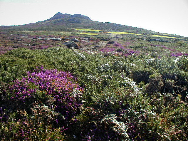
| Foel Cwmcerwyn | 3.7 miles (6 km) | Climb to the highest point in the Presili Hills on this challenging walk in Pembrokeshire. The hill stands at 1759 feet and commands wonderful views of the surrounding area. The walk starts at the Bwlch Gwynt car park on the B4329 and follows a woodland trail through the northern end of the Pantmeanog Forest before picking up a mountain track to the Foel Cwmcerwyn summit. Here you will find a trig point, a number of cairns and fabulous views. You can also reach the hill from the little village of Rosebush in the south-west. From the same car park you can also easily climb Foel Eryr. It's only about a half a mile climb from Bwlch Gwynt and makes a nice extension to the walk. Alternatively you could extend your walk by following the wonderful Preseli Hills Golden Road east to visit the Iron Age Hillfort at Foel Drygarn near Crymych. View Full Details>> | |
| Freshwater West | 10.3 miles (16.5 km) | This walk from Freshwater West explores the Pembrokeshire coast around the lovely Freshwater Bay and the village of Angle. View Full Details>> | |
| Garn Fawr | 0.6 miles (1 km) | This walk climbs to the excellent Garn Fawr viewpoint on the Pembrokeshire coast. View Full Details>> | |
| Gors Fawr Stone Circle | 0.9 miles (1.4 km) | This walk visits a fascinating ancient site in the Preseli Hills of Pembrokershire. View Full Details>> | |
| Gwaun Valley | 5.3 miles (8.5 km) | This walk takes you through the delightful Gwaun Valley, near Fishguard. The steep sided valley includes riverside paths, attractive woodland, water meadows and pretty bluebells in the spring. This walk runs from Llanychaer to Pontfaen on fairly flat paths, for a distance of about 2.5 miles (so just over 5 miles there and back). The walk starts from Llanychaer and follows footpaths east along the Afon Gwaun. You'll pass the woodland of Tre-llwyn Wood where you can look out for a variety of woodland bids including like redstarts, nuthatches and sparrowhawks. The route also passes Llanychaer churchyard where you can see the 1200 year old Crucifixion Stone. View Full Details>> | |
| Haverfordwest | 6 miles (9.7 km) | Haverfordwest is the county town of Pembrokeshire. There are some nice waterside walks along the River Cleddau which runs through the town. The town is also not far from the wonderful Pembrokeshire Coast Path. View Full Details>> | |
| Landsker Borderlands Trail | 59 miles (95 km) | A super circular walk through the Pembrokeshire and Carmarthenshire countryside visting the River Cleddau estuary, the Ogham stones, the Norman castles at Llawhaden and Carew Castle as well as the prehistoric remains at Llawhaden. View Full Details>> | |
| Lawrenny Quay and the Daugleddau River | 3.1 miles (5 km) | Enjoy woodland trails and riverside paths on this walk in the heart of the Pembrokeshire Coast National Park. Although most of the park lies on or near the coast this area is unusual in that it lies several miles inland. The little village of Lawrenny lies on a peninsula of the Cleddau estuary. The walk starts from the pretty Lawrenny Quay where this is a yacht club, pub and the popular tea rooms. The walk then picks up the Landsker Borderlands Trail and passes through Lawrenny Wood with views of the Daugleddau River. There are also nice glimpses through the trees to Benton Castle on the other side of the river. You continue along the Daugleddau to Garron Pill where you can either head south to Lawrenny village or you can just return the same way. At the end of your walk you can reward yourself with food and drink at the splendid Lawrenny Quayside where you can sit outside and enjoy great views of the river. If you would like to continue your walk then you could head east along the Cresswell River to Cresswell Quay, using the Landsker Borderlands Trail. Carew Castle is also nearby, just a few miles south of Cresswell Quay. View Full Details>> | |
| Little Haven | 5 miles (8 km) | This pretty village is located on the west coast of Pembrokeshire at the southern end of St Brides Bay. View Full Details>> | |
| Manorbier Castle | 1.9 miles (3 km) | This Norman castle near Tenby is well worth a visit. It includes pretty gardens and sits next to the coast so you can easily extend your walk to the nearby Manorbier Bay. View Full Details>> | |
| Marloes Sands | 1.9 miles (3 km) | This short circular walk visits the beautiful Marloes Peninsula on the Pembrokeshire Coast. The National Trust managed area also includes Marloes Mere and the lovely beaches of Marloes Sands. There's great views towards Gateholme Island and Skomer Island with attractive coastal vegetation including heather and gorse. There's also lots of interesting wildlife with Welsh Mountain ponies, various sea birds and seal pups to look out for. The walk starts from the National Trust car park just to the west of Marloes village. From here you can pick up the footpath heading west past the pretty mere, where you can look out for various birds from the hide. The path continues to the coast where you pick up the coast path to Marloes Sands. After passing along the sands you can pick up another path to take you back through the countryside to the car park. The sands are on the Pembrokeshire Coast Path so you can easily extend your walk by picking up the trail. Heading north west will take you past a series of pretty bays to Martin's Haven. Here you can catch a boat to Skomer Island where you can look out for a huge variety of wildlife including Puffins, Manx Shearwaters, Dolphins, Harbour Porpoises, Razorbills, Gannets and Fulmars. Head a short distance to the east and you will soon come to the lovely Dale Peninsula where you can visit St Ann's lighthouse and Dale Fort. View Full Details>> | |
| Martin's Haven | 1.2 miles (2 km) | Explore the beautiful Marloes Peninsula on this circular coastal walk in the Pembrokeshire Coast National Park. It's a wonderful area with great views towards the nearby Skomer Island, spectacular cliff tops and fields with pink wildflowers and heather in the summer. The walk starts at the Martin's Haven car park near the excellent Lockley Lodge Visitor Centre. You then head towards the coastguard hut and Wooltack Point for great views across St Bride's Bay. You continue along the coast with more splendid views towards Skokholm and Grassholm islands. The area is wonderful for wildlife with wild ponies, gannets and seals to look out for in the autumn months. To continue your walking in the area you can catch the boat from Martin's Haven to the wonderful Skomer Island from April to October. If you head east you can visit the lovely Marloes Sands and Marloes Mere. Here you'll find a bird hide where you can look out for a variety of birds visting the little lake. Near here you can also visit the lovely Dale Peninsula where you can visit St Ann's lighthouse and Dale Fort. View Full Details>> | |
| Milford Haven | 13 miles (21 km) | The town of Milford Haven is in an ideal location for exploring the wonderful Pembrokeshire Coast. This walk heads west along the coast path to visit the Dale Peninsula and Marloes Sands. The route runs for 13 miles but at the end you can catch a bus back to Milford Haven from Marloes village. The route starts on the front in Limford Haven, close to the train station. From here you head west past the docks to Hakin and Gelliswick Bay. Here you can see several oil pipelines which come ashore at this small working beach just west of Milford Haven. The route continues to the pretty Sandy Haven where you will find stepping stones and a crab bridge where people can collect crabs. It also provides a low tide route for crossing the estuary at low tide. There's a nice cliff-backed rocky beach here with lots of little rock pools to explore. The next stage takes you on to Lindsway Bay, near St Ishmael's, before coming to the cliffs at Musselwick Point. Shortly after you arrive at the pretty village of Dale. Here you can take a short detour to visit Dale Fort on the Dale Peninsula. The fort is a Victorian era fort located on a rocky promontory that now houses a field studies centre, for study of local marine biology, biology, geology, geomorphology, and other related fields. This route continues west to Marloes Sands. Here you'll find lots of interesting rock formations. A feature of the beach are the Three Chimneys, three vertical lines of hard silurian sandstone and mudstone. There's also lots of interesting wildlife with Welsh Mountain ponies, various sea birds and seal pups to look out for. After passing the sands the route heads north to the village of Marloes where you can enjoy refreshments at the cafe before catching the bus back. View Full Details>> | |
| Newport Pembrokeshire | 3.7 miles (6 km) | This lovely small town sits in a fantastic spot on the Pembrokeshire coast. With the Carningli Mountain as a backdrop, coastal paths, a nice beach and some fine river estuary trails it's a splendid place for a scenic walk. View Full Details>> | |
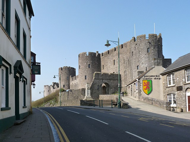
| Pembroke Castle | 1.9 miles (3 km) | This is a short walk around the fascinating medieval Pembroke Castle. It's an attractive area with the castle surrounded by a large Mill Pond. View Full Details>> | |
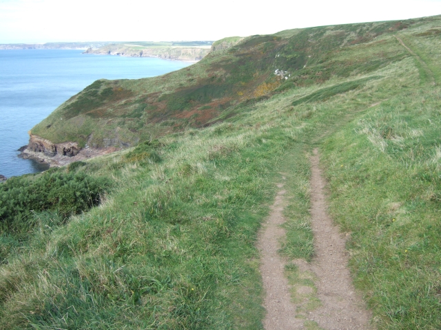
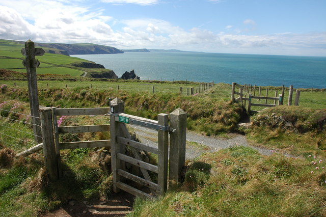
| Pembrokeshire Coast Path | 185.8 miles (299 km) | Brace yourself for some spectacular coastal scenery on this magnificent 186 mile trail that passes through the Pembrokeshire Coast National Park. The trail begins on the Teifi Estuary at St Dogmaels, following the Pembrokeshire coast to Amroth via some lovely coastal towns and villages including Fishguard, St David's, Milford Haven, Pembroke and Tenby. The wildlife along the route is plentiful and varied with Porpoises, Seals, Guillemots and Puffins just a few examples of what you can expect to see along the way. There are also great views of the beautiful islands off the Pembrokeshire coast, such as the popular Ramsey Island and Skomer Island which can both be visited by boat. View Full Details>> | |
| Pengelli Forest and Castell Henllys | 5.2 miles (8.4 km) | This walk explores the ancient woodland in Pengelli Forest in the Pembrokeshire Coast National Park. You'll also visit the fascinating Iron Age village of Castell Henllys which lies just to the east of the woods. View Full Details>> | |
| Pentre Ifan | 1.9 miles (3 km) | Visit the largest and most well preserved neolithic dolmen in Wales on this fascinating walk in Pembrokeshire. The walk starts from the Pentre Ifan car park and follows footpaths and country lanes to the burial chamber. It's an impressive sight with 7 principal stones including a 5 metre long capstone. Built around 3,500 B.C it is classed as a Scheduled Ancient Monument. View Full Details>> | |
| Picton Castle Gardens | 1.2 miles (2 km) | Explore the stunning gardens surrounding this 13th century stately home in Pembrokeshire. There's well laid out footpaths taking you through 40 acres of gardens with some woodland trails to try too. Highlights include rhododendrons, peaceful woodlands, an exotic jungle garden and a pretty walled garden. There also two nice ponds with fish, frogs, eels and dragonflies to look out for. It's great for families with an adventure playground, jungle boardwalk and maze. If you feel like extending your walk you could visit the nearby Slebech Park Estate where you will find miles of woodland trails. Canaston Woods is also nearby and has miles of good cycling and walking trails to try. View Full Details>> | |
| Porthgain | 3.5 miles (5.6 km) | The pretty village of Porthgain sits in a lovely location on the Pembrokershire coast. There's a picturesque harbour, galleries, old quarries and fine pubs to visit in the village. View Full Details>> | |
| Preseli Hills Golden Road | 6.8 miles (11 km) | This splendid walking trail runs right along the spine of the Preseli Hills giving wonderful views of the area. On a clear day you can see Cardigan Bay, Snowdonia and even Ireland. You will also pass two quarries which are believed to have provided the stones for Stonehenge. The road is thought to date back to Neolithic times. It's a 7 mile linear route but you could turn it into a circular walk by following the country lane at the end of the route south east towards Rosebush and then turning north through the Pantmaenog Forest to return to the start point. The walk starts at the Bwlch Gwynt car park on the B4329 and heads east following the trail past the northern end of the Pantmeanog Forest. Here you have the option to take a short detour south to Foel Cwmcerwyn, the highest point in the Presili Hills. View Full Details>> | |
| Pwll Y Wrach Witches Cauldron | 2.7 miles (4.4 km) | This circular walk visits Pwll Y Wrach (or the Witches' Cauldron) on the Pembrokeshire coast. View Full Details>> | |
| Ramsey Island | 3.7 miles (6 km) | Explore this beautiful island and RSPB Nature Reserve on this circular walk off the Pembrokeshire Coast. View Full Details>> | |
| Saundersfoot | 5.5 miles (8.8 km) | This delightful village sits in a lovely spot on the Pembrokeshire Coast. There's a picturesque harbour and a beautiful beach to enjoy here. View Full Details>> | |
| Skomer Island | 3.7 miles (6 km) | Visit this beautiful Island on the Pembrokeshire Coast and enjoy wonderful coastal views and thousands of breeding seabirds. The island has lovely walking trails along the coast and down the centre of the island. You can visit the island from April to October by catching a boat from Martin's Haven near Marloes village (Click here for information on sailing times). The island is fantastic for wildlife watching with Puffins, Manx Shearwaters, Dolphins, Harbour Porpoises, Razorbills, Gannets and Fulmars to look out for. In April you can see the Atlantic Grey Seal as they gather to moult at North Haven. The island itself is lovely with fields, cliff tops and interesting coastal rock formations. In the spring and summer months it is covered with pretty flowers such as Bluebells and Campion. Look out for the Skomer Vole and the multitude of Rabbits as you make your way across the reserve. It's a special place and a must see if you are visiting the Pembrokeshire Coast National Park. To continue your walking in the area you could explore the wonderful Marloes Peninsula on the Martin's Haven Walk. Also nearby is Marloes Sands and Marloes Mere. Here you'll find a bird hide where you can look out for a variety of birds visting the little lake. Near here you can also visit the lovely Dale Peninsula where you can visit St Ann's lighthouse and Dale Fort. View Full Details>> | |
| Slebech Park | 1.9 miles (3 km) | This 600 acre estate is covered with miles of footpaths making it an excellent location for walkers. It sits on the Dau cleddau river Estuary and consists of Bluebell covered Beech wood, wildflower meadows and riverside paths. This circular walk starts from the car park and follows a very good path around the estate passing woodland and ponds. You finish with a riverside stretch along the Dau cleddau river. If you'd like to continue your walking in the area then you could head a mile or so west to the wonderful Picton Castle Gardens. Canaston Woods is also nearby and has miles of good cycling and walking trails to try. Slebech Park is located a few miles east of Haverfordwest. View Full Details>> | |
| Solva Harbour | 1.9 miles (3 km) | Enjoy a walk around the beautiful Solva Harbour on the Pembrokeshire Coast. There are good walking trails on the east and west side of the harbour with the rocky headland of the Gribin giving wonderful views of the coast and St Bride's Bay. There are also great views of the River Solva and of the pretty Solva beach. This walk starts from the car park and follows good footpaths to the Gribin on the eastern side of the harbour. At the Gribin summit you will find an Iron Age fort and really wonderful views of the harbour and the coast. You can descend to the pebble beach at Gwadn where you may see breeding chough. After returning to the village you could stop for refreshments at the lovely Harbour Inn which has outdoor tables overlooking the river. The walk then continues along the western side of the harbour where there is more lovely scenery. View Full Details>> | |
| Solva to Newgale Walk | 4 miles (6.5 km) | This walk follows a lovely section of the Pembrokeshire Coast Path from Solva to Newgale. The route runs for about 4 miles along a waymarked, undulating coastal path. View Full Details>> | |
| Solva to St Davids Coastal Walk | 6 miles (9.7 km) | A popular coastal walk from Solva to St David's along a section of the Pembrokeshire Coast Path. The walk is just over 6 miles, taking place on undulating paths with wonderful sea views along the way. There is some climbing along the cliff tops but it is generally a fairly easy route. The walk starts from the beautiful Solva Harbour and south along the River Solva to the coast. You head west passing the stunning natural sea arch at Gewni Island and the interesting rock formations at The Cradle. You continue past Trelerw to Caerfai Bay where you will find purple sandstone cliffs and a sandy beach which can be reached at low tide on some steep steps. There's also tremendous views to the islands of Skomer and Skokholm from the picnic area above the beach. The next stage takes you to the St Non's Bay where you will find the ruins of St Non's Chapel, held by tradition to mark the birthplace of St David. The Grade II listed chapel is thought to be one of the oldest Christian buildings in Wales. Nearby you will find St Non's Cross and a holy well where visitors throw coins for luck. The route continues past the lovely Porthclais with its delightful harbour. The old harbour wall, built by the Romans is still largely intact. The walk then leaves the coast, following country lanes into St David's, where you finish at the cathedral. The city is noteworthy as the smallest in the UK and includes the medieval ruins of Bishops Palace next to the cathedral. The site dates back to the 6th century, although the building that stands today dates largely from the late 13th and 14th centuries. View Full Details>> | |
| South of the Landsker Trail | 62.1 miles (100 km) | This circular walk explores the Pembrokeshire Coast National Park around Pembroke. View Full Details>> | |
| St David's Head | 3.4 miles (5.5 km) | Widely considered to be the most spectacular coastal headland on the Pembrokeshire Coast, this stunning area is a must see when visiting the National Park. This circular walk makes use of the Pembrokeshire Coast Path and other public footpaths to take you on a tour of the St David's Peninsula. You'll enjoy great views over the beautiful Whitesands Bay towards the nearby Ramsey Island. The area is also geologically fascinating. You will pass Carn Llidi, a huge jagged tor, towering above the coast. You can climb the tor for stunning views to the east. The route also passes the Neolithic burial chamber of Coetan Arthur which dates from about 4000BC. View Full Details>> | |
| St Dogmaels | 1.9 miles (3 km) | This Welsh village sits in a lovely location on the River Teifi estuary near Cardigan. View Full Details>> | |
| St Govan's Chapel | 3.7 miles (6 km) | This fascinating 13th century chapel is situated by the side of a spectacular limestone cliff on the Pembrokeshire Coast. This circular walk takes you from the delightful village of Bosherton to the coastal chapel, passing through the beautiful Stackpole Estate on the way. The walk starts in Bosherton with its fine pub, pretty cottages and 13th century Norman church. You then follow a nice country lane through the countryside to the coast where you can climb down the 52 stone steps to the little chapel. There's a doorway into the chapel on the north side, where you will find low stone benches and an empty bell-cote in a single chamber. The view out of the window towards the sea is wonderful. After leaving the chapel and climbing back up the steps you continue to St Govan's Head for more great coastal views. Look out for a variety of seabirds, including guillemots, razorbills and kittiwakes. The next section takes you from St Govan's Head to the sand dunes at Broad Haven. You then pass along the lovely Stackpole Lily Ponds where you can look out for waterlilies in the summer and wildlife which includes the resident otters. The final waterside section along the ponds leads you back into Bosherton. View Full Details>> | |
| Stack Rocks and The Green Bridge Of Wales | 0.7 miles (1.1 km) | This coastal walk takes you across a section of the undisturbed Castlemartin Range on South Pembrokeshire’s rugged shoreline. View Full Details>> | |
| Stackpole Estate | 6.2 miles (10 km) | Explore the wonderful National Trust owned Stackpole Estate on this circular walk in the Pembrokeshire National Park. In the estate you'll find miles of coastal footpaths, woodland trails and waterside sections along the beautiful, large lake. View Full Details>> | |
| Strumble Head | 1.9 miles (3 km) | This circular walk takes you to this wonderful rocky headland on the Pembrokeshire coast. Strumble Head is a great place for wildlife watching with porpoises and seals regular visitors to the seas below. It's a lovely area with the well known Strumble Head Lighthouse and a beautiful coastline with views towards Dinas Head and Cardigan Bay. This walk starts off at the Strumble Head car park and takes you along the Pembrokeshire Coast Path to Porthsychan before returning through the countryside on a country lane. The final stretch back to the car park has great views of the lighthouse for most of the way. If you'd like to extend your walk you could head south along the Pembrokeshire Coast Path to the rocky volcanic outcrop Garn Fawr where you will find an Iron Age Hillfort and spectacular views of the surrounding area. View Full Details>> | |
| Tenby to Lydstep | 6 miles (9.6 km) | A popular walk along a section of the Pembrokeshire Coast Path from Tenby to Lydstep Point. Starting at Tenby Castle follow the coast path south west along the lovely South Beach. You then climb to Giltar Point where there's nice views along the cliffs. The path continues west along the cliffs to the beautiful Lydstep Haven. It's a really lovely spot with a nice beach and a holiday park. The path then heads out to Lydstep Point where there are fine views to Lundy Island and the Somerset coast. Also look out for pretty wildflowers in the summer months and wildlife including dolphins and porpoises. The final section takes you away from the coast to the little hamlet of Lydstep where you can enjoy refreshments at the cafe before catching the bus back to Tenby. To explore the area to the north of Tenby try the Tenby to Saundersfoot Walk. View Full Details>> | |
| Tenby to Saundersfoot Walk | 5 miles (8 km) | A popular walk along the Pembrokeshire Coast Path from Tenby to the neighbouring village of Saundersfoot. There's much to enjoy with exhilarating cliff top paths, beautiful beaches, woodland sections and fabulous coastal views. It's about a 5 mile walk on an undulating path, so a reasonable level of fitness is required. The walk starts on the front in Tenby and takes you past Paragon Beach, Castle Beach and St Catherine's Island. The island is reachable at low tide and contains St Catherine's Fort, a Grade II listed 19th century Palmerston Fort. There's lovely views across to the island on the opening section of the walk. The coastal path then takes you past the medieval Tenby Castle. The ruined fortification dates from the 13th century and includes a circular walk following the line of the original curtain walls. It is also home to Tenby Museum & Art Gallery. After exploring the castle the route heads north along the coast path to Monkstone Beach, passing Lodge Valley woodland on the way. You can visit the secluded beach on some steep steps. It's a peaceful place to escape the crowds. After rounding Monkstone Point the walk continues north through Rhode Wood before coming into Saundersfoot. The village is a very popular destination with its lovely harbour and wide blue flag beach. The train station is a little way out of the town. You can follow a country lane to the station and catch a train directly back to Tenby if you like. There's also regular buses from the village. If you would like to extend the walk you can continue along the coast path to Amroth. Here you can visit the National Trust's Amroth and Colby Woodland Garden. You can pick up the long distance Knights Way in Amroth and follow it north to the gardens. If you head in the other direction you can visit the beautiful Lydstep Haven on the Tenby to Lydstep Walk. View Full Details>> | |
| Trefin | 2.4 miles (3.8 km) | This coastal village is located in North Pembrokeshire on the Pembrokeshire Coast Path. Trefin includes a small low-tide sand and shingle beach below the historic mill. Some of Trefin's old village cottages and the old mill's remains date back to the 15th century View Full Details>> | |
| Treginnis Peninsula | 5.9 miles (9.5 km) | This circular walk explores the beautiful coastline and fascinating geological features of the Treginnis Peninsula in the Pembrokeshire National Park. You will pass the oldest volcanic rocks in Wales, formed over 600 million years ago. It's a particularly beautiful stretch of coast with wonderful views over to the nearby Ramsey Island. It's also a great area for wildlife watching. Look out for birds including Peregrine, Oystercatcher, Kittiwake and Shag. You may also see porpoises in the water below and deer on Ramsey Island. The walk starts at the Porth Clais car park and follows country lanes towards Treginnis Lodge where there are super views towards Skomer Island and St Bride's Bay. Just past Treginnis Lodge you turn right off the country lane at the sign for Pencnwc Farm, and head north towards Porthstinian/St Justinian. At St Justinian you will pass the RNLI station, the Grade I listed ruined chapel and the small harbour where you can catch boats to Ramsey Island. At St Justinian you pick up the Pembrokeshire Coast Path and head south passing the Iron Age hillfort of Castell Heinif and Seal Bay where you can look out for seal pups in late summer and early autumn. You then head east along the coast passing Porthlysgi Bay with views of Skomer Island, Midland Isle and the Marloes Peninsula in the distance. View Full Details>> | |
| Ty Canol Woods Walk | 2.1 miles (3.4 km) | This circular walk visits the Ty Canol National Nature Reserve near Newport. View Full Details>> |