Cairngorms Walks

Use the links to view full route information including elevation profiles, interactive maps and GPS downloads.
You can also view an overview map of all the routes in the using the Cairngorms Walk Map>>
| Route Name | Photo | Distance | Description |
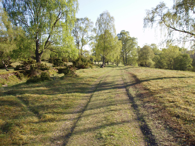
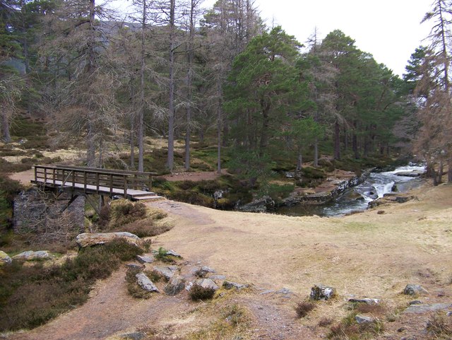
| 7 Bridges | 5 miles (8.8 km) | This popular circular walk takes you around the town of Ballater, visiting several bridges on the River Dee and the River Muick. The walk runs for just over 5 miles with some lovely riverside paths, peaceful woodland trails and great views of the surrounding Cairngorms Mountains. The walk starts in the town centre and follows the waymarked path to Ballater Bridge where you cross the river. You then follow the South Deeside Road to the Bridge of Muick, where you cross the River Muick. The next section heads north west along The Avenue which runs through Dalhefour Wood. Here you have the option of taking a small detour and visiting Knock Castle, just to the west of the path. The four-storey ruin, dates from approximately 1600 and has an interesting history. After leaving Dalhefour Wood you cross the river on Polhollick Bridge, a white iron suspension bridge dating from the late 19th century. You then turn east to follow a riverside path to the Bridge of Gairn. Here you cross the River Gairn and turn south east to follow the trail along the Dee and back into the town centre. To continue your walking around Ballater, head west and visit the Balmoral Estate. Here you can try the interesting Balmoral Cairns Walk which visits the historic castle and a series of cairns dedicated to members of the British royal family and events in their lives. View Full Details>> | |
| Abernethy Forest | 3 miles (5.5 km) | This splendid forest and nature reserve in the Cairngorms has miles of good walking trails to try. This circular walk starts from the RSPB forest lodge and takes you along the woodland trails along the River Nethy. You can extend your walk further into the expansive forest and visit a series of pretty lochs and streams. The reserve is a fantastic place for wildlife with Ospreys and red squirrels to look out for. The forest includes the beautiful Loch Garten with an Osprey Centre where you can observe the birds nesting in the Caledonian pineforest and view the birds on the live CCTV camera. It's a splendid area with the Cairngorms Mountains making a great backdrop. View Full Details>> | |
| Aviemore | 6 miles (9 km) | The town of Aviemore is a great place for exploring a beautiful region of the Cairngorms National Park. In the area you will find numerous lochs, forests, mountains and rivers. View Full Details>> | |
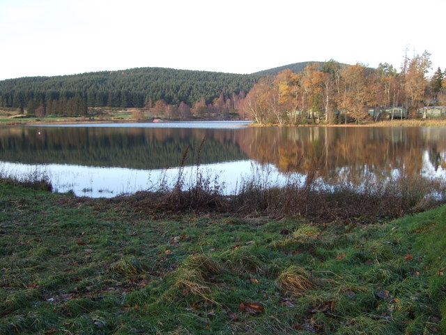
| Ballater | 1 miles (2 km) | This Burgh in Aberdeenshire is located in a fine spot on the River Dee. It's proximity to the Cairngorms National Park makes it a fine base for walkers. View Full Details>> | |
| Balmoral Cairns | 5 miles (8 km) | This walk visits a series of stone cairns on the estate of Balmoral Castle in Deeside. The cairns commemorate members of the British royal family and events in their lives. The circular walk runs for about 5 miles with nice woodland trails and fine views over the Deeside hills from the high points. You can start from the castle itself or from nearby Crathie. The majority of the cairns were erected by Queen Victoria in the 19th century. They commemorate the marriages of Victoria's children, of the Princess Royal (to Frederick, Crown Prince of Prussia in 1858), Prince Albert Edward, Princess Alice, Princess Helena, Princess Louise, Prince Arthur, Prince Leopold and Princess Beatrice. The most striking cairn is the large pyramid erected by Victoria in memory of her husband Prince Albert after his death in 1861. In 2012 an additional cairn was erected and unveiled by the Queen to mark her Diamond Jubilee. To continue you walking in the area head south and try the climb to Lochnagar. From the summit of the hill there's fabulous views back down to the Balmoral Estate and over the Cairngorms mountains. The walk starts from the Balmoral Estate Visitor centre where you can also pick up trails around the lovely Loch Muick. Near here there's also mile of fine walking trails in the Corrie Fee Nature Reserve. The reserve is rich with wildlife and also includes beautiful alpine flowers with rare mountain willows clinging to the steep crags of the bowl shaped valley. View Full Details>> | |
| Ben Avon | 21 miles (33 km) | This challenging walk in the Cairngorms takes you to the unusual Ben Avon plateau with its numerous granite tors and wonderful far reaching views. You start in Braemar in a parking area just off the Old Military Road to the east of the village. You then pick up the Gleann an t-Slugain path which will take you to Ben Avon. It's generally a very good path passing through woodland, along pretty streams and through the delightful Fairy Glen. On the way you'll enjoy great views over Glen Quoich, Glas Allt Mor and Slochd Mor. At the summit you will find the huge Leabaidh an Daimh Tor. Some scrambling is required to get to the true summit where there are excellent views of Beinn a'Bhuird mountain. If you'd like to continue your walking in the area then you could head to Linn of Dee and Linn of Quoich which are both near Braemar. View Full Details>> | |
| Ben Macdui | 10 miles (16 km) | Climb to the summit of the second highest mountain in Britain on this challenging walk in the Cairngorms. The walk starts from the Cairngorm Ski Centre car park and climbs to the summit via the Miadan Creag an Leth-choin ridge, passing Lochan Buidhe on the way. You can return the same way or head to the nearby Cairn Gorm by taking the north east path at Lochan Buidhe. View Full Details>> | |
| Ben Vrackie | 5 miles (8 km) | Climb to the summit of Ben Vrackie on this challenging walk in Pitlochry. Start the walk from the car park just to the north of the town near Moulin. View Full Details>> | |
| Braemar | 1 miles (1 km) | This beautiful village in Aberdeenshire is a popular base for exploring the Cairngorms National Park. In the village there's pleasant walks along the River Dee and the Morrone Birkwood National Nature Reserve with its woodland and wildlife. View Full Details>> | |
| Cairn Gorm | 3 miles (5.5 km) | This walk follows the signed 'Windy Ridge Path' from the Cairngorm Ski Centre car park to the summit of the mountain. At 1245 metres (4084 ft) Cairn Gorm is the sixth highest mountain in the United Kingdom. The route passes the Ptarmigan Restaurant, the highest restaurant in the UK. It is located at the Ptarmigan Train Station of the CairnGorm Mountain railway. It's just over half way from the summit so it's a great place to stop for refreshments and enjoy wonderful views of Loch Morlich, the Rothiemurchus Forest, Ben Nevis and Ben Hope. You continue to the summit where you will find a cairn and a weather station building. The views of the surrounding area are truly wonderful. You descend via the same path with the option of catching the funicular railway back to the base at Ptarmigan. The Ben Macdui and Coire an t-Sneachda walks start from the same car park so if you'd like to continue your walking in the area then these are good options. View Full Details>> | |
| Coire an t-Sneachda | 3 miles (5.5 km) | Follow a good path to this stunning glacial corrie in the Cairngorms. You start off from the Cairngorm Ski Centre car park and soon pick up the well maintained path to this spectacular corrie. As you climb you will see wonderful views of the Rothiemurchus Forest and Loch Morlich while crossing pretty streams on huge stepping stones. The surrounding glacial cliffs and huge boulders add to the dramatic nature of this stunning area. In the colder months you may see ice climbers attempting Magic Crack. The climb to Cairn Gorm also starts from the same car park so you can continue your walking in the area on this path. View Full Details>> | |
| Corrie Fee Nature Reserve | 5 miles (8 km) | Explore this beautiful natural amphitheatre created by a huge glacier thousands of years ago. View Full Details>> | |
| Craigellachie Nature Reserve | 4 miles (6 km) | This large nature reserve in Aviemore has a number of splendid walking trails to try. In the reserve you can enjoy several small lochs, woodland trails and stunning views of the Cairngorms. You can follow the easier waymarked trails around the lochs before climbing to wonderful viewpoints. View Full Details>> | |
| Dava Way | 23 miles (37 km) | A super cycling and walking route along a dismantled railway line from Forres in Moray to Grantown On Spey, Highland. View Full Details>> | |
| Deeside Way | 42 miles (68 km) | This shared cycling and walking trail runs along a disused railway line from Aberdeen to Ballater, in the Cairngorms. View Full Details>> | |
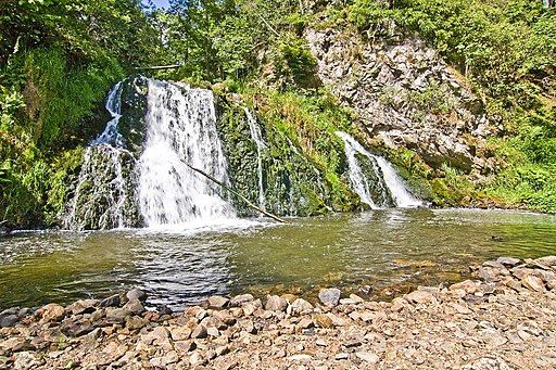
| Dess Waterfall | 1 miles (1.3 km) | This walk visits the Sloc of Dess Waterfall near Aboyne in Grampian. The secluded falls and surrounding woodland area a lovely place for a quiet walk. View Full Details>> | |
| Falls of Bruar | 2 miles (2.5 km) | This walk takes you through a lovely wooded gorge to the Falls of Bruar in Perthshire. View Full Details>> | |
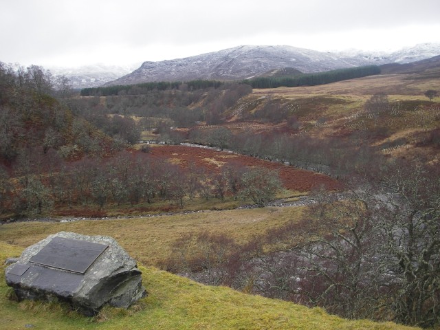
| Glen Clova | 6 miles (10 km) | Enjoy an easy walk through the beautiful Glen Clova, on the edge of the Cairngorms National Park. There's a nice country lane running through the Glen from the Hotel to Glen Doll, about 3 miles up the road. Along the way there are nice views of the River South Esk, which runs through the area. At Glen Doll there is a nice picnic area where you can relax before returning on the same path. View Full Details>> | |
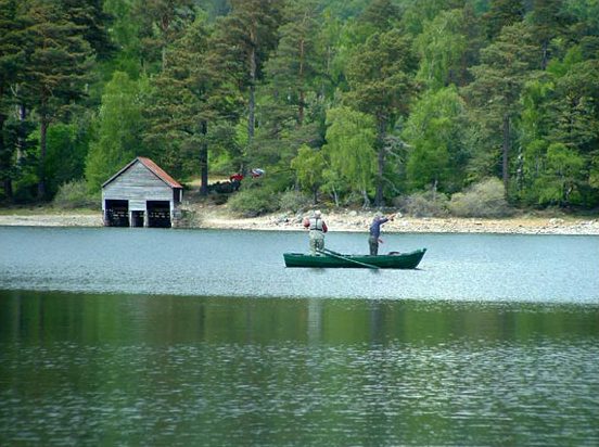
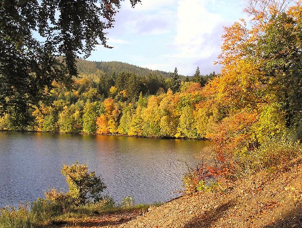
| Glen Tanar | 5 miles (8.5 km) | Enjoy peaceful woodland and riverside trails along the Water of Tanar on this lovely Cairngorms walk. The circular walk runs for 5 miles along good waymarked paths with rushing water, little bridges, Caledonian Scots pinewood and lots of wildlife to see. It's a pretty easy waymarked walk on fairly flat paths, so nothing very challenging on the way. Look out for red squirrels, frogs, cross-bills and Capercaillie as you make your way through the glen. You can start the walk from the Glen Tanar estate visitor centre car park, next to the Bridge of Tanar. The route then follows the footpaths south along the river, passing little bridges, a boat house, weirs and the attractive woodland. After about 2.5 miles you can cross over to the other side of the water and follow different paths back to the visitor centre. View Full Details>> | |
| Glenmore Forest Park | 6 miles (9 km) | This forest in the Cairngorms National Park has miles of fantastic cycling and walking trails to enjoy. This circular route starts at the excellent visitor centre and follows cycle and walking trails into the forest and alongside the lovely Loch Morlich. The loch has a pretty beach perfect for relaxing on after your ride/walk, while the visitor centre has a great cafe with refreshments. There's also a wide variety of wildlife to look out for including Scottish Crossbill, Crested Tit, Capercaillie and Red Deer. The magnificent Cairngorms mountains make a wonderful backdrop for the route. From the nearby town of Aviemore you could pick up the excellent Speyside Way for more cycling and walking in the area. View Full Details>> | |
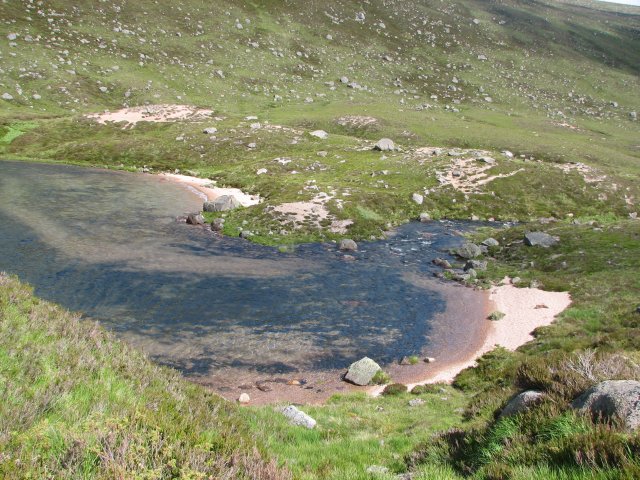
| Green Loch | 3 miles (5.2 km) | This walk takes you to the unusually coloured Green Loch (An Lochan Uaine) near Aviemore in the Glenmore Forest Park. The small lake is a popular spot to visit with its photogenic turquoise hue. View Full Details>> | |
| Jocks Road | 13 miles (21 km) | Follow the Jock's Road from Glendoll to Braemar on this long distance walk in Glen Clova. View Full Details>> | |
| Kirriemuir | 4 miles (6 km) | This town in Angus is famous as the birthplace for playwright J. M. Barrie where you can see a statue of Peter Pan in the town square. The town is in a great spot for walkers too, near to the Cairngorms National Park and a scenic local loch. View Full Details>> | |
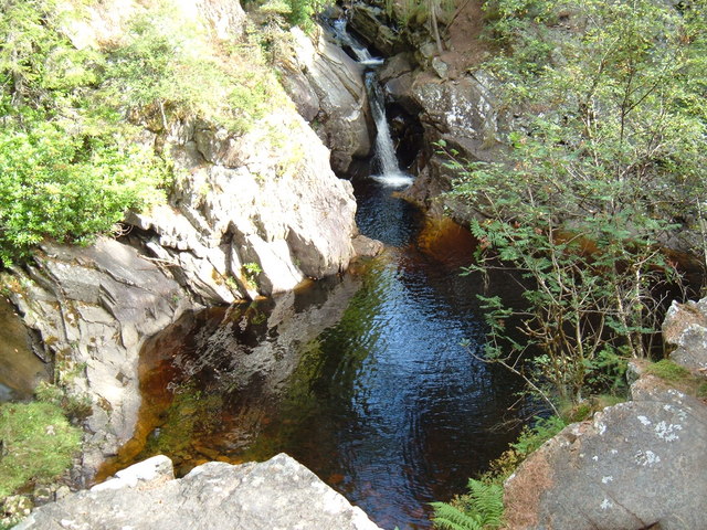
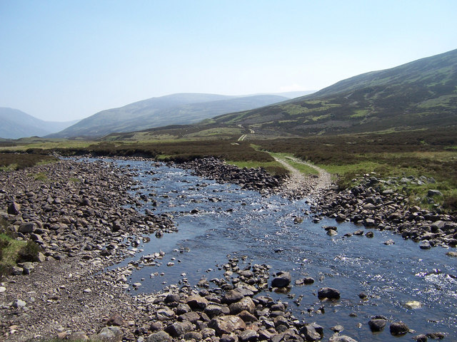
| Linn of Dee | 7 miles (10.5 km) | This walk visits the beautiful 300-metre natural rock gorge at the Linn of Dee in the Cairngorms. The walk starts at the Linn of Dee car park (postcode below is approximate) and takes you through woodland to the bridge over the River Dee. The Dee is a popular salmon river with a ladder by the waterfall where the fish have the chance to swim upstream to spawn. It's a lovely spot with the rushing water, pine woodland, the old stone bridge and the rocky gorge. The walk then heads north through Glen Lui along Lui Water to Derry Lodge. This Victorian building was used as a base for shooting parties but is now disused. You can then continue along the pretty Derry Burn with lovely woodland trails and fabulous views of the Cairngorm mountains. The footpaths for most of the walk are very good. You can continue your walking in this beautiful area by heading a few miles along the road to the east where you will find the splendid Linn of Quoich. View Full Details>> | |
| Linn of Quoich | 3 miles (5 km) | Enjoy riverside walking, beautiful waterfalls and peaceful woodland trails on this walk through Glen Quoich in the Cairngorms. The walk starts at the Linn of Quoich parking area and follows Quoich Water to the waterfalls which were popular with Queen Victoria. On the walk you will pass an old building which was Queen Victoria's tearoom. The river is surrounded by attractive Scots pines and there is the wonderful backdrop of the Cairngorm Mountains to enjoy. You will also pass the Punch Bowl, a round carved hole that has formed over the centuries by the pounding water. You can continue your walking in the area by heading to the Linn of Dee which is only a few miles along the road to the west. View Full Details>> | |
| Linn Of Tummel | 2 miles (3.3 km) | This walk visits the National Trust's Linn Of Tummel near Pitlochry in Perthshire. View Full Details>> | |
| Loch an Eilein | 4 miles (6.5 km) | This popular circular walk in the Cairngorms takes you around the beautiful Loch an Eilein and the smaller Loch Gamhna. It's a beautiful and tranquil location with the still waters surrounded by stunning hills and mountains. The undulating footpaths around the lochs are generally very good and not challenging. There are sections near to the water and several delightful woodland trails through the surrounding Rothiemurchus Forest. Also of interest is the unusual ruined island castle and the visitor centre. Parking is available at the northern end of the loch or you can catch the train to Aviemore which is a few miles north of the loch. If you're on a bike you can cycle from Aviemore train station along National Cycle Route 7 and a country lane near the Loch An Eilein Pottery to reach the loch. View Full Details>> | |
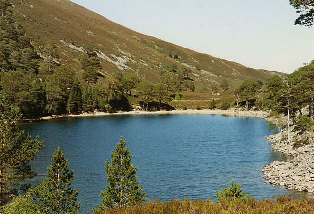
| Loch Avon | 4 miles (5.8 km) | This walk takes you around the remote Loch Avon in Glen Avon. Also known as Loch A'an it is the source of the River Avon, a tributary of the River Spey. There's decent walking trails along the stunning loch with wonderful views over the water to the surrounding mountains. View Full Details>> | |
| Loch Brandy | 3 miles (5 km) | This walk in Glen Clova visits the lovely Loch Brandy. The walk starts from the car park in Clova. Cross the road from here and you can pick up a well defined footpath running north to the loch. It's a steady climb, running for about 1.5 miles to the waterside. The pretty loch is surrounded by steep hills and is a really stunning sight. There are paths running up and around the water as well. These give great views back down to the water but are more challenging than the relatively easy path up to the loch. View Full Details>> | |
| Loch Callater | 8 miles (13 km) | This walk visits the beautiful Loch Callater near Braemar in Aberdeenshire. View Full Details>> | |
| Loch Einich | 14 miles (22 km) | This tranquil loch is located in a remote place in the Cairngorms National Park. The loch can be reached by following a walking and cycling track south from the popular Loch an Eilein. It's about a 7.5 mile hike or ride from the loch through the beautiful Gleann Einich. View Full Details>> | |
| Loch Garten | 2 miles (4 km) | This walk takes you around the beautiful Loch Garten RSPB Nature Reserve and also visits the nearby Loch Mallachie in the Cairngorms. You start at the Loch Garten Osprey Centre at the north eastern side of the loch. Here you can observe the birds nesting in the Caledonian pineforest, visit the excellent visitor centre and view the birds on the live CCTV camera. There are a number of splendid nature trails to follow through the forest and along the pretty loch. Look out for wildlife which includes red squirrels, dragonflies, crested tits and, in early spring, the capercaillie. The walk continues on woodland trails to the smaller, but still delightful, Loch Mallachie. It's a glorious area with the Cairngorms mountains making a splendid backdrop. The Speyside Way passes nearby so you can pick this up if you would like to extend your walk. You could also head east into the expansive Abernethy Forest where there are miles of trails to follow. The woods include the River Nethy and a series of pretty lochs and streams. View Full Details>> | |
| Loch Insh | 1 miles (2 km) | This walk visits the beautiful Loch Insh near Kincraig in the Caingorms. View Full Details>> | |
| Loch Kinord | 3 miles (5.5 km) | Enjoy an easy circular walk around this delightful loch and nature reserve in the Cairngorms. There is a waymarked trail taking you through the woodland and along the loch situated in the Muir of Dinnet National Nature Reserve. The reserve is a wonderful place for flora and fauna with otters, goldeneye ducks, migrating geese and other wildfowl to look out for. There are also lots of interesting plants around the water including water lobelia, quillwort and shoreweed. View Full Details>> | |
| Loch Morlich | 4 miles (6 km) | Enjoy an easy circular walk around Loch Morlich in the Cairngorms. There is a good footpath running all the way around the water and through the surrounding forest. It's a popular, waymarked walk with ample parking at the visitor centre located at the north eastern end of the lake. The trail runs for just under 4 miles on a fairly flat footpath with a few small climbs along the way. There's much to enjoy with a beautiful, long beach, peaceful woodland trails and the wonderful backdrop of the Cairngorms mountains. You can extend your walk by further exploring the surrounding Glenmore Forest Park. View Full Details>> | |
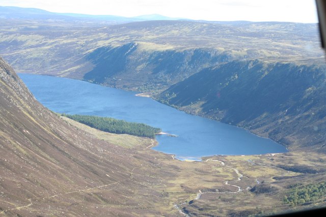
| Loch Muick | 8 miles (13 km) | Enjoy a watersidewalk around the beautiful Loch Muick on this super walk in the Cairngorms. There's a good circular track around the loch with the option of visiting the lovely Glas Allt Shiel waterfall at the western end. The route runs for about 7.5 miles with some small climbs along the way. The walk starts at the Balmoral Estate visitor centre (near the car park) and heads towards the loch on a good track. You'll cross the River Muick and pass through woodland and countryside before arriving at the loch. The lochside path then takes you to Glas-allt Shiel house, a former country retreat of Queen Victoria. Here you have the option of climbing up to see the Glas Allt Shiel waterfalls. You continue round the loch, crossing pretty burns and passing through old birch woodland as you go. It's a very picturesque area with hills surrounding the loch and a variety of wildlife too. Look out for red squirrel, red deer, oyster catchers, salmon and trout as you make your way round the loch. View Full Details>> | |
| Loch of Aboyne | 1 miles (1 km) | This walk visits the Loch of Aboyne in Grampian. The picturesque loch has some nice footpaths running alongside it with views across the water to the surrounding hills and mountains. View Full Details>> | |
| Loch Pityoulish | 2 miles (3.1 km) | This pretty loch is located just to the east of Aviemore in the Cairngorms. View Full Details>> | |
| Loch Tummel | 4 miles (6 km) | Visit Queen's View for one of the best views in Britain on this short walk in Perthshire, Scotland. View Full Details>> | |
| Loch Vaa | 2 miles (2.5 km) | This walk visits Loch Vaa near Boat of Garten and Aviemore in the Cairngorms. View Full Details>> | |
| Lochan Mor | 2 miles (2.8 km) | This circular walk visits the pretty Lochan Mor near Loch an Eilein in the Cairngorms National Park. View Full Details>> | |
| Lochnagar | 11 miles (17 km) | This challenging walk climbs to Lochnagar Mountain in the Grampians of Scotland. The walk starts from the Balmoral Estate visitor centre where there is parking available. From here you can pick up footpaths heading west up the mountain. You'll pass the picturesque loch and Meikle Pap before coming to the 1155 metre summit of the hill. The mountain's principal feature is a north-facing corrie around which most of the subsidiary tops as well as the main peak sit. It is also a popular breeding ground for dotterel and golden eagles. The true summit is called Cac Carn Beag and provides magnificent views over Deeside and the Cairngorms massif. There's a handy viewpoint indicator which details all the peaks and features you can see from the top. View Full Details>> | |
| Pitlochry Killiecrankie and Loch Faskally | 4 miles (6.5 km) | A lovely waterside walk from Pitlochry to Killiecrankie, taking in Loch Faskally, the River Tummel, the Faskally Forest, Loch Donmore and the River Garry. It's a beautiful area with shady woodland paths, peaceful lakes and wonderful views of the surrounding Cairngorm hills. Start the walk from the visitor centre and car park in Pitlochry, next to the loch and the dam. From the centre you can see the salmon ladder where the fish leap their way up the river from March to October. View Full Details>> | |
| Speyside Way | 65 miles (105 km) | This splendid route is one of the four official Long Distance Routes in Scotland. It follows the River Spey from Buckie, on the Moray Firth, to Aviemore. View Full Details>> | |
| Wildcat Trail Newtonmore | 6 miles (10 km) | This is a super circular walk around the village of Newtonmore in the Cairngorms National Park. View Full Details>> |