South Downs Walks

Use the links to view full route information including elevation profiles, interactive maps and GPS downloads.
You can also view an overview map of all the routes in the using the South Downs Walk Map>>
*New* - Walks and Cycle Routes Near Me Map - Waymarked Routes and Mountain Bike Trails>>
| Route Name | Photo | Distance | Description |
| Alfriston | 11.2 miles (18 km) | The riverside village of Alfriston is located in a wonderful spot for exploring the South Downs. This circular walk visits some of the highlights of the area including Cuckmere River and Cuckmere Haven, Seven Sisters Country Park, Long Man of Wilmington and Friston Forest. The route runs for just under 12 miles, using sections of The South Downs Way National Trail and other public trails and paths that run through the countryside to the east of Alfriston. View Full Details>> | |
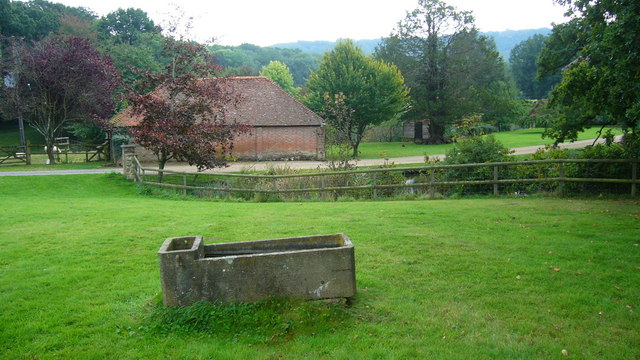
| Alton | 8.4 miles (13.5 km) | The Hampshire town of Alton is nicely positioned on the northern edge of the South Downs National Park. Several waymarked walking trails pass the town providing the opportunity to explore the surrounding area on well maintained footpaths. The town is also close to the popular Alice Holt Forest This circular walk from the town takes you up onto the Downs where you can enjoy some fine country views. The walk starts at the Source of the River Wey, just to the west of the town centre and train station. Head east along the river and it will take you past Alton Public Gardens where there's a bandstand, cafe and some nice footpaths. In the centre of town you then pick up the Hangers Way and follow the waymarked path past King's Pond before heading out into the countryside on Neatham Down. View Full Details>> | |
| Amberley Circular Walk | 5.9 miles (9.5 km) | The delightful village of Amberley is located at the foot of the South Downs, in the Horsham District of West Sussex. There's lots of lovely walking trails to follow through the surrounding countryside and along the River Arun. This circular walk makes use of the South Downs Way and Wey South Path long distance trails to take you along the river and through the surrounding South Downs countryside. It's about a 6 mile hike with some moderate hill climbs and great views to enjoy from the high points. The walk starts from the train station which is on the Arun Valley Line, with regular services to Bognor Regis Portsmouth and London. You could also start from the village centre if you prefer. After leaving the train station you head south along the river toward North Stoke. Here you turn east and follow country lanes to Camp Hill and The Burgh. The route then turns north to Downs Farm before heading into the village. It's very picturesque with several thatched houses and the 12th-century Amberley Castle. There's also the splendid Amberley Museum & Heritage Centre. Here you will find a 36-acre open-air museum, dedicated to the industrial heritage of South East England and with a special interest in aspects of the history of communications and transport. It's located next to the train station so you can pay a visit at the start or end of the walk. To extend your walking in the area head north from the village and visit the lovely Amberley Wild Brooks Nature Reserve. You could also head east along the South Downs Way and climb to Rackham Hill and Kithurst Hill. If you head west you can visit Eartham Woods and explore the expansive Slindon Estate. Here you'll find miles of footpaths and bridleways to follow through the 1400 hectare estate. There's also the Amberley to Arundel Walk which takes you along a lovely waterside footpath next to the River Arun. View Full Details>> | |
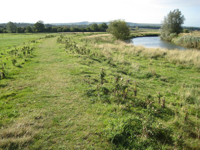
| Amberley to Arundel | 12.4 miles (20 km) | A popular riverside walk along the River Arun from Amberley to Arundel. The walk takes you along a delightful waterside footpath and includes a visit to the splendid Arundel Castle and Arundel Park on the return leg. The walk starts in Amberley where you follow a public footpath west towards Bury. Here you pick up the riverside trail and follow it south past Houghton, South Stoke and Offham before coming into Arundel. There's great views of the medieval castle as you pass through the town. On the return leg you pick up a section of the Monarch's Way long distance trail to take you through the expansive Arundel Park. Here you'll find woodland trails, a lovely lake and the splendid Arundel Wetland Centre where you can look out for a wide variety of wildlife including water voles and rare geese. The trail eventually leads you back to Houghton where you pick up the river again and follow it back to Amberley. If you would like a shorter walk you can always just catch the train back from Arundel to Amberley rather than come back through the park. To continue your walking in the area you could try our Amberley Circular Walk which takes you onto the beautiful South Downs to the south of the village. You could also visit the Slindon Estate and Angmering Park Estate Woods where there are more fine trails to try. View Full Details>> | |
| Angmering Park Estate Woods | 5 miles (8 km) | The expansive area of woodland surrounding the Angmering Park Estate has miles of public bridleways and footpaths for walkers and cyclists to try. View Full Details>> | |
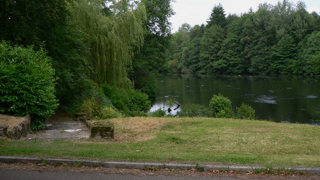
| Ardingly Reservoir | 5 miles (8 km) | This 198 acre reservoir and nature reserve has a lovely waterside walking path ideal for an easy stroll. The walk starts at the parking lot at the southern end of the reservoir and take you along the eastern side of the water to the village of Balcombe before returning to the start point. As a nature reserve you will pass through a variety of habitats including wetland, reedbed, deciduous woodland, hazel coppice and haymeadow. Look out for Great crested grebe and kingfishers as you make your way round the reservoir. Our circular Ouse Valley Viaduct Walk also starts from the same car park. It is a short walk along the river to the impressive structure which is a highlight of the area. View Full Details>> | |
| Arundel Castle and Arundel Park | 8.7 miles (14 km) | This circular walk takes you through the parkland and countryside surrounding this restored medieval castle in West Sussex. The route includes lovely long waterside sections along the River Arun and a visit to a wildfowl reserve. It runs for about 8 miles on largely flat footpaths with a couple of moderate climbs on the way. The walk starts near the castle and picks up the Monarch's Way long distance walking trail to take you into Arundel Park. This old deer park on the chalk of the South Downs has an ancient artificial lake, Swanbourne Lake. You'll pass the pretty lake and follow footpaths through woodland and grassland to the River Arun. The route then follows a lovely riverside footpath back towards the castle. You'll pass the splendid Arundel Wetland Centre where you can look out for a wide variety of wildlife including water voles and rare geese. The castle itself is well worth visiting with lovely gardens, exquisite furniture, tapestries and a rare collection of paintings, though there is a fee for entry to the grounds. It also has a fascinating history dating back to 1067 and some of the original features such as the Norman Keep, medieval Gatehouse and Barbican survive today. The Slindon Estate is located just a few miles to the west of the castle so you could continue your walking in the area by visiting this 1400 hectare estate. If you follow the Monarch's Way east you will soon come to Angmering Park Estate Woods. There's miles of good cycling and walking trails to try here. There's also the Amberley to Arundel Walk which takes you along a lovely waterside footpath next to the River Arun. Our Arundel Circular River Walk runs along both sides of the river and visits the interesting village of Burpham. View Full Details>> | |
| Arundel Circular River Walk | 7.9 miles (12.7 km) | Enjoy a waterside walk along both sides of the River Arun on this easy walk in Arundel. The route runs for a distance of about 8 miles along a nice flat footpath. The walk starts on the Queen Street Bridge in the centre of Arundel. From here you can pick up a section of the Monarch's Way on the southern side of the river. The path bends round to the north, following the river to Burpham. The interesting village has some nice thatched cottages, a Grade I listed Saxon Church and a century-old cricket pitch where W. G. Grace played. Burpham also has a rich literary history. Mervyn Peake and his family lived here and he walked the South Downs while devising the fantasy characters of Gormenghast. From the village there are lovely views across the Arun and its water meadows towards Arundel Castle, Arundel Cathedral and Arundel Priory. You could stop for refreshments at The George which dates from 1736. Here you'll find modern, seasonal cooking and local real ales in a smartly made-over, dog-friendly village inn. You continue north towards South Stoke where you cross to the other side of the river. The path then heads south, passing Offham before coming to the Arundel Wetland Centre. Here you can look out for a wide variety of wildlife including water voles and rare geese. The route continues back into Arundel, passing the restored medieval castle on the way. The castle has a fascinating history dating back to 1067 and some of the original features such as the Norman Keep, medieval Gatehouse and Barbican survive today. Shortly after passing the castle you return to the river bridge and the route end. View Full Details>> | |
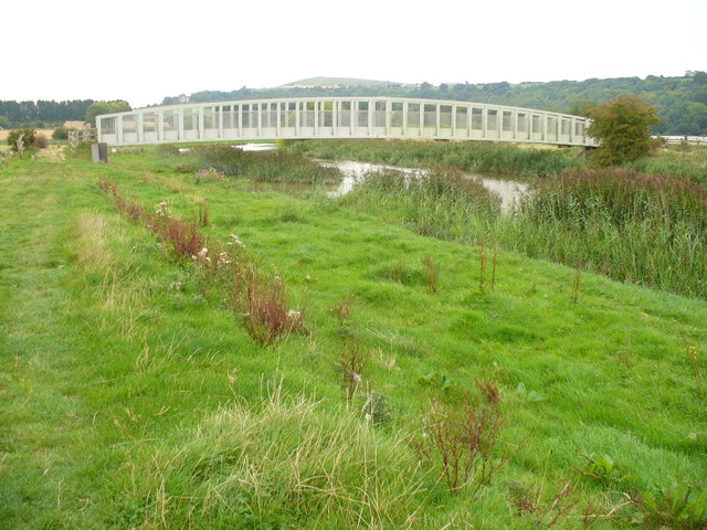
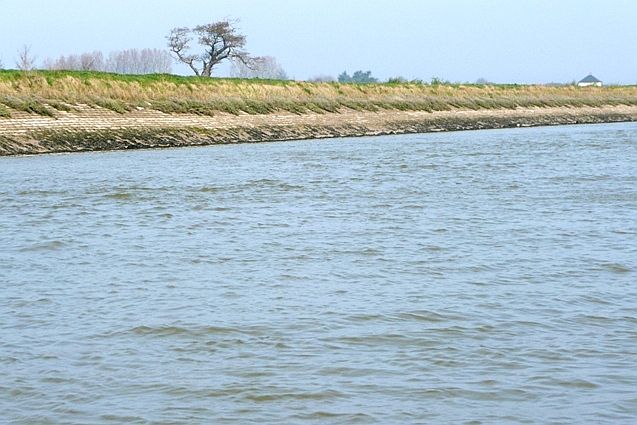
| Arundel to Littlehampton River Walk | 5.3 miles (8.5 km) | Enjoy a waterside walk along the River Arun from Arundel to Littlehampton on this easy route in West Sussex. The walk runs for a distance of just over 5 miles on a nice, flat riverside footpath. At Littlehampton you can return on foot the same way or catch the train back to Arundel. View Full Details>> | |
| Balcombe Circular Walk | 5.9 miles (9.5 km) | This circular walk explores the lakes and woods to the east of the West Sussex village of Balcombe. On the route you'll visit the lovely Ardingly Reservoir and the beautiful gardens at the historic Wakehurst Place. There's also a waterside stretch along the pretty Balcombe Lake to enjoy. View Full Details>> | |
| Beachy Head | 3.7 miles (6 km) | This exhilarating walk takes you along the highest chalk sea cliff in Britain, at Beachy Head on the South Downs. The cliffs rise to a height of 162 metres (531 ft) with fabulous views along the coast to West Sussex and Dungeness in Kent. You can start your walk from the good sized car park on Beachy Head Road which has a postcode of BN20 7YA for your sat navs. From here you can pick up the trails on to the The South Downs Way which will take you along the headland. You could also start the walk from the nearby town of Eastbourne and follow the Wealdway along the beach from the town centre. See our Eastbourne to Beachy Head Walk for details and a map. As well as the magnificent views there's some lovely countryside to explore inland. Look out for lots of wildflowers in the summer and a variety of birdlife which includes Lapwing, Skylark and Perigrin Falcon. After your walk you can enjoy refreshments at the Beachy Head cliff top pub which is next to the car park. To extend your walk you can continue west along the coastal path to Birling Gap and the Belle Tout Lighthouse. Beyond there is the fantastic Seven Sisters Country Park at Cuckmere Haven. Here you will find more great cycling and walking trails along the coast and the River Cuckmere. View Full Details>> | |
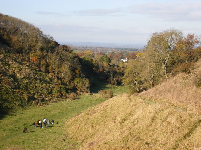
| Bignor Hill | 7 miles (11.2 km) | This walk or cycle climbs to Bignor Hill from the village of Amberley in West Sussex. It's a moderate climb of about 3.5 miles, following the South Downs Way for the duration of the route. It's a good path which is also suitable for cycling. If you prefer a shorter walk then you could park at the car park just half a mile west of the hill, and start your climb from there. This route starts off from Amberley train station, following a section of the River Arun out of the village. The waymarked path then heads west, past Coombe Wood before skirting the northern edge of Houghton Forest. You then climb past Bury Hill and Westburton Hill before arriving at the Bignor Hill summit. At over 700ft the hill commands wonderful views over the South Downs to the coast. To extend the walk you could follow the Monarch's Way south west along the Stane Street Roman Road to visit Eartham Woods. To turn it into a circular route you could head south east into Houghton Forest and return on the woodland trails to the village. You could also explore the countryside around the village on our Amberley Circular Walk. View Full Details>> | |
| Birling Gap | 1.9 miles (3 km) | Visit Birling Gap and enjoy a splendid coastal walk to the Belle Tout lighthouse. The area is run by the National Trust so there are great facilities with a good sized car park, cafe, shop and visitor centre on the cliff top. This walk starts from the Birling Gap car park just a mile south of East Dean at the end of Birling Gap Road. From here you can pick up the trails along the The South Downs Way to the lighthouse. Belle Tout has been used many times in films and tv because of the spectacular location. It has been called 'Britain's most famous inhabited lighthouse'. There's fantastic views along to the nearby Beachy Head and 500 acres of open chalk grassland with a wide variety of butterflies and wildflowers to look out for. To extend your walk just head east along the The South Downs Way to Beachy Head. Here you can walk across the highest chalk sea cliff in Britain with fabulous views and Perigrin Falcons to look out for. Continuing east from the headland will take you into Eastbourne. If you head west you will soon come to Seven Sisters Country Park where you can explore the beautiful Cuckmere Haven on foot or by bike. The village of East Dean is also nearby so you could start the walk from here and follow bridleways south to the coast. Just beyond East Dean you will find Friston Forest which has miles of good mountain bike trails and footpaths. You can visit these locations on our splendid South Downs Circular Walk which starts at the Birling Gap car park and takes you on a tour of the surrounding area. View Full Details>> | |
| Bishops Waltham | 7.1 miles (11.5 km) | This Hampshire based medieval market town has some nice walks to try in the surrounding South Downs countryside. This circular walk takes you around Bishop's Waltham on some of the waymarked walking trails that branch off into the surrounding countryside. It runs for about 7 miles and includes some small hill climbs on the way. From the high points there are some lovely views over the South Downs. The walk starts from Bishop's Waltham Palace at the southern end of the town. The atmospheric ruins date all the way back to 1135. From here you can pick up the Allan King's Way and follow the trail south west along the Bishop's Waltham Railway path. This tree lined path runs along a disused railway towards Brooklands Farm where you turn north to the village of Upham. Here you pick up the Monarch's Way and head east toward Street End. Here you turn south to follow public footpaths back to the town, passing Vernon Hill House on the way. View Full Details>> | |
| Black Down | 3.7 miles (6 km) | Climb to the highest point in the South Downs on this challenging route in Sussex. The area is run by the National Trust and includes a series of well defined paths taking you to flower-rich meadows, ancient woodland and copses. There are fabulous views over the Weald from the Temple of the Winds, at the southern end of Black down. The English Channel can also be seen through the River Arun gap on a clear day. The circular route below starts at the car park near the Temple of the Winds and takes you north across Black Down to Boarden Door Bottom. Cyclists can also enjoy a number of easy bridleways or more challenging mountain bike trails which run across the area. The Sussex Border Path walking trail runs through Black Down so you could pick up this trail and head west to the nearby Marley Common to continue your walk. Black Down is located just a few miles south of Haslemere town centre. You can reach it from the train station on our Haslemere Circular Walk which also visits Marley Common. View Full Details>> | |
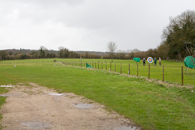
| Brighton and Hove Five Peaks | 18.6 miles (30 km) | Starting and finishing at Hove Park, this 30km loop takes in some of the highest peaks on the South Downs National Park in the Brighton & Hove catchment area. View Full Details>> | |
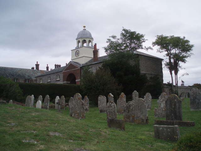
| Brighton to Lewes | 7 miles (11.2 km) | A walk across the South Downs from Brighton to Lewes using a mixture of roads and footpaths. There's splendid views across the Downs and a visit to the Castle Hill Nature Reserve to enjoy. Starting from Brighton train station head north east towards the racecourse. After passing along the northern side of the course you come to the Drove Road, a track which you can follow up onto the South Downs. You'll pass Newmarket Hill and the Castle Hill National Nature Reserve where you will find chalk grassland, wildflowers and wonderful views to the coast. Look out for flora and fauna including carpets of yellow Birds-foot-trefoil, pink Thrift to bloom, various butterflies and the Lesser Whitethroat bird. The route then heads past Kingston near Lewes village. The pretty village includes a pond, a number of picturesque cottages and a local pub The Juggs, which is housed in a 14th-century cottage. Continue along Jugg's Road and you will soon come into Lewes, passing the 15th-century timber-framed Anne of Cleves House, before finishing near the castle. Lewes Castle stands at the highest point of the town and can be visited by purchasing tickets from Barbican House opposite the entrance gate. In Lewes you can extend your walk by visiting the delightful Mount Caburn Nature Reserve. The South Downs Way National Trail crosses the area, so you could pick up the trail to extend your walk. View Full Details>> | |
| Brighton Way | 54.1 miles (87 km) | A super route though the South Downs from Horley to Brighton. The trail passes Crawley, Haywards Heath and Burgess Hill before finishing on the south coast. The walk has several train stations dotted along the route so you can easily do this one in manageable sections. Highlights include the Ardingly Nature Reserve and Ardingly Reservoir near Balcombe. Near here there's also fine views of the impressive Ouse Valley Viaduct, one of the most photographed sites on the path. The walk also climbs Ditchling Beacon where there are fabulous views of the South Downs. View Full Details>> | |
| Burgess Hill | 6 miles (9.6 km) | This West Sussex town is situated close to the South Downs where you can enjoy some splendid walks. View Full Details>> | |
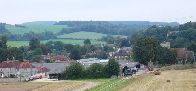
| Buriton | 7.8 miles (12.5 km) | Buriton is a very pretty quintessential English village located in East Hampshire, two miles south of Petersfield. In the village there's a particularly lovely village pond, picturesque cottages, a classic village pub and a fine old church. View Full Details>> | |
| Burpham | 11 miles (17.7 km) | This charming Sussex based village has some nice thatched cottages, a Grade I listed Saxon Church and a century-old cricket pitch where W. G. Grace played. View Full Details>> | |
| Butser Hill | 0.6 miles (1 km) | Climb to the highest point on the South Downs on this walk near Petersfield. There's a good sized car park off Limekiln Lane just to the west of the hill. From here it is a short climb to the 271 metres (889 ft) high summit of the hill. At the top you can enjoy wonderful views over the South Downs to the Isle of Wight. The area is also a nature reserve with woodland, lowland, chalk grassland habitats. Look out for variety of butterflies including Duke of Burgundy, Chalkhill Blue and Silver-Spotted Skipper. Fans of the comedy Only Fools and Horses may remember a scene with Del Boy reluctantly taking off on a hang glider. This scene was filmed on the western slopes of Butser Hill. View Full Details>> | |
| Chanctonbury Ring | 3.7 miles (6 km) | Climb to this early Iron Age hill fort on the South Downs and enjoy wonderful views over the surrounding countryside and coast. The hill is also an important area for flora and fauna, including the protected Great Crested Newt which can be found in the dew pond on the hill. Chanctonbury hill stands at a height of 238 metres (781 ft) a few miles north of the coastal town of Worthing. You can start this circular walk from the car park on Washington Bostal, just off the A24. From here you pick up the South Downs Way and follow it east to the hill. After exploring the fort and taking in the views you descend to Chalkpit Wood where you follow the Wiston Bostal track towards Chanctonbury Ring Rd. Here you turn west and follow a bridleway through woodland passing Owlscroft Barn and Combe Holt, before returning to the car park. A shorter alternative route is to start from the car park on Chanctonbury Ring Road and climb to the hill fort from there. If you would like to extend your walk then we recommend you head south from the hill to the nearby Cissbury Ring. The historic site can be reached by following a bridleway south from Chalkpit Wood for about 2 miles. It is the second largest hill fort in England, dating back to around 250 BC. You can also continue along the South Downs Way in either direction. Head west and you will come to Kithurst Hill, Springhead Hill and the village of Amberley. Head east and you will come to Bramber Castle on the River Adur. Also nearby is the mysterious Clapham Wood near the village of Clapham. View Full Details>> | |
| Cheesefoot Head | 7.5 miles (12 km) | This circular walk visits a large natural amphitheatre near Winchester before exploring the surrounding area on a network of footpaths. It's an undulating route with some moderate climbs and lovely views over the South Downs, The New Forest, the Isle of Wight and Butser Hill. Start the walk from the Cheesefoot Head car park a few miles east of Winchester, near the small village of Chilcomb. From here you can pick up the King's Way and the South Downs Way to take you past the site and into the surrounding countryside. Start by heading south along the King's Way through Longwood Warren before bending round to the east. You'll pass pockets of woodland before coming to Lane End and Beauworth. Here you turn north along Holden Lane, following the South Downs Way across Gander Down. You then turn south, passing the woodland in the Temple Valley before returning to the car park. View Full Details>> | |
| Cissbury Ring | 1.9 miles (3 km) | Visit this historic hill fort in West Sussex and enjoy terrific views over the South Downs countryside on this circular walk. It's a very beautiful place with rolling hills, patches of woodland, wildlife-rich chalk grassland, wildflowers in the summer and a series of good footpaths and tracks to guide your around the area. At 60 acres the fill fort is the second largest in England, dating back to around 250 BC. It also contains a Neolithic mine, one of the first flint mines in Britain. You can start the walk from the Storrington Rise car park which is less than a mile west of the hill. Then climb east towards the hill fort which stands at a height of around 600ft. The area is wonderful for flora and fauna in the summer months. Look out for bee orchids, field fleawort and round-headed rampion. Around the wildflowers you will see many different types of pretty butterfly. Keep your eyes peeled for chalkhill blues, dark-green fritillaries and marbled whites. The area is located just north of Worthing so you could walk there from the town. You can follow a bridleway from the outskirts across Findon Valley to reach the site. The Monarch's Way long distance footpath passes just to the north of the hill so you could pick this up to extend your walk. If you head east you could visit Bramber Castle and Upper Beeding on the River Adur. The The South Downs Way also passes close to the site. There's lots of different bridleways you can pick up around the hill too. You can follow them across Canada Bottom and Tenants Hill for more great views over Worthing to the coast. If you follow the paths north you will soon come to Chanctonbury Ring Hill Fort. The fort dates from the early Iron Age and at a height of 238 metres (781 ft) commands fine views of the area. Also nearby is the mysterious Clapham Wood near the village of Clapham. View Full Details>> | |
| Clanfield | 2.5 miles (4 km) | This Hampshire based village is in a great spot for exploring the countryside of the South Downs. View Full Details>> | |
| Clapham Wood | 2.2 miles (3.5 km) | These mysterious woods are located in the Arun District of West Sussex, next to the village of Clapham. The woods are most well known for paranormal activity including several UFO sightings. They also have some nice public footpaths to follow through the woods. The woods are surrounded by some lovely Sussex countryside and have bluebells growing in the spring. There's parking available at the south western corner of the woods. View Full Details>> | |
| Cowdray Park | 6.8 miles (11 km) | This circular walk explores the splendid Cowdray Estate in Midhurst. There's miles of trails taking you to woodland, parkland and ponds. There's also nice riverside trails along the River Rother which runs through the park. On the way look out for the ponies and horses some of which are used for the polo matches you can see on the estate. Other highlights include the ancient Queen Elizabeth tree which is between 800 and 1000 years in age. The tree is the 3rd oldest Sessile Oak in England and is so named because Queen Elizabeth 1st visited it in 1591. View Full Details>> | |
| Cuckmere River and Cuckmere Haven | 9.9 miles (16 km) | This lovely waterside walk takes you along the Cuckmere River from Alfriston to the beautiful Cuckmere Haven on the south coast. The walk starts in Alfriston and follows the riverside path to Exceat, passing the famous chalk White Horse on the way. You continue to the coast and Cuckmere Haven where you will find a shingle beach and wonderful views of the Seven Sisters Cliffs. The route then passes along the beach and picks up the South Downs Way to take you into the popular Seven Sisters Country Park. In the park there are 700 acres of parkland with wonderful views over the South Downs. The walk continues to Exceat where you cross the bridge and follow the footpath along the western side of the river to Alfriston. It's a super walk and very flat and easy apart from a short climb on the coastal section. The area is also a nature reserve with species-rich chalk grassland and wildflowers. Look out for wildlife which includes a variety of butterflies and wildfowl. If you enjoy this walk then you could try the Long Man of Wilmington walk which also starts in Alfriston and takes you up to the iconic chalk figure. Our South Downs Circular Walk also passes through the area. It will take you on a tour of the surrounding area, visiting Friston Forest and Birling Gap. View Full Details>> | |
| Devils Dyke | 2.5 miles (4 km) | This circular walk explores this beautiful valley near Brighton. The valley stretches for about a mile through the South Downs. It is the longest, deepest and widest 'dry valley' in the UK. The area is criss crossed with footpaths and bridleways making it an ideal location for walking and mountain biking. As well as stunning views across the South Downs you will pass lovely meadows with a variety of flowers, an Iron Age Hill Fort and the remains of a Victorian funfair. In the summer months you can enjoy a sea of pink Orchids with a variety of butterflies including Adonis blue, chalkhill blue and silver spotted skipper. You can easily extend your walk by heading east onto Newtimber Hill where you will find one of the finest examples of chalk grassland in the country, ancient woodland and rare plants and flowers such as burnt orchid and juniper tree.
Also on the route is the Devils Dyke Pub where you can have some lunch while enjoying some wonderful views. This route starts at the parking area at the western end of Devils Dyke and makes use of the South Downs Way and other footpaths to take you around the Dyke. The area is managed by the National Trust so there are good footpaths and an excellent cafe. This route is designed for walkers but there are many bridleways running across the area so mountain bikers can enjoy the Dyke too. If you'd like to extend your walk you could follow the South Downs Way east and visit Ditchling Beacon - the highest point in East Sussex. If you head west along the South Downs way you can visit Edbarton Hill and Truleigh Hill with its distinctive radio masts. The hill was originally the site of a radar station during the Second World War. View Full Details>> | |
| Ditchling Beacon | 5 miles (8 km) | Climb to the highest point in East Sussex and enjoy wonderful views of the Weald and the Downs on this circular walk. The lovely chalk grassland of the area is covered with a variety of flowers and plants during the summer months. Look out for marjoram, thyme and different types of orchid with butterflies such as the Chalkhill Blue flying around them. The walk begins in the village of Ditchling just to the north of Ditchling Beacon and follows the Sussex Border Path to Burnhouse Bostall. You then pick up the South Downs Way and head to the beacon passing the Ditchling Beacon Nature Reserve on the way. You then descend to Ditchling following bridleways past Wick Farm and Stoneywish Country Park. If you'd like to continue your walking in the area then you could head west along the The South Downs Way to the beautiful Devils Dyke. The video below shows the area well from about 7:00 minutes on. View Full Details>> | |
| Downs Link | 36 miles (58 km) | This is a terrific walking or cycling path running from St Martha's Hill in Guildford to Shoreham by Sea. View Full Details>> | |
| Eartham Woods | 3.1 miles (5 km) | This large area of beech woodland near Slindon has some nice footpaths to follow. The woods are a great place to see bluebells in the spring months. You may also see deer, woodland birds and various butterflies as you make your way through the forest. You can start your walk from the car park located at the south eastern end of the woods, just to the north of the village of Eartham. The woods are part of the wider National Trust owned Slindon Estate. The 1400 hectare estate has miles of excellent trails with wonderful views over the South Downs to enjoy. The Monarch's Way also runs through the woods. You could pick up the long distance trail and head east to the nearby Houghton Forest. The expansive Goodwood Country Park is just to the west while the Grade II listed Halnaker Windmill and viewpoint is also very close by. View Full Details>> | |
| East Meon | 13 miles (21 km) | This village in East Hampshire has some nice walks across the South Downs to try. This walk from the village centre uses the South Downs Way National Trail to visit two of the highlights of the area. You start by following a country lane south west to Coombe Cross, about half a mile from the village. Here you can pick up the South Downs Way and follow it south to Salt Hill and Wether Down, one of the highest hills in Hampshire, rising to 234 metres (768 ft) above sea level. At Mercury Park you head east to Tegdown Hill before climbing to Butser Hill, the highest point on the South Downs. The hill stands at a height of 271 metres (889 ft) and provides wonderful views across the downs to the coast. After taking in the views you descend to Queen Elizabeth Country Park, via Hilhampton Bottom. The park is Hampshire's biggest country park with 20 miles of trails for walkers, cyclists & horse riders. It includes 1400 acres of open access woodland and downland with lots of flora and fauna to look out for. View Full Details>> | |
| Eastbourne to Alfriston Walk | 9.6 miles (15.5 km) | This walk follows a popular section of The South Downs Way from the coast at Eastbourne to the village of Alfriston in the lovely valley of the River Cuckmere. The route runs for about 9 miles with views of the Weald countryside to enjoy on the way. From the high points there are also splendid views back to the coast. The route starts on the front in Eastbourne before picking up the waymarked trail and following it north to Jevington. The path then passes the noteworthy Long Man of Wilmington, an iconic hill figure on Windover Hill. The final section then descends to the village, crossing the River Cuckmere before finishing in Alfriston. To extend your exercise try our Cuckmere River and Cuckmere Haven Walk which takes you from the village to the beautiful Cuckmere Haven on the south coast. View Full Details>> | |
| Exceat to Eastbourne Walk | 9.9 miles (16 km) | This walk takes you from the Exceat visitor centre in the Seven Sisters Country Park, to the seaside town of Eastbourne. The walk runs for a distance of just under 10 miles using a coastal section of the The South Downs Way National Trail. The route is waymarked throughout and includes a few moderate climbs as you traverse the wonderful sea cliffs on the way. The area is also great for flora and fauna with Lapwing, Skylark and Perigrin Falcon to look out for. There's also lots of pretty wildflowers and butterflies in the summer months.
Start the walk from the car park at the visitor centre at a postcode of BN25 4AD. From here you can pick up the waymarked trail and follow it south along the Cuckmere River toward Cuckmere Haven. The route then turns east to follow the coast path to Birling Gap. This area includes the picturesque Belle Tout lighthouse and a National Trust cafe where you could stop for refreshments. It's a popular spot with some spectacular views to enjoy from the cliff top. The route continues east to Beachy Head, the highest chalk sea cliff in Britain. It's another fine spot with views all the way to West Sussex and Kent. After taking in the views the route then descends to Eastbourne, passing along the seafront before finishing at the pier. View Full Details>> | |
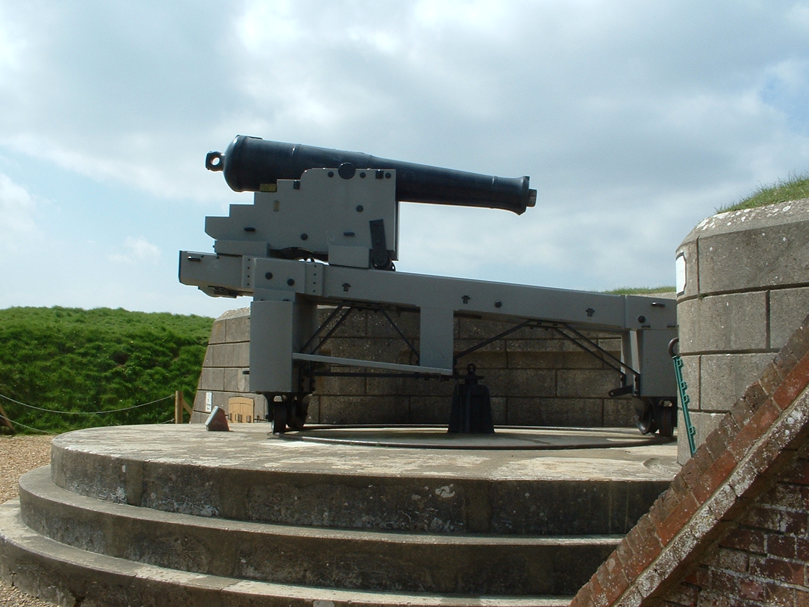
| Fareham | 7.5 miles (12 km) | This market town in Hampshire has some lovely walks along Portsmouth Harbour and an interesting maritime history. This circular walk in uses a section of the Allan King's Way to visit the Nelson Monument and Fort Nelson near the town. You'll also enjoy a coastal stretch along Portsmouth Harbour and the easy access Fareham Creek Trail. The walk starts opposite the town quays where you can follow a coastal path around the Cams Hill Estate. Here you can pick up the Allan King's Way and follow it north to the Nelson Monument. The distinctive 120 feet (37 m) high monument sits on Portsdown Hill. It was completed in 1808, shortly after Nelson's death, to "perpetuate the glorious victories of the British Navy". The route then continues to Fort Nelson which was built as a result of the 1859 Royal Commission by Lord Palmerston to prevent a French land attack. The fort is one of five defensive forts built on the summit of Portsdown Hill in the 1860s, overlooking the important naval base of Portsmouth. The site is now part of the Royal Armouries, housing their collection of artillery, and a Grade I Listed Building. You can tour the armouries which include French field guns captured at the Battle of Waterloo and fortress guns from India and China. The fort is also in an elevated position so there are fine views over the surrounding countryside and the city of Portsmouth. After exploring the fort the route then returns to the start point on the same paths. To continue your walking in the area head east along the Allan King's Way to visit Portchester Castle. View Full Details>> | |
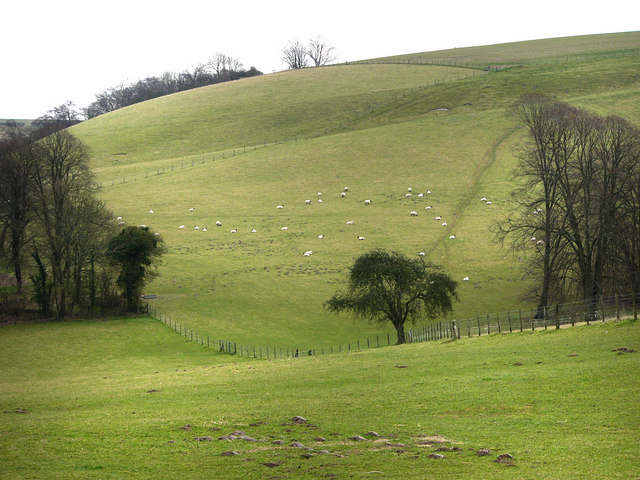
| Firle Beacon | 3.7 miles (6 km) | This circular walk takes you to the splendid Firle Beacon in the South Downs. The popular route makes use of the The South Downs Way and various bridleways and country lanes to take you to the beacon from the pretty village of Firle. The start point for the walk is the little village of Firle, located just a few miles from Lewes. You can enjoy a stroll through the village with its three pubs, old church, cricket green and little pond. You will also pass Firle Place and its surrounding grounds. The old manor house was first built in the late 15th century by Sir John Gage. The route follows a bridleway around the grounds of the house before ascending to Firle Beacon. From the 712 feet (217 m) summit there are wonderful views over the Weald towards the south coast. The Firle Escarpment is also a Site of Special Scientific Interest. The large area of chalkland is home to a variety of flora and fauna. Look out for the rare spider orchid Ophrys sphegodes and Exmoor Ponies as you make your way through this lovely area. From the beacon summit you descend on the South Downs Way before picking up Firle Bostal country lane to take you back to the village. This lane is shown on the google street view link below. It's easy to extend your walk by continuing west from the beacon along the South Downs Way to Beddingham Hill. Another option is to start the walk from the nearby village of Alfriston on the Cuckmere River. You can then follow the South Downs Way to the beacon via Bostal Hill. You could also visit the lovely Mount Caburn Nature Reserve with its interesting plants, flowers and wildlife. View Full Details>> | |
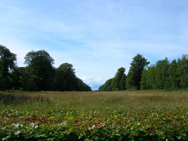
| Friston Forest | 5 miles (8 km) | Enjoy miles of cycling and walking trails in this large forest on the South Downs near Eastbourne. There are trails for mountain bikers ranging from gentle off road trails to an exhilarating single track ride. There are two fairly easy waymarked trails for walkers. Look out for wildlife including rare butterflies and deer. This circular route starts at the car park and takes you along some of the bridleways in the forest. It also visits the pretty village of West Dean. It's easy to extend your outing by visiting the nearby Cuckmere River and Cuckmere Haven and Seven Sisters Country Park. You could also pick up the The South Downs Way which runs past the forest. Our South Downs Circular Walk also passes through the forest. It will take you on a tour of the surrounding area, visiting Seven Sisters Country Park and Birling Gap. View Full Details>> | |
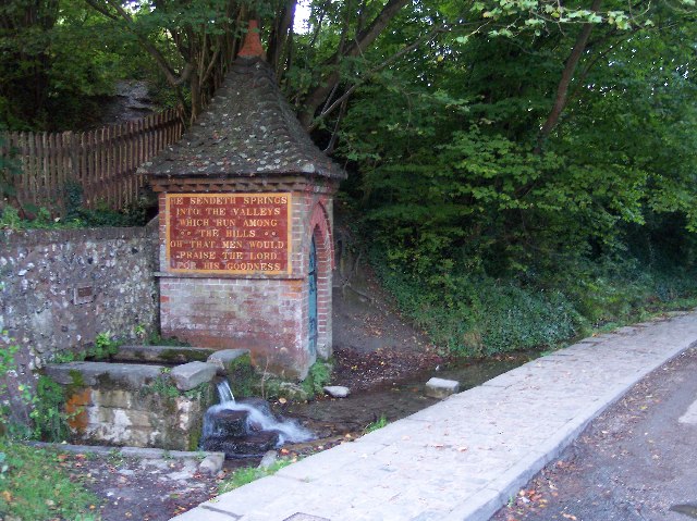
| Fulking | 4.3 miles (7 km) | The pretty village of Fulking sits in a lovely position on the South Downs. In the village there's picturesque cottages and a natural spring and fountain which was installed in 1886. Henry Willett, a wealthy brewer from Brighton, and the famous painter and art critic John Ruskin are usually credited with devising and instigating the water supply scheme. View Full Details>> | |
| Glynde to Lewes Walk | 6.4 miles (10.3 km) | This popular circular walk on the South Downs takes you from the village of Glynde to the town of Lewes. On the way you'll pass Mount Caburn where there are excellent views over the area. The route runs for a distance of just over 6 miles with some moderate climbs on the way. The walk starts from the pretty village of Glynde located two miles (5 km) east of Lewes. You could start from Glynde railway station which is reachable from Lewes. There's also a public car park near the train station as well. From the village you can pick up a public footapth heading west toward Mount Caburn. This area is also a designated nature reserve consisting of managed chalk downland and a Bronze Age hill fort. There is a wide variety of flora and fauna to look out for too. At the summit of the 480-feet (146m) high hill you'll find the fort and a splendid view point with far reaching views across the South Downs. View Full Details>> | |
| Halnaker Windmill | 1.9 miles (3 km) | This walk visits an iconic local landmark in the form of the Grade II listed Halnaker Windmill. The route runs for just under 2 miles with a small hill climb on the way. The now disused mill is located a few miles north east of Chichester, near the village of Boxgrove and the Goodwood Estate. You can start the walk from Warehead Farm where there is a small amount of roadside parking. From here follow Mill Lane north east for about 5 minutes before turning north to climb Halnaker Hill. At the top of the 128 metre/420 feet high hill you will find the windmill and some attractive chalk grassland. In the warmer months the area is covered with pretty wildflowers which attract a variety of butterflies including Marbled White, Common Blue, Large Skipper and Red Admiral. There's also fine views over the surrounding countryside from the elevated position of the mill. View Full Details>> | |
| Hampshire Bowman and Droxford | 5 miles (8 km) | This circular walk takes you from the popular Hampshire Bowman pub to Droxford using a mixture of public country footpaths in the area. The area is very attractive with views of the South Downs National Park on the way. This route runs for about 5 miles with small hill climbs on the way. The route starts from the car park of the Hampshire Bowman Pub on Dundridge Lane in the village of Dundridge. It's located just over a mile east of the medieval town of Bishop's Waltham. From here you can follow footpaths up to Shepherds Down and Peak Down before picking up the Wayfarer's Walk to take you into Droxford. The pretty village includes quaint cottages, a mill pond and some nice footpaths along the River Meon which flows just to the east. After exploring the village you then pick up country lanes to take you west to Upper Swanmore. The route then turns north to take you back to the pub where you can enjoy some well earned refreshments. The 19th century historic pub has a nice garden outdoors and a real fire indoors for colder days. The pub is dog friendly too if you have your canine friend with you. View Full Details>> | |
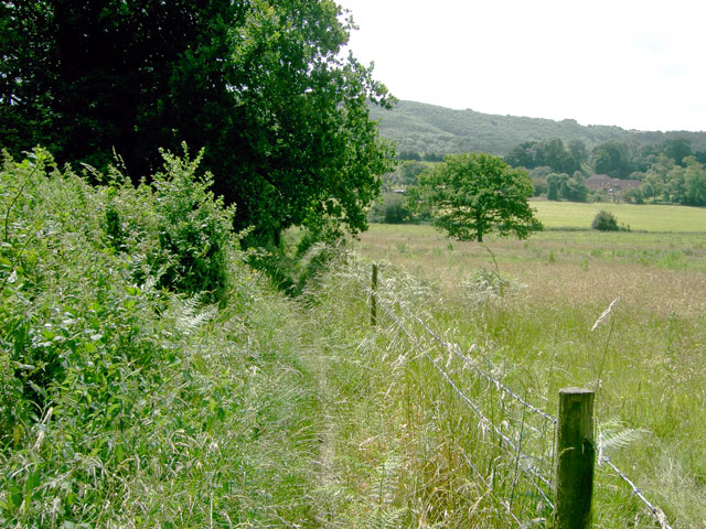
| Harting Down | 3.4 miles (5.5 km) | This large area of chalk downland on the South Downs is managed by the National Trust. View Full Details>> | |
| Haslemere Circular Walk | 8.1 miles (13 km) | This fine circular walk takes you around the Surrey town of Haslemere. It's a varied walk with woodland, heathland and hills climbs to enjoy. From the high points you can also enjoy fine views across the lovely countryside of the South Downs National Park. The walk starts from Haslemere train station and heads through the town before heading south to Valewood Farm House. Here you can pick up the Sussex Border Path and the Serpent Trail. These long distance trails will take you up onto Black Down. The National Trust run area includes a series of well defined paths taking you to flower-rich meadows, ancient woodland and copses. There are fabulous views over the Weald from the Temple of the Winds, at the southern end of the down, which is the highest point in the South Downs. After taking the views the route descends west toward Fenhurst before turning north toward Marley Heights and Marley Common. View Full Details>> | |
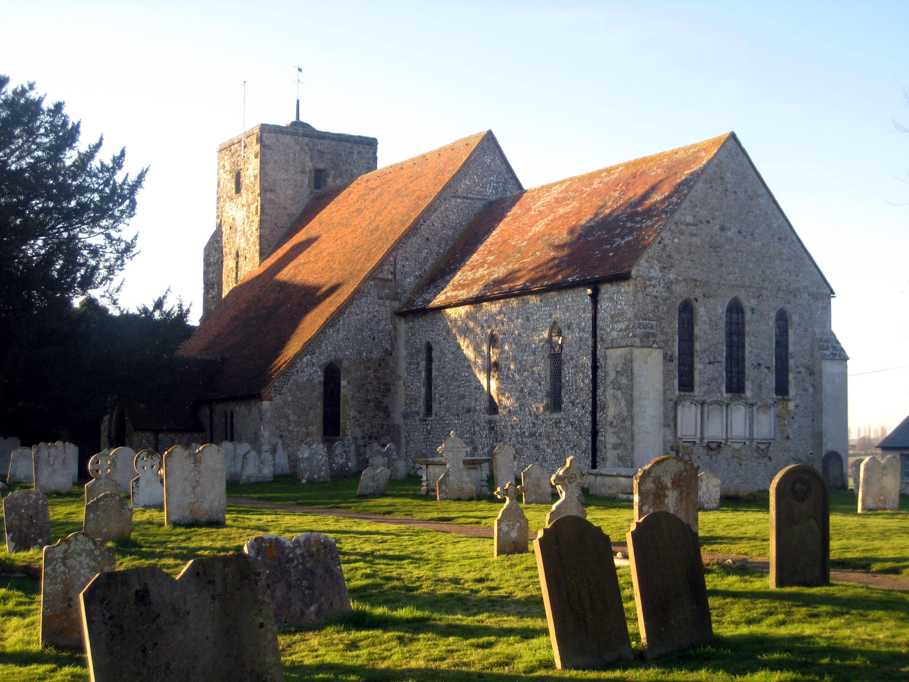
| Hassocks | 10.3 miles (16.5 km) | This West Sussex based village is in a great location for exploring some of the local highlights of the South Downs. There's also some history with a noteworthy Anglo-Saxon church and a fine former coaching inn for refreshments afterwards. View Full Details>> | |
| Highdown Hill and Highdown Gardens | 3.1 miles (5 km) | This walk visits Highdown Gardens before climbing Highdown Hill in the South Downs. The walk begins at the car park at Highdown Gardens. Both the gardens and parking are free, though you are free to make a donation if you wish. You can then follow a series of footpaths through the park with its beautiful collection of rare plants and trees. The chalk gardens are situated on Downland countryside with wonderful views towards the sea. Highlights include two pretty ponds with fish, toads and newts, a Himalayan Birch Bark Cherry Avenue, a Rose Garden and a Herb Garden. After touring the gardens you can then continue your walk to Highdown Hill. The hill stands at 81 metres (266 ft) and is a popular spot for walkers. From the summit there are wonderful views of the coast including the Seven Sisters and the Isle of Wight. View Full Details>> | |
| Hinton Ampner | 0.6 miles (1 km) | Explore the beautiful gardens surrounding this stately home near New Alresford in Hampshire. View Full Details>> | |
| Houghton Forest | 3.7 miles (6 km) | These woods near Arundel have good mountain bike trails and some nice footpaths to try. You can park at the Whiteways Countryside car park, just off the A29 at the south eastern end of the forest. From here you can pick up the trails heading north west through the woods. You could also follow either the Monarch's Way or South Downs Way from the village of Houghton. You can also extend your walking in the area by continuing along either of these long distance trails or the Midhurst Way which also passes through the forest. View Full Details>> | |
| Itchen Way | 31.1 miles (50 km) | Follow the River Itchen from its mouth at Woolston to its source near Hinton Ampner on this beautiful waterside walk. You start near Woolston station near Southampton Docks and head north through Southampton to a lovely riverside park near Swaythling and the Itchen Valley Country Park. The path continues past Southampton Airport and through Eastleigh before arriving at Winchester with its impressive cathedral. Here you can take a small detour to climb the lovely St Catherine's Hill and enjoy fine views over the town below, the River Itchen and the surrounding countryside of the South Downs. From Winchester you then turn east towards Itchen Abbas and New Alresford with the final section passing through Cheriton and finishing at National Trust owned Hinton Ampner. View Full Details>> | |
| Kingley Vale National Nature Reserve | 4.3 miles (7 km) | Enjoy a walk around this interesting and beautiful Nature Reserve in the South Downs, near Chichester. There are well defined paths with fabulous views over the South Downs towards the south coast. The reserve also contains one of the finest yew forests in Europe, including a grove of ancient trees which are among the oldest living things in Britain. View Full Details>> | |
| Lavington Common | 3.4 miles (5.5 km) | Enjoy a peaceful stroll across the Lavington and Duncton Commons on this easy walk near Midhurst in West Sussex. There's miles of good footpaths taking you across attractive heathland and woodland. It's a great place for wildlife with woodlark, nightjar, tree pipits, stonechat and reptiles including the rare sand lizard. The site also includes Merlin's Wood with its tunnel of rhododendrons. You can pick up the trails from the car park on Duncton Common Road. Heading west will take you across Lavington Common while heading east takes you across Duncton Common where there are more woodland trails and a pretty stream. The Serpent Trail long distance footpath runs across the common so it's easy to extend your walk. If you head west the trail will take you to Iping Common and Stedham Common where there are more nice heathland trails and a large pond. The South Downs Way passes across Graffham Down just a mile to the south of the common. View Full Details>> | |
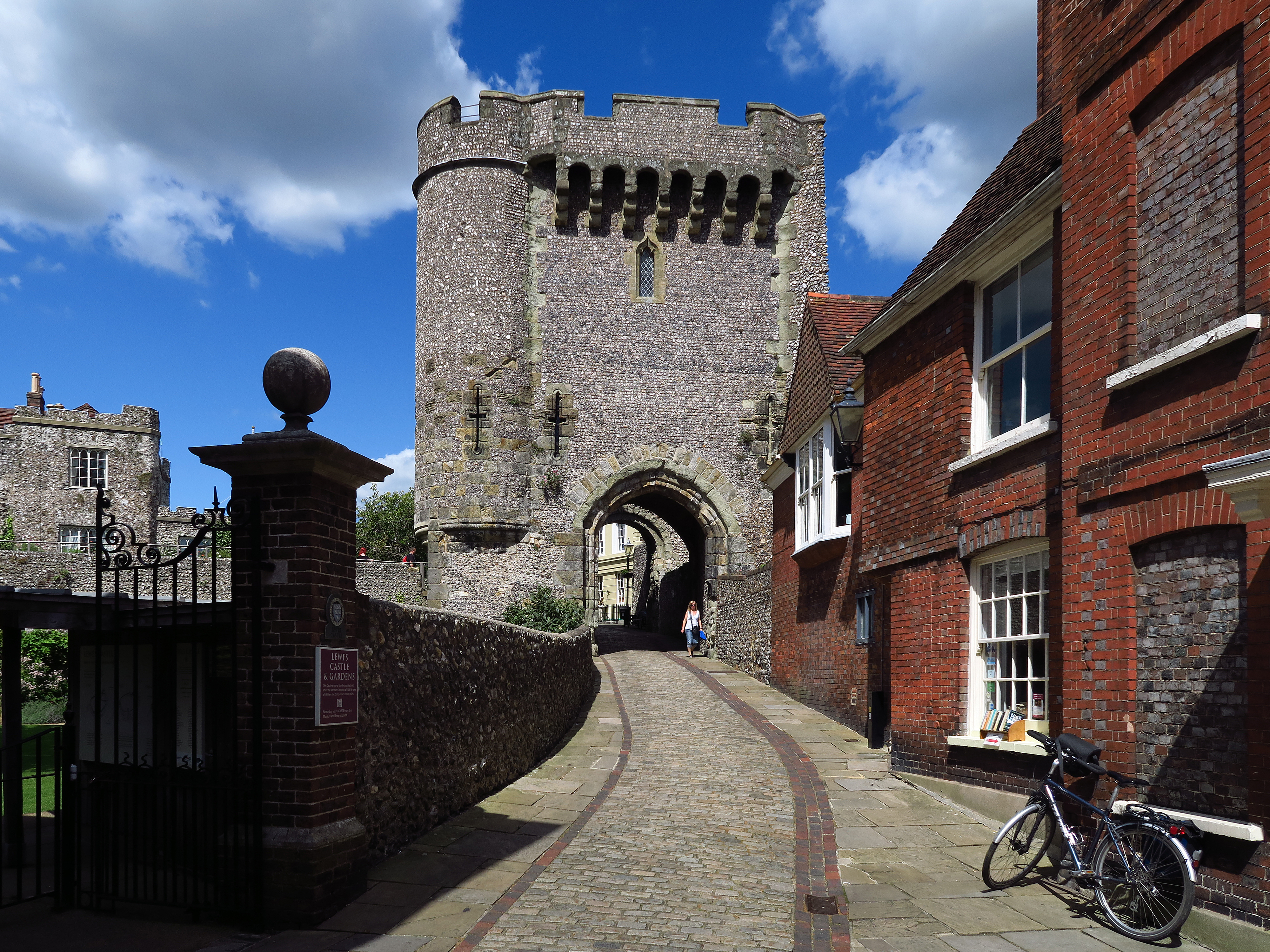
| Lewes | 5.6 miles (9 km) | This circular walk around the county town of East Sussex includes riverside paths, lovely views of the South Downs and a visit to Lewes Castle. The attractive town is located a few miles north east of Brighton, in a pretty area of the South Downs. As such there's several good options for walkers with some good hill climbs and waterside walks along the River Ouse to enjoy. This walk starts at the 11th century castle and heads east along the High Street to the river. Here you pick up the Sussex Ouse Valley Way to take you north along the River Ouse to South Malling and Offham. This section runs past the Offham Marshes Site of Special Scientific Interest where you can look out for birds such as mallards, mute swans, grey herons and moorhens. After passing through Offham you turn south to pick up a section of the Greenwich Meridian Trail which leads you through the countryside and back to the town. To continue the walk you could follow the river in a southerly direction and visit the village of Rodmell. Here you can pick up the South Downs Way long distance trail. One of the higlights of the area is the nearby Mount Caburn. Here you will find a lovely nature reserve and wonderful views from the 480-feet (146m) hill summit. Our Glynde to Lewes Walk will take you there on a circular path while also visiting the historic Glynde Place. Another good option is to follow the Sussex Ouse Valley Way in a north easterly direction to Barcombe Mills. Here you can enjoy waterside trails, a small reservoir and a delightful riverside pub. Another major highlight of the area is the climb to Firle Beacon. View Full Details>> | |
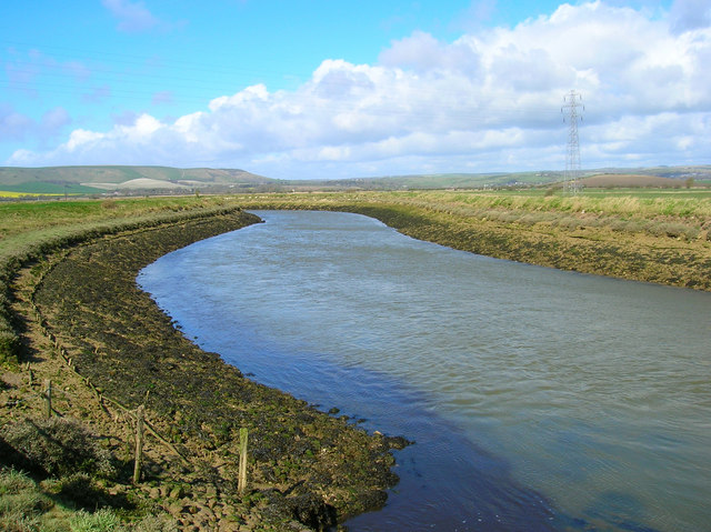
| Lewes to Alfriston | 11.2 miles (18 km) | A lovely walk from Lewes to Alfriston, first following the River Ouse before picking up the South Downs Way. It's a varied walk running for about 11 miles with flat riverside paths preceding some moderate climbs into the surrounding hills. From the high points there are tremendous views towards the south coast. The walk starts on the river at Cliffe, just to the east of the train station and the castle. From here you can pick up the Sussex Ouse Valley Way and follow it south past the Lewes Railway Nature Reserve to Southease. Here you pick up the South Downs Way and follow it east to Beddingham Hill and Firle Beacon. The beacon is one of the highlights of the area with wonderful views over the Weald towards the south coast. The Firle Escarpment is also a Site of Special Scientific Interest. The large area of chalkland is home to a variety of flora and fauna. Look out for the rare spider orchid Ophrys sphegodes and Exmoor Ponies as you make your way through this lovely area. After taking in the views the route descends to Bostal Hill before coming into Alfriston. View Full Details>> | |
| Lewes to Eastbourne | 20 miles (32.2 km) | A long walk from Lewes to Eastbourne taking in some of the loveliest South Downs scenery. The route runs for about 20 miles, beginning with a riverside walk along the River Ouse to Southease where you pick up the South Downs Way. You can then follow the long distance trail all the way to Eastbourne, passing Firle Beacon, Alfriston, the Cuckmere River, the Long Man of Wilmington, Windover Hill and Jevington. There's much to enjoy with riverside trails, wonderful views to the coast from the high points and a nice coastal section into Eastbourne at the end. This section of the downs is great for flora and fauna with lots of pretty heather and wildflowers to see. You can also look out for wildlife including the delightful Exmoor Ponies. While the start and end of the route are quite flat, there are some quite challenging hill climbs along the way. View Full Details>> | |
| Liphook | 5.3 miles (8.5 km) | This large Hampshire based village is a great place to start a walk. View Full Details>> | |
| Liss | 6.8 miles (11 km) | This circular walk around the Hampshire village of Liss, uses waymarked trails to explore the surrounding countryside and woodland. On the route you will visit the hamlet of Liss Forest, the Riverside Railway Walk and the villages of Rake and Hill Brow. There's also some nice views over the South Downs as you make your way along Rake Hangar. The walk starts from Liss train station where you can pick up the Liss Riverside Railway Walk which is a waymarked trail running through a nature reserve. The path runs north from the station along the line of the old Longmoor Military Railway. There's views of the River Rother and the River Blackwater and lots of interesting flora and fauna to look out for on the trail. At Liss Forest you pick up a section of the Shipwrights Way and follow it east towards the village of Rake. Near here you join with the Sussex Border Path and the Serpent Trail which lead you south west along Rake Hangar toward Hill Brow. You then head west across Farther Commons before following country lanes and bridle paths back to Liss train station. View Full Details>> | |
| Long Man of Wilmington | 5.3 miles (8.5 km) | Climb to this iconic hill figure on Windover Hill on this splendid circular walk in the South Downs. The walk begins in the village of Alfriston on the Cuckmere River and follows the South Downs Way to the Long Man. It's a fairly easy climb on a good path with splendid views of the South Downs and the coast to enjoy. From the high point you descend to Litlington passing the delightful Lullington Heath Nature Reserve on the way. It's a lovely area made up of chalk heath with heather, bell heather and gorse bushes. At Litlington you pick up the Vanguard Way and enjoy a lovely waterside section along the Cuckmere River which takes you back to Alfriston. View Full Details>> | |
| Meon Valley Trail | 9.3 miles (15 km) | This peaceful cycling and walking trail runs along a disused railway track from West Meon to Wickham via Droxford. There are splendid views of the beautiful Meon Valley and the River Meon to enjoy as well as a variety of wildlife including butterflies, redwing and egrets. The route is reasonably flat, running along a surfaced path for just under 10 miles. View Full Details>> | |
| Meonstoke | 8.7 miles (14 km) | This Hampshire based village has some lovely trails through the attractive countryside of the Meon Valley. There's also some fine listed buildings including the 13th century church and 18th century Meonstoke House which includes some excellent Georgian architecture. View Full Details>> | |
| Midhurst Way | 19.3 miles (31 km) | This West Sussex market town sits in a lovely spot on the River Rother in the South Downs National park.
This linear walk runs for about 19 miles from Midhurst to Arundel through some lovely Sussex countryside. The path passes Cowdray Park, Lodsworth, Petworth, Chingford Pond, Bignor, Westburton Hill and Houghton Forest with fabulous views of the South Downs as you go. There are several attractions on the route including the splendid Arundel Castle, at the start of the walk. The castle dates from the 11th century and boasts exquisite, stately rooms and magnificent grounds overlooking the River Arun. The path also passes very near to Petworth House and Petworth Park which holds the 'National Trust's finest art collection displayed in a magnificent 17th century mansion within a beautiful 700-acre park'. The walk also offers fine views of the Rivers Rother and Arundel while also passing the ruins of the fascinating Cowdray House near Midhurst. This route is quite accessible beginning at Arundel train station while finishing at the bus station at Midhurst. View Full Details>> | |
| Mount Caburn | 4.3 miles (7 km) | This walk visits the delightful Mount Caburn Nature Reserve in the South Downs. You can reach the reserve by following a footpath from the centre of Lewes. It's just over 2 miles to the reserve from the town with the route crossing the River Ouse before passing Malling Down Nature Reserve, Ranscombe Camp hill, Oxteddle Bottom and Caburn Bottom. The reserve consists of managed chalk downland and a Bronze Age hill fort. There is also a wide variety of flora and fauna to look out for. This includes the largest British population of burnt-tip orchid and pyramidal orchids. There are also many different types of wildflowers such as Sweet briar, Marjoram and the bright yellow horseshoe vetch. These attract various butterflies including Adonis, chalkhill blue butterfly and silver-spotted skippers. It's also great for bird watching with Skylarks, meadow pipits, yellowhammers, corn bunting, kestrels, peregrine falcon and buzzards to look out for. The summit of Mount Caburn stands at 480-feet (146m) and consists of an Iron Age Hill Fort. There are wonderful views of Lewes, Glynde, Firle and the South Downs to enjoy. After climbing the hill you could visit the delightful Little Cottage Tea Rooms and enjoy a cream tea. The tea rooms are located just to the south of the reserve on Ranscombe Lane. A shorter, alternative route to the reserve is to start from Glynde Bridge. There is a train station and parking area about a mile from the hill. If you would like to extend your walking in the area then you could head to the nearby Firle Beacon. It is located just a few miles to the south east and offers great views over the Weald towards the south coast. A few miles to the north you can visit the delightful Barcombe Mills where there are lovely waterside walks along the River Ouse and Barcombe Reservoir. View Full Details>> | |
| New Lipchis Way | 37.3 miles (60 km) | This is an exceptionally lovely walking trail that runs from Liphook, in Hampshire, to East Head at the entrance to Chichester Harbour. The path takes you through some of the loveliest parts of West Sussex including greensand ridges,
Wealden river valleys, heathlands, high chalk downland and then finally the coastal plain at Chichester. The first section of the walk runs from Liphook to Midhurst, passing through Woolbeding Common before a waterside section along the River Rother takes you to Midhurst. View Full Details>> | |
| Ockley to Leith Hill | 8.1 miles (13 km) | This circular walk takes you from Ockley Station to Leith Hill, one of the major walking highlights of the South Downs. It's a great way to explore the area if you are coming by public transport. The walk starts from Ockley Train station which is only about 29 miles (47.1 km) from London Waterloo station. From the station you can pick up public footpaths heading west to Ockley village and Forest Green. Here you turn north before passing through Leith Hill Wood where you pick up the Greensand Way and follow it east up to the hill summit. The hill is the highest point on the Greensand Ridge, reaching a height of 294 metres (965 ft) above sea level. On the summit there is an 18th century Gothic tower, with panoramic views northwards to London and south to the English Channel. After taking in the views the route heads south through Leith Hill Place Wood and Jayes Park to Ockley. You then follow the same paths east to return to the train station where the route finishes. View Full Details>> | |
| Old Winchester Hill | 8.7 miles (14 km) | This walk takes you up to the summit of Old Winchester Hill in the South Downs of Hampshire. The hill and surrounding area is a National Nature Reserve with a wide variety of butterflies and wildlife to look out for. These include buzzards, kites, roe deer and foxes. The area is made largely of chalk grassland with extensive scrub and many orchid species. There is also an Iron Age hill fort and earlier Bronze Age barrows and burial mounds. This circular walk starts at the village of Meonstoke and makes use of the South Downs Way to take you to Old Winchester Hill before returning via Warnford and Beacon Hill. There are super panoramic views of the South Downs and the Meon Valley from the high points. On a clear day you may even be able to see the Isle of Wight. If you'd like to continue your walk then you could pick up the South Downs Way or the Monarch's Way which run past the hill. View Full Details>> | |
| Parham House | 0.6 miles (1 km) | Explore the parkland and gardens surrounding this Elizabethan House near Storrington and Amberley. The gardens include a four-acre Walled Garden, herbaceous borders, a glasshouse, vegetable garden, orchard and a 1920s Wendy House. View Full Details>> | |
| Portsdown Hill | 1.6 miles (2.5 km) | This walk visits Portsdown Hill in the city of Portsmouth. The long chalk ridge is located just above Portsmouth and Fareham in Hampshire. On the hill you can visit the historic Fort Widley and enjoy fine views down to Portsmouth Harbour below. The walk starts from the car park and view point, located on Portsdown Hill Road, just to the east of the fort. From here you can pick up footpaths heading west to the fort where there is another public path circling around the fort. The fort was built in the mid 19th century on the recommendation of the Royal Commission on the Defence of the United Kingdom. It was designed, along with the other Palmerston Forts on Portsdown Hill, to protect Portsmouth from attack from the rear. Today the Fort is home to an equestrian centre run by Peter Ashley Activity Centres. After rounding the fort the route then heads east to explore Candy's Pit where there are some woodland trails and a cave. Back at the car park you will find a nice burger fan where you can pick up some refreshments and then sit and enjoy the views on one of the benches. To the north you can see the Forest of Bere, with the South Downs visible in the distance. Butser Hill can also be seen on a clear day. View Full Details>> | |
| Pulborough | 3.3 miles (5.3 km) | This large village is located on the northern edge of the South Downs in the Horsham district of West Sussex. Near the village there's nice riverside walks along the River Arun, some pretty nature reserves and large woodland areas. View Full Details>> | |
| Queen Elizabeth Country Park | 5.3 miles (8.5 km) | Explore 2000 acres of open access woodland and downland in the South Downs on this circular walk or cycle in Hampshire. Queen Elizabeth Country Park is Hampshire's biggest country park with 20 miles of trails for walkers, cyclists & horse riders. Highlights in the park include Butser Hill - the highest point on the South Downs with views to the Isle of Wight. There is also a Visitors Centre where you can sign up for a guided walk. The park is very popular with mountain bikers with several off road trails running through the park. See the video below for example of what you can expect. View Full Details>> | |
| Rackham Woods | 6.8 miles (11 km) | This circular walk explores Rackham Woods on the South Downs, in the Horsham District of West Sussex. View Full Details>> | |
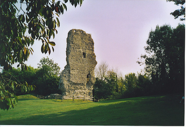
| River Adur and Bramber Castle | 3.7 miles (6 km) | Follow a waterside path along the River Adur to Bramber Castle on this walk in West Sussex. View Full Details>> | |
| Rowlands Castle | 8.7 miles (14 km) | This interesting village is located in East Hampshire, near Portsmouth and Havant. It includes an unusual lung shaped village green, the remains of a motte-and-bailey castle and a 19th century church. The village is located in a lovely spot for walkers being close to the South Downs, Stansted Park, the Forest of Bere and the south coast. View Full Details>> | |
| Selborne Common | 2.2 miles (3.5 km) | This circular walk visits Selborne Common and Selborne Hill, one of the highest points in the county of Hampshire. The common is owned by the National Trust and has a number of nice woodland trails to try. In the woods you can see a variety of wildflowers including yellow archangel, wood spurge and wood anemone. Also look out for lots of butterflies such as Duke of Burgundy, silver-washed fritillary and purple emperor. Notable birds to see include buzzard, sparrowhawk, stock dove, tawny owl, green woodpecker and great spotted woodpecker. From the high points you can enjoy lovely views over the South Downs. View Full Details>> | |
| Seven Sisters Country Park | 3.4 miles (5.5 km) | Explore nearly 700 acres of parkland and coast on this delightful circular walk through the South Downs. The Country Park is named after the famous Seven Sisters chalk cliffs on the Sussex Heritage Coast. On the route you will enjoy fabulous views of the Cuckmere river before heading towards the beautiful coastline. The walk starts from the country park visitor centre next to Exceat Bridge at a postcode of BN25 4AB for your sat navs. From here you can pick up the South Downs Way National Trail and follow the waymarked path south along the Cuckmere River to the Seven Sisters cliffs. The path then heads east along the wonderful coast path to a significant landmark at Birling Gap. This special area is run by the National Trust and includes the famous Belle Tout lighthouse. There's also fabulous views along to the nearby Beachy Head and 500 acres of open chalk grassland with a wide variety of butterflies and wildflowers to look out for. The route then leaves the coast and heads north towards Friston Forest where you can enjoy some nice woodland trails and look out for rare butterflies and deer. These trails will lead you west back to the visitor centre where the route finishes. There are a number of other footpaths and trails in the Park - further information and trail maps can be found in the Visitor Centre. Cycling is permitted on the valley floor and there is a concrete track which offers access to the beach. Mountain biking is also popular in Friston Forest so much of this area is great for cyclists as well as walkers. View Full Details>> | |
| Slindon Estate | 6.5 miles (10.5 km) | The Slindon Estate is a fantastic place for walkers and cyclists with miles of footpaths and bridleways to follow through the 1400 hectare estate. It is made up of a variety of habitats including woodland, downland, farmland, and parkland. All the while there are wonderful views over the Weald, the South Downs and the coast with the Isle of Wight beyond. This circular walk starts at the village of Slindon on Butt Lane and climbs towards Bignor Hill and Gumber Corner. Here you pick up the Stane Street Roman Road and the Monarch's Way which leads you into a long woodland section through Nore Wood. It's a lovely section with bluebells, wild flowers and other woodland plants to enjoy. The final section takes you back to Slindon passing the eye-catching Nore Hill Folly. If you would like to continue your walking in the area then you could head a few miles to the east and enjoy a walk around Arundel Castle and Arundel Park with a riverside stretch along the River Arun. This route skirts the edge of Eartham Woods which has bluebells and deer to look out for. Houghton Forest is also close by and has more mountain bike trails to try. View Full Details>> | |
| South Downs Circular Walk | 7.8 miles (12.5 km) | This terrific 8 mile circular walk visits some of the major highlights of the East Sussex area of the South Downs National Park. You'll take in Birling Gap, Seven Sisters Country Park, Friston Forest and the Cuckmere River and Cuckmere Haven. There's wonderful coastal views, riverside paths, woodland trails and some moderate climbs to enjoy on this varied route which is one of the best circular walks on the South Downs. The walk starts from the Birling Gap car park. This National Trust owned area has great facilities and includes the splendid Belle Tout lighthouse. From the car park you head west along the The South Downs Way National Trail. This section of the trail runs along the coast to Cuckmere Haven. This area has a nice shingle beach with wonderful views of the Seven Sisters Cliffs. There's also riverside trails along the Cuckmere River and a wide variety of flora and fauna to look out for. The route then heads north through the Seven Sisters Country Park. Here you'll find 700 acres of parkland with lots of great cycling and walking trails. The walk then turns east through Friston Forest, where there are miles of shady woodland trails. You can look out for rare butterflies and deer as you make your way through the forest. After leaving the forest you turn south, passing through countryside around East Dean, before returning to the car park on the coast. To extend your exercise you could head east along the South Downs Way and visit Beachy Head, the highest chalk sea cliff in Britain. View Full Details>> | |
| St Gile's Hill Winchester | 0.6 miles (1 km) | This short walk climbs to a fine viewpoint above the city of Winchester. From the top of the hill there are great views of the city's main highlights including Winchester Cathedral, the College and Wolvesey Castle. The hill is located just to the east of the city centre and can be reached by following The Broadway and then Bridge Street to the base of the hill. Here you follow a series of steep steps to the hill top where you will find a little park with benches, an information board and the observation area. View Full Details>> | |
| Steyning | 5.5 miles (8.9 km) | This West Sussex based market town is in a fine location for exploring the South Downs National Park and the beautiful River Adur Valley. View Full Details>> | |
| Storrington | 9.9 miles (16 km) | This picturesque small town in West Sussex is in a nice position on the northern edge of the South Downs. There's miles of trails here and some decent riverside trails along the Adur to the west of the town. The town itself is also very pretty with a mill pond and good selection of shops and pubs. View Full Details>> | |
| Truleigh Hill | 3.1 miles (5 km) | This hill in West Sussex has a set of distinctive radio masts on the summit. You can park at a small parking area to the west of the hill and follow the South Downs Way past Beeding Hill to the top of Truleigh Hill. There's great views of the surrounding hills and countryside from the high points. You can turn it into a circular walk by following tracks across Bushy Bottom and then the Monarch's Way back to the car park. You could also start the walk from nearby Upper Beeding or Bramley Castle if you prefer. To extend your walk you can continue east along the South Downs Way to Edbarton Hill and then on to Devils Dyke. The beautiful V-Shaped Valley is a great place for walking and mountain biking. You can use the google street view link below to follow this part of the trail. View Full Details>> | |
| West Dean Estate | 3.7 miles (6 km) | This walk takes you around the beautiful gardens, woodland and arboretums in the West Dean Estate near Chichester. View Full Details>> | |
| West Meon | 12 miles (19.3 km) | The village of West Meon is in a splendid location for exploring the lovely Meon Valley and the South Downs. There's a number of waymarked walking trails passing through the area which can easily be picked up from the village. This 12 mile loop walk uses several of these trails to visit some of the highlights of the area. You'll enjoy climbs to Old Winchester Hill and Beacon Hill where there's fine views over the South Downs. The walk starts just to the east of the village where you can pick up the start of the Meon Valley Trail. The shared cycling and walking trail runs along a disused railway track from West Meon to Wickham with great views of the Meon Valley. Follow the trail south to Hayden Farm where you can pick up the Monarch's Way long distance trail. This takes you south past Peake Farm to The South Downs Way which will take you up to Old Winchester Hill. View Full Details>> | |
| West Sussex Literary Trail | 55.3 miles (89 km) | This walk runs from Horsham to Chichester with many literary connections along the way. The walk begins at Horsham, near Percy Bysshe Shelley's millennium fountain, and heads through the South Downs to Chichester with its connections to William Blake and John Keats. You will pass through a series of interesting and picturesque towns and villages including Sinfield, Storrington, Amberley and Duncton before finishing near the iconic cathedral in Chichester. View Full Details>> | |
| Wickham | 15.2 miles (24.5 km) | This route from Wickham uses part of the Meon Valley Trail and the waymarked King's Way to create a circular walk around the village. The walk first follows the old railway line along the River Meon before heading into the attractive countryside and woodland to the east of the village. View Full Details>> | |
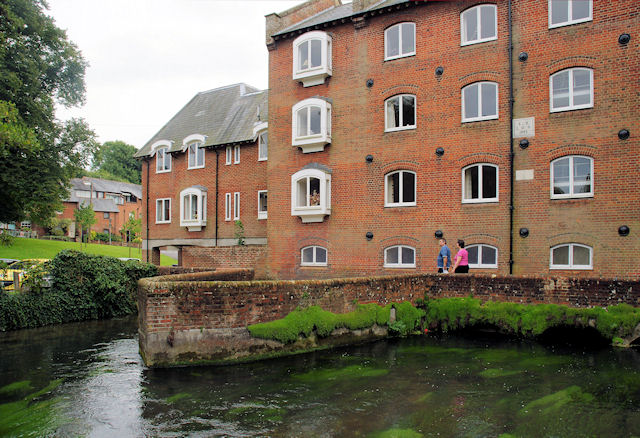
| Winchester River Walk | 3.6 miles (5.8 km) | A lovely circular walk along the River Itchen and Itchen Navigation in Winchester. The route uses a section of the Itchen Way to take you along the Itchen Navigation before crossing St Cross Bridge and picking up the Clarendon Way to take you back into the city along the River Itchen. The walk starts at the cathedral in the city centre and heads east to pick up the riverside path. You then head south past Wharf Bridge and Tun Bridge before coming to St Catherine's Hill. You can take a short detour from the route by climbing the hill for great views over the South Downs, the city and the river below. Just after passing the hill you come to St Cross Bridge where you cross the water. Here there's views of the disused Hockley Viaduct which was built in the late 1880s. View Full Details>> | |
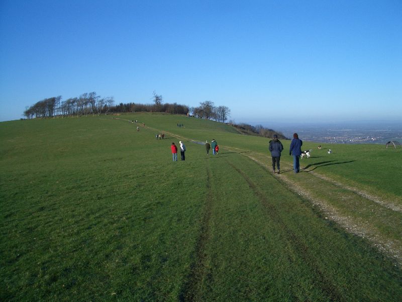
| Wolstonbury Hill | 3.5 miles (5.7 km) | This walk climbs to the splendid viewpoint on Wolstonbury Hill in the South Downs. View Full Details>> | |
| Woolmer Forest | 3.4 miles (5.5 km) | This large area of heathland and woodland has public footpaths to follow from the hamlet of Conford in the north eastern part of the site. View Full Details>> |